Sandgerði
| Sandgerðisbær | |
|---|---|
|
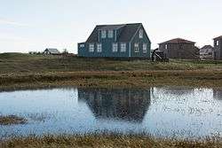
Skyline of Sandgerðisbær | |
|
Coat of arms of Sandgerðisbær | |
 Sandgerðisbær | |
| Region | Southern Peninsula |
| Constituency | Southwest Constituency |
| Mayor | Sigrún Árnadóttir |
| Area | 62 km2 (24 sq mi) |
| Population | 1,609 |
| Density | 25.95/km2 (67.2/sq mi) |
| Municipal number | 2503 |
| Postal code(s) | 245 |
| Website |
sandgerdi |

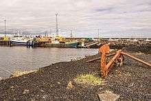
Sandgerðisbær is an Icelandic municipality located in southwestern Iceland on the Southern Peninsula. Sandgerði began to develop as a fishing village in the second half of the nineteenth century when motorboats took over the rowing boats. [1] The land area of Sandgerðisbær is covers the entire western coast of Miðnes (Rosmhvalanes) north from Garðskagi to Ósabotnar in the south. Inland the land area of Sandgerðisbær stretches into the international airport at Keflavíkurflugvöllur with the air terminal within the municipal boundaries. Reynir football club play in Iceland's third tier.In Sandgerði, some noticeable enterprises have also developed into growing tourist industry. One of the most interesting is the Sudurnes Science and Learning Center. A museum and research center, dedicated to natural science and related subjects like water and animal life near the sea.[1]
References
- 1 2 "Sandgerði". Hit Iceland. Retrieved 2016-08-30.
External links
![]() Media related to Sandgerði at Wikimedia Commons
Media related to Sandgerði at Wikimedia Commons