Sankhar
| Sankhar साँखर | |
|---|---|
| Village Development Committee | |
|
Sankhar view from Gandakidhik, Palpa | |
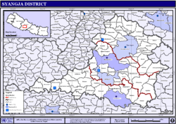 Map of Village Development Committees in Syangja District | |
 Sankhar Location in Nepal | |
| Coordinates: 27°53′48″N 83°55′17″E / 27.896528°N 83.92149°ECoordinates: 27°53′48″N 83°55′17″E / 27.896528°N 83.92149°E | |
| Country |
|
| Zone | Gandaki Zone |
| District | Syangja District |
| Government | |
| • Type | Village Development Committee |
| Population (2011) | |
| • Total | 4,630[1] |
| Time zone | Nepal Time (UTC+5:45) |

Sankhar is a Village Development Committee in Syangja District in the Gandaki Zone of central Nepal. At the time of the 2011 Nepal census it had a population of 4,630 people residing in 1,055 individual households.[1] Majuwa, Mohami, Bhattarai Danda, Keladighat, Patasar, Panglung, Khasa Bankata, Pipalchhap, Khardi, Samakot, Tangle, Gahate, Ajingare, and Hadiban are major villages in Sankhar.
Tourism
Kali Gandaki river flows through some villages of Sankhar such as Bankata, Murchaur, Majuwa, Bhattarai Danda, at the edge of Keladighat. Kali Gandaki itself is known for rafting. Many tourists visit Sankhar each year for rafting.[2] Tourists can go for trekking as Sankhar is surrounded by hills on all sides. The view of mountain Makalu and Annapurna has added more beauty to Sankhar. The tourism industry has not yet been developed because of the lack of resources. For visiting tourists in Sankhar the most known and most famous places which are known as Keladighat and Ramghat. Keladighat is the historical place by the point of view for tourism. In Keladighat, there is a temple and different parks to visit. In temple Radha Krishna is worshiped in 24 hours nonstop. Most of the people go there to worship as they said their wishes are fulfilled. Majuwa is mainly known as the heart of Sankhar as it has plain land with fertile land for agriculture. But, nowadays it is developing to a highly populated area. Mohami, a village in Sankhar, is famous for its historical place because it had a palace for royal family at the period of kingship in Nepal.
Political situation
Sankhar is divided into nine wards. It is surrounded by Kali Gandaki at northern side, Gajarkot VDC from east, Sekham and Chimnebas VDCs from west and Kyakami VDC at south. Patasar is its headquarter. Keladighat Temple (known as the second heaven by the locals) is situated at the northern side of Sankhar which is near from Kali Gandaki river. It lies in ward number 6 of Sankhar.
Bridge
A newly constructed motor-able bridge[3] mainly benefits the people around Syangja, Palpa, Nawalparasi, Tanahun and almost all people of nearby districts.
These days, buses, trucks and tractors ply through the bridge in hundreds of numbers on daily basis. And, the bridge has brought new dimensions for the economic development of the nearby VDCs which were lagging behind and unaccessible until few years ago.
See also
References
- 1 2 "National Population and Housing Census 2011(National Report)" (PDF). Central Bureau of Statistics. Government of Nepal. November 2012. Retrieved November 2012. Check date values in:
|access-date=(help) - ↑ "Kali Gandaki River Rafting Festival". Retrieved 20 June 2015.
- ↑ Aryal, Madhav (26 April 2014). "Keladighat bridge nears completion" (Syangja/Palpa/Tanahun). The Kathmandu Post. Retrieved 27 April 2014.