Resistencia International Airport
| Resistencia International Airport Aeropuerto Internacional de Resistencia | |||||||||||
|---|---|---|---|---|---|---|---|---|---|---|---|
 | |||||||||||
| IATA: RES – ICAO: SARE | |||||||||||
| Summary | |||||||||||
| Airport type | Public / Military | ||||||||||
| Operator | Government and Aeropuertos Argentina 2000 | ||||||||||
| Serves | Resistencia, Chaco | ||||||||||
| Location | Ruta N11, Km 1003.4, Resistencia (H3500) | ||||||||||
| Elevation AMSL | 170 ft / 52 m | ||||||||||
| Coordinates | 27°26′59″S 059°03′22″W / 27.44972°S 59.05611°WCoordinates: 27°26′59″S 059°03′22″W / 27.44972°S 59.05611°W | ||||||||||
| Map | |||||||||||
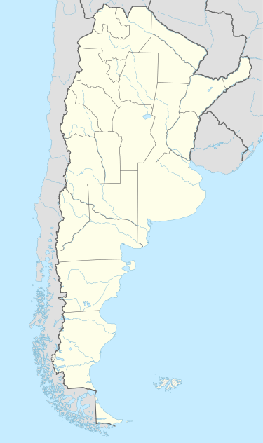 RES Location of airport in Argentina | |||||||||||
| Runways | |||||||||||
| |||||||||||
| Statistics (2010) | |||||||||||
| |||||||||||
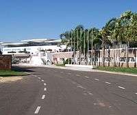
Resistencia International Airport (Spanish: Aeropuerto Internacional de Resistencia) (IATA: RES, ICAO: SARE) is an airport in Chaco Province, Argentina serving the city of Resistencia, built in 1965 while the terminal was completed in 1971. It is also known as Aeropuerto de Resistencia General José de San Martín.
It has a 6,500 square metres (70,000 sq ft) passenger terminal, 128,850 square metres (1,386,900 sq ft) of runways, a 3.5 hectares (8.6 acres) platform (which can support large airliners such as a Boeing 747), parking for 150 cars and it is the base of the RANE (Región Aérea Noreste). In 2007, 99,169 passengers left Resistencia in 2,957 flights.
It is operated by Aeropuertos Argentina 2000. Doctor Fernando Piragine Niveyro International Airport, serving Corrientes, is 16 km (10 mi) from this airport, and it is usual to fly from one and return to the other.
Airlines and destinations
| Airlines | Destinations |
|---|---|
| Aerolíneas Argentinas | Buenos Aires-Aeroparque |
| Aerolíneas Argentinas operated by Austral Líneas Aéreas | Buenos Aires-Aeroparque, Córdoba[4] |
Statistics
| Passengers | Change from previous year | Aircraft operations | Change from previous year | Cargo (metric tons) | Change from previous year | |
|---|---|---|---|---|---|---|
| 2005 | 113,092 | | 3,550 | | 587 | |
| 2006 | 103,784 | | 3,600 | | 594 | |
| 2007 | 99,169 | | 2,957 | | 424 | |
| 2008 | 84,936 | | 3,088 | | 411 | |
| 2009 | 158,629 | | 4,069 | | 491 | |
| 2010 | 125,905 | | 3,437 | | 326 | |
| Source: Airports Council International. World Airport Traffic Statistics (Years 2005-2010) | ||||||
References
- ↑ Airport information for SARE at World Aero Data. Data current as of October 2006.Source: DAFIF.
- ↑ Airport information for RES at Great Circle Mapper. Source: DAFIF (effective October 2006).
- ↑ Airport Council International 2010 World Airport Traffic Report
- ↑ AR increases domestic flights
External links
- (Spanish) Aeropuerto de Resistencia "Jose de San Martin" at Organismo Regulador del Sistema Nacional de Aeropuertos
- (Spanish) Aeropuertos Argentina 2000
- Current weather for SARE at NOAA/NWS
- Accident history for RES at Aviation Safety Network