Qorlortorsuaq
| Qorlortorsuaq | |
|---|---|
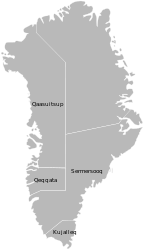
 Qorlortorsuaq Location within Greenland | |
| Coordinates: 60°46′30″N 45°13′54″W / 60.77500°N 45.23167°WCoordinates: 60°46′30″N 45°13′54″W / 60.77500°N 45.23167°W | |
| State |
|
| Constituent country |
|
| Municipality | Kujalleq |
| Population (2009) | |
| • Total | 13 |
| Time zone | UTC-03 |
| Postal code | 3919 |
Qorlortorsuaq is the name of a village in the Nanortalik district, in the Kujalleq municipality in southern Greenland, located at the site of the largest waterfall in the country; the waterfall also goes by the name of Qorlortorsuaq. Presently with 13 inhabitants, the population has grown since 2005 when 8 inhabitants were on record.[1] The population consists mostly of farmers. Qorlortorsuaq also houses the only trout farm in the country[2]
Qorlortorsuaq is a location of the Qorlortorsuaq hydroelectric dam. The hydropower plant is part of the focus of the government of Greenland to replace fossil fuelled power plants with renewable energy, and is only one of a number of hydroelectric projects planned for construction. The plant has made it possible to decommission the three aging diesel generators, so called "bunker fuel generators" made from old ship engines,[3] that previously provided electricity to the towns.[4]
References
- ↑ "Population Statistics". Population-Statistics.com. Retrieved 2011-02-13.
- ↑ "Historic sites and ruins in the Nanortalik district". Retrieved 2011-02-13.
- ↑ "Arctic Sunrise, Greenpeace USA". Greenpeace USA. Retrieved 2011-02-13.
- ↑ "QORLORTORSUAQ – Hydroelectric Project". Verkis. Retrieved 2011-02-13.