Qhawana
| Qhawana | |
|---|---|
 Árbol de Piedra ("stone tree") with Qhawana in the background | |
| Highest point | |
| Elevation | 5,300 m (17,400 ft) [1] |
| Coordinates | 22°04′26″S 67°57′36″W / 22.07389°S 67.96000°WCoordinates: 22°04′26″S 67°57′36″W / 22.07389°S 67.96000°W |
| Geography | |
 Qhawana Location in Bolivia | |
| Location |
Bolivia Potosí Department |
| Parent range | Andes |
Qhawana (Quechua for viewpoint, window,[2] Hispanicized spelling Cahuana) is an extinct volcano[1] at the border of Bolivia and Chile which reaches a height of approximately 5,300 m (17,388 ft). It is located in the Potosí Department, Sud Lípez Province, San Pablo de Lípez Municipality. Qhawana lies on the western border of the Eduardo Avaroa Andean Fauna National Reserve, south of Silala.[1][3][4]
References
- 1 2 3 Bolivian IGM map 1:50,000 Volcán Chico 6027-IV (see: Cerro Cahuana (Volcán Apagado))
- ↑ Teofilo Laime Ajacopa, Diccionario Bilingüe Iskay simipi yuyayk'ancha, La Paz, 2007 (Quechua-Spanish dictionary)
- ↑ "San Pablo de Lípez". Retrieved January 22, 2016. (unnamed)
- ↑ "Reserva Nacional de Fauna Andina Eduardo Avaroa". boliviarea.com. Retrieved January 24, 2016. Map
Capital: Potosí | ||
| Provinces | 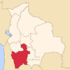 | |
| Municipalities (and seats) |
| |
This article is issued from Wikipedia - version of the 8/13/2016. The text is available under the Creative Commons Attribution/Share Alike but additional terms may apply for the media files.