Q'illu Salli
| Q'illu Salli | |
|---|---|
 Q'illu Salli Location in Bolivia | |
| Highest point | |
| Elevation | 4,918 m (16,135 ft) [1] |
| Coordinates | 21°43′06″S 66°32′37″W / 21.71833°S 66.54361°WCoordinates: 21°43′06″S 66°32′37″W / 21.71833°S 66.54361°W |
| Geography | |
| Location | Bolivia, Potosí Department, Sud Lípez Province |
| Parent range | Andes |
Q'illu Salli (Quechua q'illu yellow, salli sulfur,[2] "yellow sulfur", also spelled Khellu Salli) is a 4,918-metre-high (16,135 ft) mountain in the Andes of Bolivia. It is situated in the Potosí Department, Sud Lípez Province, San Pablo de Lípez Municipality. Q'illu Salli lies south-east of San Pablo de Lípez, south-west of the mountain Kuntur Wasi and south of the river Lluch'a Mayu (Llucha Mayu).[1][3]
References
- 1 2 BIGM map 1:50,000 San Pablo de Lípez 6228-I
- ↑ Diccionario Quechua - Español - Quechua, Academía Mayor de la Lengua Quechua, Gobierno Regional Cusco, Cusco 2005 (Quechua_Spanish dictionary)
- ↑ "San Pablo de Lípez". ine.gob.bo. Retrieved September 6, 2014. (unnamed)
Capital: Potosí | ||
| Provinces | 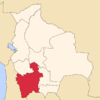 | |
| Municipalities (and seats) |
| |
This article is issued from Wikipedia - version of the 4/30/2016. The text is available under the Creative Commons Attribution/Share Alike but additional terms may apply for the media files.