Puente Aranda
| Puente Aranda | |
|---|---|
| Locality of Bogotá | |
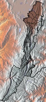
 Location of the locality in the city of Bogotá | |
 Location of the locality in the Capital District of Bogotá | |
| Country |
|
| City | Bogotá D.C. |
| Area | |
| • Total | 17.31 km2 (6.68 sq mi) |
| Elevation | 2,600 m (8,500 ft) |
| Population (2007)[1] | |
| • Total | 250,715 |
| • Density | 14,000/km2 (38,000/sq mi) |
| Time zone | Colombia Standard Time (UTC-5) |
| Website | Official website |


Puente Aranda is the 16th location of the Capital District of the Colombian capital city, Bogotá. It is located in the midwest within the city and was named after an old bridge in the hacienda of Juan Aranda over the "Chinúa River" now called the San Francisco Creek that dates from the 16th Century. Puente Aranda has 1724 Ha of area which are almost entirely urban. This locality has more than 300,000 inhabitants, 5% of the total urban area inhabitants of Bogota.
Geography
To the north the locality of Puente Aranda borders the 19th Street which serves as boundary with the locality of Teusaquillo. To the south with the Autopista Sur and the localities of Tunjuelito and Antonio Nariño, to the east with Norte-Quito-Sur Avenue and the locality of Los Mártires. To the west with the Carrera 68 and the localities of Kennedy and Fontibón.
Puente Aranda was in the past a convergence of many streams and wetlands which suffered floodings in contrast with the now almost entirely urbanized flat area with a slight elevation from east to west. Puente Aranda is built over an area without major geological risks away from the mountains.
The Fucha river, the San Cristobal River and the "Canal of the Commoners" crosses the locality among other canalized streams like Seco River, La Albania River, Commoners River and the San Francisco creek.
History
Colonial and Postcolonial
The Puente Aranda hacienda was property of Don Jorge Aranda and was established in a marsh terrain south of the then village of Santafé in the 16th century by the oidor Francisco de Anuncibay who arrived to the New Kingdom of Granada in the year 1537. This hacienda was first named "Hacienda of Aranda" and "The Roof of the Jorges" were the river Chinúa and San Agustín merged. It was also the main western path to get to the Magdalena River, which was and still is the most important fluvial artery of Colombia and a bridge was built to facilitate this but was permanently subject to floods. In 1768 the bridge was reconstructed with a better structure and named Puente de Aranda (Aranda's Bridge). Then an esplanade was built along across the wetlands towards the west in an effort to communicate Bogota with the port of Honda over the Magdalena River. This way Honda was then connected to Fontibon and the "Encomienda Avenue" nowadays 13th Street (Centenario Avenue). Simón Bolívar and his troops camped in the Hacienda of Aranda in 1814 during the wars of independence from Spain.
In 1898 the southern line of the Railway of Bogotá was established which connected Bogota with the Tequendama Falls area and which was also part of the development of the region. The area was until the beginning of the 20th century a rural area of many haciendas.
Urbanization
By 1944 the rapid expansion of Bogotá towards the south reached the Puente Aranda area, the Aranda bridge was demolished to build Las Americas Avenue, a project supported by the Colombian Society of Architects which would join the 13th Street in the now Carrera 50 and dividing into two ways 13th Street towards Fontibón and Las Americas Avenue towards the locality of Kennedy in Bogotá. The area where these two ways intersect is the site of the new Aranda bridge and the name of the neighborhood of Puente Aranda surrounding the crossing.
The area then had a rapid residential and industrial development, with numerous small manufacturing businesses basing their operations in the area. This same year Puente Aranda was zonified and consolidated with the Pilot Plan for Bogotá in 1951. In 1963 Puente Aranda and its neighboring barrios were declared sectors of Bogota only after Chapinero which had been named a zone in 1954. Since then Puente Aranda has been producing many industrial products; textiles, chemicals, metallurgy, food and services.
Puente Aranda then extended to conurbate with the localities of Fontibón and Bogotá to the west, and Antonio Nariño and Rafael Uribe Uribe to the south.
in 1972 the "Special District of Bogota" was created and divided the city into 16 zones, each one of them considered a minor cityhall in an effort to begin establishing a Metropolitan Area for Bogota. The 16 mayors head of zones were appointed by the Mayor of Bogotá. This system was ratified in an accord in the year 1977.
With the Colombian Constitution of 1991 the Special District became the Capital District dividing Bogota into 20 localities and its minor city hall became a Local City Hall with its City Council and a Local Administrative junta.
Demography
The locality has an increasing rhythm of development which by the year 2000 had 1794 city blocks, 700 of these industrial and some 800 residential. there are five relatively important neighborhoods considered Units of Zone Planification:
- Ciudad Montes, 107,144 inhabitants
- San Rafael, 91,990 inhabitants
- Muzu, 73,270 inhabitants
- Puente Aranda, 11,845 inhabitants
- Corridor Industrial, 5,585 inhabitants
Population
The first census was done in 1973 in which Puente Aranda had an estimated population of 221,776 inhabitants. In the 1985 Census Puente Aranda registered a population of 305,123 inhabitants and since then the population started decreasing due to the construction of new residential areas in other parts of Bogota until 1993 when Puente Aranda registered a population of 282,491 inhabitants. For the 2005 Census Puente Aranda had increased its population to 370,292 inhabitants.
Transportation
Puente Aranda is surrounded by the Carrera 68, la Carrera 30, the Avenue of the Americas, the Calle 13, the Calle 19, the Calle 3, the Calle 6 and the Carrera 50, which are its most important roads. it also includes a section over the Avenida Primero de Mayo, all these streets are covered by different bus routes which connect it to the rest of the city.
The locality is also served by the bus rapid transit system TransMilenio with multiple stops on the F and G lines; Marsella, Pradera, Américas Carrera 53 A, Puente Aranda, Carrera 43, Industrial Zone and CDS Carrera 32.
At the Carrera 53 there is a satellite stop that covers intermunicipal routes through Fontibón and the rest of the Metropolitan Area of Bogotá to towns like Funza, Mosquera, Madrid, among others. The area is also covered by the Bogota's Bike Paths Network.
Neighbourhoods
The most important neighbourhoods of Puente Aranda are: Tibana, Puente Aranda, Pensilvania, Comuneros, Primavera, El Jazmín, Jorge Gaitán Cortés, Santa Matilde, Ciudad Montes, La Guaca, El Remanso, La Ponderosa, La Alquería, La Coruña, Ospina Pérez, Muzu, Galán, La Asunción, Bochica Sur, Pradera, Milenta, Trinidad Galán, La Igualdad, San Rafael, San Rafael Industrial, Salazár Gómez, Veraguas, Veraguas Central, Gorgonzola, La Camelia, Tejar, Santa Rita, Vosconia, Torremolinos, El Ejido, Santa Isabel, Colón, San Gabriel and Sorrento. Furthermore, the Industrial Corridor includes the Industrial Zone, the Industrial Center and the Centennial Industrial Zone.
References
- ↑ (Spanish) Population 2007 - DANE
External links
- (Spanish) Website Alcaldia Puente Aranda
- (Spanish) National University of Colombia; Puente Aranda
 | Administrative subdivision in 19 localities | 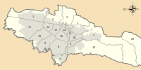 | |
|---|---|---|---|
| Metropolitan Area | |||
| Geography | |||
| |||
Coordinates: 4°36′45″N 74°06′24″W / 4.61250°N 74.10667°W