President Head

President Head (62°43′34.7″S 61°12′05.8″W / 62.726306°S 61.201611°WCoordinates: 62°43′34.7″S 61°12′05.8″W / 62.726306°S 61.201611°W) is a headland forming the east extremity of Snow Island, in the South Shetland Islands, Antarctica. Extending 2.6 km in east-northeast direction, rising to 107 m at St. Sofroniy Knoll. Adjacent ice-free area ca. 303 hectares (750 acres).[1]
The name "President Island" was applied by the Stonington sealers in 1820-21 to Snow Island, but that name did not become established. "President Head" was applied by the United Kingdom Antarctic Place-Names Committee (UK-APC) in 1961 in order to preserve the name on this island.
Maps
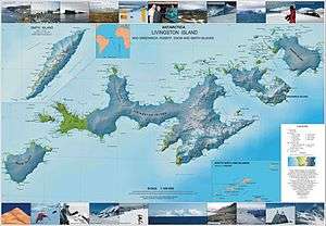
- L.L. Ivanov et al. Antarctica: Livingston Island and Greenwich Island, South Shetland Islands. Scale 1:100000 topographic map. Sofia: Antarctic Place-names Commission of Bulgaria, 2005.
Notes
- ↑ L.L. Ivanov. Antarctica: Livingston Island and Greenwich, Robert, Snow and Smith Islands. Scale 1:120000 topographic map. Troyan: Manfred Wörner Foundation, 2009. ISBN 978-954-92032-6-4
References
![]() This article incorporates public domain material from the United States Geological Survey document "President Head" (content from the Geographic Names Information System).
This article incorporates public domain material from the United States Geological Survey document "President Head" (content from the Geographic Names Information System).