Prenton
| Prenton | |
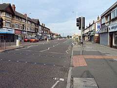 Shops on the A552 road in Prenton |
|
 Prenton |
|
| Population | 14,488 (2011 CensusWard) |
|---|---|
| OS grid reference | SJ310866 |
| – London | 178 mi (286 km)[1] SE |
| Metropolitan borough | Wirral |
| Metropolitan county | Merseyside |
| Region | North West |
| Country | England |
| Sovereign state | United Kingdom |
| Post town | PRENTON |
| Postcode district | CH43 |
| Dialling code | 0151 |
| ISO 3166 code | GB-WRL |
| Police | Merseyside |
| Fire | Merseyside |
| Ambulance | North West |
| EU Parliament | North West England |
| UK Parliament | Birkenhead |
|
|
Coordinates: 53°22′20″N 3°02′19″W / 53.3721°N 3.0385°W
Prenton is a suburb of Birkenhead, Merseyside, on the Wirral Peninsula, England and a 'post town' in the CH postcode area. Administratively, it is also a ward of the Metropolitan Borough of Wirral. Before local government reorganisation on 1 April 1974, it was part of the County Borough of Birkenhead, within the county of Cheshire. At the 2001 Census, the population of Prenton was 14,429, consisting of 6,787 males and 7,642 females.[2] The population increased slightly to 14,488 at the 2011 Census, consisting of 6,954 males and 7,534 females.[3]
History
Prenton appears as Prestune in the Domesday Book of 1086, with the name Pren- ton persisting despite the Norman-French accented spelling. Domesday describes Prenton as having a one-league square woodland - which is 9 sq mi (23 km2), if the League is taken in its old English measurement of 3 mi (4.8 km). The size and importance of the wood may reflect the name of the settlement. Pren is Welsh (British) for the material 'wood' and in the name Prenton there is the Saxon suffix tún for a settlement, which suggests a settlement in a wood. The Welsh/British name for Prenton would thus be Prentre which could easily have changed into Prenton following Anglian penetration of the area in the early seventh century. Note that Landican (one mile distant from Prenton) retained its Welsh/British name even through Anglian and subsequent Norse occupation. Domesday also records the presence of a water mill at Prenton, and this has been provisionally identified at Prenton Dell.
Previously a township in Woodchurch Parish, Wirral Hundred, Prenton was added to Birkenhead civil parish in 1933. The population was 81 in 1801, 99 in 1851 and 412 in 1901.[4]
In August 1940, during the Second World War, a house maid working in Prenton became the first fatality of a bombing raid on the Merseyside area.[5][6]
Geography
Prenton is situated on the eastern side of the Wirral Peninsula, about 2.5 km (1.6 mi) west of the River Mersey at Tranmere Oil Terminal. The area is approximately 6.5 km (4 mi) south-south-east of the Irish Sea at Wallasey and about 7.5 km (5 mi) east-north-east of the Dee Estuary at Thurstaston. Prenton is at an elevation of between 17–80 m (56–262 ft) above sea level; the highest point being near the junction of Pine Walks and Burrell Road, with the Halfway House crossroads at an elevation of 50 m (160 ft) above sea level.[7]
Prenton Brook merges with the River Fender, at Prenton, within the North Cheshire Trading Estate.
 |
Noctorum | Oxton | Tranmere | |
| Landican | |
Rock Ferry | ||
| ||||
| | ||||
| Barnston | Storeton | Bebington |
Community
Housing is mostly private, and ranges from terraced properties nearer Birkenhead, to large detached villas in the Mountwood conservation area. The major roads were mostly laid out in the early part of the 20th century. Much of the housing is from the Edwardian era and the 1930s, though there are some late Victorian buildings and some modern property.
The main shopping area is on Woodchurch Road (A552), which includes the Sainsbury's, Aldi, Home Bargains and Rightway supermarkets. However there are many small shops in other locations such as The Dell housing estate or in nearby Oxton. Sited on the junction of Woodchurch Road and Storeton Road is the 'Halfway House' public house, dating back to at least 1879[8] when the area was a rural hamlet.
Sport
Prenton's main claim to fame is Prenton Park, which is the ground of Tranmere Rovers Football Club.
Prenton Golf Club is to the south of the suburb.
Education
Prenton includes the all-girls' secondary Prenton High School for Girls and the mixed primary Prenton Primary School.
Notable people
- Eric Nixon, English footballer, worked in Prenton.
- Louis Page, English footballer, died in Prenton.
- Julie Paulding, English cyclist, born in Prenton.
- Benjamin Dabbs, English footballer, lived in Prenton.
See also
References
- ↑ "Coordinate Distance Calculator". boulter.com. Retrieved 6 March 2016.
- ↑ 2001 Census: Prenton, Office for National Statistics, retrieved 2 July 2007
- ↑ "Ward population 2011". Retrieved 1 June 2015.
- ↑ Cheshire Towns & Parishes: Prenton, GENUKI UK & Ireland Genealogy, retrieved 2 July 2007
- ↑ Port Cities: Liverpool 'Blitz' timeline, E. Chambré Hardman Archive, retrieved 17 March 2008
- ↑ Boumphrey, Ian (2001), Birkenhead at War: 1939-45, ISBN 1-899241-16-7
- ↑ "SRTM & Ordnance Survey Elevation Data in PHP". Retrieved 6 November 2016.
- ↑ Boumphrey, Ian & Marilyn (1992), Yesterday's Wirral (No.7), ISBN 0-9507255-7-9
Bibliography
- Mortimer, William Williams (1847). The History of the Hundred of Wirral. London: Whittaker & Co. pp288-289.
External links
| Wikimedia Commons has media related to Prenton, Birkenhead. |
- Halfway House pub: photo (1960)
- Prenton Golf Club
- Prenton Lawn Tennis Club
- Prenton Rugby Union Football Club
- Tranmere Rovers FC: official website