Ponthir
| Ponthir | |
| Welsh: Pont-hir | |
 Entering Ponthir from Llanfrechfa |
|
 Ponthir |
|
| Area | 3.43 km2 (1.32 sq mi) [1] |
|---|---|
| Population | 1,482 [2] |
| – density | 432/km2 (1,120/sq mi) |
| OS grid reference | ST 327 928 |
| Community | Ponthir |
| Principal area | Torfaen |
| Ceremonial county | Gwent |
| Country | Wales |
| Sovereign state | United Kingdom |
| Post town | NEWPORT |
| Postcode district | NP18 |
| Dialling code | 01633 |
| Police | Gwent |
| Fire | South Wales |
| Ambulance | Welsh |
| EU Parliament | Wales |
| UK Parliament | Monmouth |
| Welsh Assembly | Monmouth |
Coordinates: 51°37′50″N 2°58′23″W / 51.630425°N 2.972997°W
Ponthir (Welsh: Pont-hir) is a village and community at the south-west of the county borough of Torfaen on the boundary of the counties of Monmouthshire and Newport. It is approximately six miles from Newport city centre and 3½ miles from Cwmbran, lying between the settlements of Caerleon and Llanfrechfa.[3]
Etymology
The Welsh language placename indicates the correct pronunciation; i.e. saying the 't' and 'h' separately. The name first appeared in print as Pontheere in 1605 and again as Pont hir in 1677. The name means 'long (hir) bridge (pont)' and refers to a previous bridge over the River Llwyd, the present one having been built in 1800.[4]
History and amenities
Ponthir is primarily a residential area, with several new housing estates around the older village. It has a primary school, (Ponthir Church in Wales Primary School) which was for some time under threat of closure but was reprieved, and it now has the best SATs results in Torfaen. It also changed its category to a Voluntary aided school (church) school.[5]
Ponthir has many amenities such as two nurseries, two children's playgrounds, two churches, a village hall, a cricket club, a football club (Ponthir United), 2 pubs - The Ponthir House and The Star, a grocery shop, a doctor and a dentist. There used to be a railway station but it closed in 1962. The railway is still in use. It is surrounded by the rolling hills of Monmouthshire, many farms, and the Afon Llwyd (meaning "grey river") runs through the village.[3]
A Welsh Water sewage and water treatment plant for the surrounding area is located here, and this was where bacteria were first used to treat sewage sludge using an electrically powered aerator to circulate the sludge and ensure good microbial digestion. This process saved the local authority money as well as reducing noxious odours.[6]
References
- ↑ "2011 Census:Quick Statistics:Population Density for Ponthir". Office for National Statistics. Retrieved 29 Nov 2013.
- ↑ "2011 Census:Key Statistics:Key Figures for Ponthir". Office for National Statistics. Retrieved 25 Nov 2013.
- 1 2 Concise Road Atlas: Britain. AA Publishing. 2015. p. 28. ISBN 978-0-7495-7743-8.
- ↑ Owen, Hywel Wyn; Morgan, Richard (2007). Dictionary of the Place-Names of Wales. Gomer. p. 388. ISBN 978-1-84323-901-7.
- ↑ "Ponthir Church in Wales School". WalesOnline. 8 January 2014. Retrieved 2 May 2016.
- ↑ "Sweet smell of digesting sludge". New Scientist. 14 July 1983. Retrieved 2 May 2016.
| Principal settlements | 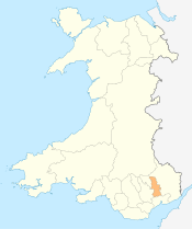 | |
|---|---|---|
| Electoral wards | ||
| Communities | ||
| Places of interest | ||
| Rivers and canals | ||
| Topics | ||