Pic de Médécourbe
| Pic de Médécourbe | |
|---|---|
| Pic de Medacorba | |
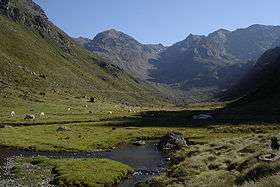 The Vicdessos valley looking towards Pic de Médécourbe and Col de Bareytes (2859m) in the background | |
| Highest point | |
| Elevation | 2,914 m (9,560 ft) [1] |
| Coordinates | 42°36′07″N 01°26′32″E / 42.60194°N 1.44222°ECoordinates: 42°36′07″N 01°26′32″E / 42.60194°N 1.44222°E |
| Geography | |
 Pic de Médécourbe Location on the Andorra–France–Spain tripoint | |
| Location | Andorra – France – Spain border |
| Parent range | Pyrenees |
Pic de Médécourbe (Catalan: Pic de Medacorba) is a mountain in Europe that sits on the western tripoint boundary of Andorra, France and Spain. It is 2,914 metres (9,560 ft) tall. It overlooks Étang de Soulcem, a large artificial lake used for hydroelectricity, and the Vicdessos valley.[1]
There is also an eastern tripoint of Andorra, France, and Spain approximately 6 km south of Pas de la Casa.[1]
References
This article is issued from Wikipedia - version of the 12/20/2015. The text is available under the Creative Commons Attribution/Share Alike but additional terms may apply for the media files.