Petersville Parish, New Brunswick
| Petersville | |
|---|---|
| Parish | |
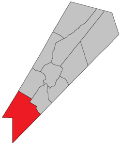 Location within Queens County, New Brunswick. | |
| Country |
|
| Province |
|
| County | Queens County |
| Established | 1838 |
| Area[1] | |
| • Land | 588.56 km2 (227.24 sq mi) |
| Population (2011)[1] | |
| • Total | 723 |
| • Density | 1.2/km2 (3/sq mi) |
| • Pop 2006-2011 |
|
| • Dwellings | 326 |
| Time zone | AST (UTC-4) |
| • Summer (DST) | ADT (UTC-3) |
Petersville is a Canadian parish in Queens County, New Brunswick.[2]
History
Greenwich Parish erected from Hampstead Parish and Gagetown Parish in 1838: named for Henry Peters, speaker of the New Brunswick house of the Assembly.
Delineation
Petersville Parish is defined in the Territorial Division Act[3] as being bounded:
- Being all that part of the County southwest of a line beginning where the road from Jones’ mill[lower-alpha 1] crosses the County line; thence northerly along the said road to the northwest line of lot number one, granted to John Short; thence northeasterly along the same to the northeast line of lot number five, granted to Sylvanus Haviland; thence northwesterly along the same and its northwestern prolongation to the southeast line of lands granted to James Corbett; thence northeasterly along the same to the southwest line of the grant to Henry Appleby; thence northwesterly along the same to the Gagetown Road;[lower-alpha 2] thence northeasterly along the same to the northeast line of lot number twenty-five, granted to T.T. Hewlett, and thence northwesterly along the same and its northwestern prolongation to the Sunbury County line.
Communities
Parish population total does not include incorporated municipalities (in bold).
|
|
|
Bodies of water & Islands
This is a list of rivers, lakes, streams, creeks, marshes and Islands that are at least partially in this parish:
- None
Demographics
PopulationPopulation trend[4]
|
LanguageMother tongue language (2006)[5]
|
Access Routes
Highways and numbered routes that run through the parish, including external routes that start or finish at the parish limits:[6]
Footnotes
- ↑ Olinville Road
- ↑ Lawfield Road, within CFB Gagetown
References
- 1 2 2011 Statistics Canada Census Profile: Petersville Parish, New Brunswick
- ↑ New Brunswick Provincial Archives - Petersville Parish
- ↑ "Territorial Division Act (R.S.N.B. 1973, c. T-3)". Government of New Brunswick website. Retrieved 24 August 2016.
- ↑ Statistics Canada: 2001, 2006 census
- ↑ Profile: Petersville Parish, New Brunswick
- ↑ Atlantic Canada Back Road Atlas ISBN 978-1-55368-618-7
 |
Blissville Parish | Burton Parish | Gagetown Parish | |
| Clarendon Parish | |
Hampstead Parish | ||
| ||||
| | ||||
| Lepreau Parish | Westfield Parish | Greenwich Parish |
| Subdivisions | |
|---|---|
| Cities | |
| Counties | |
| |
Coordinates: 45°32′15″N 66°21′24″W / 45.537618°N 66.356735°W
This article is issued from Wikipedia - version of the 8/24/2016. The text is available under the Creative Commons Attribution/Share Alike but additional terms may apply for the media files.