Paulton Memorial Hospital
| Paulton Memorial Hospital | |
|---|---|
| Sirona Care and Health | |
 | |
| Geography | |
| Location | Paulton, Somerset, England, United Kingdom |
| Organisation | |
| Care system | Public NHS |
| Hospital type | Community |
| Services | |
| Emergency department | No Accident & Emergency |
| Beds | 28 |
| History | |
| Founded | 1872 |
| Links | |
| Website | http://www.sirona-cic.org.uk/health-care-services/flats-residential-nursing-homes/paulton-hospital/ |
| Lists | Hospitals in England |
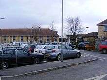
Paulton Memorial Hospital is a small community hospital located in the village of Paulton, Somerset, approximately 12 miles from the City of Bath, managed by Sirona Care & Health
There are 28 beds for inpatients in the hospital ward including 6 single rooms and the largest bay having 6 beds. An outpatient service operates 5 days a week Monday to Friday. Bath and North East Somerset Primary Care Trust contracted in Consultants time from 2 local acute trusts to provide specialist local outpatient service. The hospital also has other specialists offering advice (i.e. Diabetic Nurse Specialist, Continence Advisors) and a one stop INR clinic weekly and diagnostic ultrasound scans once or twice weekly.
Since 1949 the Memorial Hospital has also provided a maternity unit, managed by Royal United Hospital Bath NHS Trust which performs approximately 180 deliveries a year providing midwifery care during pregnancy, birth and the postnatal period.
History
The original hospital was founded by Colonel and Mrs. John George Mogg and was opened on October 1872 by Lord Arthur Harvey the then Bishop of Bath and Wells.
Over the past 130 years to the present day the local community have contributed greatly to the many developments that have taken place and to the purchase of substantial amounts of equipment, the most recent being £250,000 towards the building of the new Hospital which was opened in January 1997.
Since 2003 plans have been under discussion to close the hospital even prompting a debate in parliament.[1]
See also
References
- ↑ "Debates for 10th Sept 2003". Hansard. Retrieved 2006-06-25.
External links
Coordinates: 51°17′56″N 2°29′36″W / 51.298788°N 2.493467°W