Parappanangadi

| Parappanangadi parappnad | |
|---|---|
| town | |
|
Parappanangadi | |
| Coordinates: 11°02′59″N 75°51′27″E / 11.04972°N 75.85750°ECoordinates: 11°02′59″N 75°51′27″E / 11.04972°N 75.85750°E | |
| Country |
|
| State | Kerala |
| District | Malappuram |
| Government | |
| • Body | Parappanangadi Municipality |
| Area | |
| • Total | 22.5 km2 (8.7 sq mi) |
| Languages | |
| • Official | Malayalam, English |
| Time zone | IST (UTC+5:30) |
| PIN | 676303 |
| Telephone code | 0494 |
| Vehicle registration | KL-55,KL-65,KL-10 |
| Nearest city | Malappuram |
| Literacy | 100%% |
| Lok Sabha constituency | Ponnani |
| Civic agency | Parappanangadi Municipality |
| Climate | normal (Köppen) |
| Website |
www |
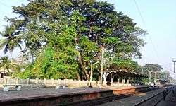
Parappanangadi is a small town in Tirurangadi taluk of Malappuram district, Kerala, India. It is a town located close to the Arabian sea. Parappanangadi railway station is one of the oldest railway stations in Kerala. It was a part of the first rail route (Tirur–Beypore) in Kerala.[1]
Parappanangadi is one of the most beautiful and peaceful villages of Kerala.[2]
History
This area was under the control of Parappanad Kingdom. In 1425, the country was divided into North Parappanad and South Parappanad. Parappanad Kingdom was the dependent of Zamorins of Calicut. As per history books, it's given that in the middle of the 18th century, the Royal Family of Parappanad Kingdom migrated into Travencore in the time of invasion of Hyderali.
Abhayam Palliative Project
"Abhayam" - an initiative of AKG Memorial Charitable Trust, Parappanangadi is one of the major NGOs in the district which function in the field of palliative care and other philanthropic activities.
Tourist Attractions
- Ottummal Beach
- Kettungal
- Keeranallur
- Newcut
- Kalpuzha
Important Landmarks
- Nahas hospital
- AKG Memorial hospital
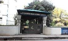
- BEM High School
- Co-operative College
- SNM Higher Secondary School
- Government High School Neduva
Temples
- Kalikavu Temple Puthenpeedika
- Thrikkulam Shiva Temple, Chemmad Road
- Sree mookambika Temple
- Ayyappankavu temple, Neduva
- Kaliyattakavu Bhagavathi Temple Puthenpeedika
- Vishnu sahasranamam Puthenpeedika*
- Bhagavathi Temple, Chirakkal
Nearby places
- Abdurahiman-Nagar, Ariyallur, Chelari and Idimuzhikkal
- Kalathingalpara, Kodinhi, Kundoor and Kunnumpuram
- Mambeethi, Muttumpuram, Nannambra, Neduva and Oorakam
- Pallikkalbazar, Pariyapuram, Poocholamad and Saddam-Beach
- Tennala, Teyyala, Thalappara and Vallikkunnu
Culture
Parappanangadi village is a predominantly Muslim populated area. Hindus exist in comparatively smaller numbers. So the culture of the locality is based upon Muslim traditions. Duff Muttu, Kolkali and Aravanamuttu are common folk arts of this locality. There are many libraries attached to mosques giving a rich source of Islamic studies. Most of the books are written in Arabi-Malayalam which is a version of the Malayalam language written in Arabic script. People gather in mosques for the evening prayer and continue to sit there after the prayers discussing social and cultural issues. Business and family issues are also sorted out during these evening meetings. The Hindu minority of this area keeps their rich traditions by celebrating various festivals in their temples. Hindu rituals are done here with a regular devotion like other parts of Kerala.[3]
Transportation
National highway No.66 passes through Parappanangadi and the northern stretch connects to Goa and Mumbai. The southern stretch connects to Cochin and Trivandrum. State Highway No.28 starts from Nilambur and connects to Ooty, Mysore and Bangalore through Highways.12,29 and 181. The nearest airport is at Kozhikode. The nearest major railway station is at Parappanangadi.
References
| Wikimedia Commons has media related to Parappanangadi. |