P'ukru (Bolivia)
For the mountain in Peru, see P'ukru.
| P'ukru | |
|---|---|
 P'ukru Location in Bolivia | |
| Highest point | |
| Elevation | 4,768 m (15,643 ft) [1] |
| Coordinates | 19°49′38″S 65°41′35″W / 19.82722°S 65.69306°WCoordinates: 19°49′38″S 65°41′35″W / 19.82722°S 65.69306°W |
| Geography | |
| Location |
Bolivia, Potosí Department |
| Parent range | Andes, Potosí mountain range |
P'ukru (Quechua for hole, pit, gap in a surface,[2] also spelled Phujro) or Phujru (Aymara for hole or pit in the earth without water, not very deep)[3] is a 4,768-metre (15,643 ft) high mountain in the Potosí mountain range in the Bolivian Andes. It is situated in the Potosí Department, Tomás Frías Province, in the south of the Potosí Municipality. P'ukru lies southwest of Khunurana and a mountain named Q'umir Qucha.[1][4]
References
- 1 2 Bolivian IGM map 1:50,000 Puna 6434-I
- ↑ Teofilo Laime Ajacopa, Diccionario Bilingüe Iskay simipi yuyayk'ancha, La Paz, 2007 (Quechua-Spanish dictionary)
- ↑ Radio San Gabriel, "Instituto Radiofonico de Promoción Aymara" (IRPA) 1993, Republicado por Instituto de las Lenguas y Literaturas Andinas-Amazónicas (ILLLA-A) 2011, Transcripción del Vocabulario de la Lengua Aymara, P. Ludovico Bertonio 1612 (Spanish-Aymara-Aymara-Spanish dictionary)
- ↑ "Potosí". INE, Bolivia. Retrieved October 8, 2014.
Capital: Potosí | ||
| Provinces | 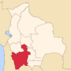 | |
| Municipalities (and seats) |
| |
This article is issued from Wikipedia - version of the 12/6/2015. The text is available under the Creative Commons Attribution/Share Alike but additional terms may apply for the media files.