Orange Street Historic District
|
Orange Street Historic District | |
|
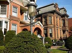
436 and 444 Orange St. | |
  | |
| Location | Roughly bounded by Whitney Ave., State, Eagle & Trumbull Sts., New Haven, Connecticut |
|---|---|
| Coordinates | 41°18′56″N 72°54′55″W / 41.31556°N 72.91528°WCoordinates: 41°18′56″N 72°54′55″W / 41.31556°N 72.91528°W |
| Area | 125 acres (51 ha) |
| Built | 1830 |
| Architect | Multiple |
| Architectural style | Greek Revival, Italianate, Queen Anne |
| NRHP Reference # | 85002314[1] |
| Added to NRHP | September 12, 1985 |
The Orange Street Historic District is a 125-acre (51 ha) historic district in the East Rock section of New Haven, Connecticut that was listed on the U.S. National Register of Historic Places in 1985. At that time, it included 546 buildings deemed to contribute to the historic character of the area.
The district is an irregularly shaped area that includes the southern half of Orange Street. The northern half of Orange Street is included in the Whitney Avenue Historic District, which abuts the Orange Street Historic District on the west.[2]
The Congregation Mishkan Israel's former building, at 55 Audubon Street, is one contributing building.
Gallery
 Everard Benjamin House (1838), 232 Bradley St., with Ionic portico.
 10 Lincoln St. (about 1840).
 Gothic cottage, 12 Lincoln St. (about 1840).
 Timothy Lester House (1846), 431 Orange St., towered Italian villa.
 223 Bradley St. (about 1848), home of George Dudley Seymour.
 Greek Revival porch, 445 Orange St. (about 1855).
 Nehemiah Sperry House (1857), 466 Orange St.
 Italian villa, 400 Orange St. (about 1857).
 John C. Anderson House (1882), 444 Orange St.
 Temple Mishkan Israel (1897), 55 Audubon St.
See also
References
- ↑ National Park Service (2009-03-13). "National Register Information System". National Register of Historic Places. National Park Service.
- ↑ Dorothea Penar; J. Paul Loether & John Herzan (February 27, 1985). "National Register of Historic Places Inventory-Nomination: Orange Street Historic District" (PDF). National Park Service. and Accompanying 34 photos, from 1984 and 1985
External links
| Topics | |
|---|---|
| Lists by states |
|
| Lists by insular areas | |
| Lists by associated states | |
| Other areas | |
| |
This article is issued from Wikipedia - version of the 11/28/2016. The text is available under the Creative Commons Attribution/Share Alike but additional terms may apply for the media files.