Newburyport Historic District
|
Newburyport Historic District | |
|
Buildings along State Street in the historic district | |
  | |
| Location | Newburyport, Massachusetts |
|---|---|
| Coordinates | 42°48′41″N 70°52′40″W / 42.81139°N 70.87778°WCoordinates: 42°48′41″N 70°52′40″W / 42.81139°N 70.87778°W |
| Architect | Multiple |
| Architectural style | Greek Revival, Late Victorian, Federal |
| NRHP Reference # | [1] |
| Added to NRHP | August 2, 1984 |

The Newburyport Historic District encompasses most of the historic downtown area of Newburyport, Massachusetts. It is roughly bounded by the Merrimack River, Water Street, State Street and High Streets. Covering some 750 acres (300 ha) of land and more than 2,500 contributing buildings, it includes the most populous part of the city, and a panoply of architectural styles, dating from the 17th century to the early 20th century.[2]
The district was added to the National Register of Historic Places in 1984.[1] It includes a number of properties previously listed on the National Register, including the former US Custom House (now a museum), the main post office, and the National Historic Landmark Caleb Cushing House.[2]
See also
References
- 1 2 National Park Service (2008-04-15). "National Register Information System". National Register of Historic Places. National Park Service.
- 1 2 "NRHP nomination for Newburyport Historic District". Commonwealth of Massachusetts. Retrieved 2014-01-20.
External links
| Topics | 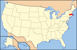 | ||||||||||||||||||||||||||||||
|---|---|---|---|---|---|---|---|---|---|---|---|---|---|---|---|---|---|---|---|---|---|---|---|---|---|---|---|---|---|---|---|
| Lists by county | |||||||||||||||||||||||||||||||
| Lists by city |
| ||||||||||||||||||||||||||||||
| Other lists | |||||||||||||||||||||||||||||||
| |||||||||||||||||||||||||||||||
This article is issued from Wikipedia - version of the 11/27/2016. The text is available under the Creative Commons Attribution/Share Alike but additional terms may apply for the media files.