Nasaasaaq
| Nasaasaaq | |
|---|---|
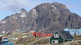 The western (right) and main (left) summits of Nasaasaaq seen from the northwest, from Sisimiut | |
| Highest point | |
| Elevation | 784 m (2,572 ft) [1] |
| Prominence | 784 m (2,572 ft) |
| Coordinates | 66°55′35″N 53°33′10″W / 66.92639°N 53.55278°WCoordinates: 66°55′35″N 53°33′10″W / 66.92639°N 53.55278°W |
| Geography | |
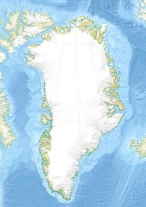 Nasaasaaq Mainland of Greenland | |
Nasaasaaq (Danish: Kællingehætten) is a 784 metres (2,572 ft) high[1] prominent mountain in the Qeqqata municipality in western Greenland. It is located on the mainland of Greenland, immediately to the southeast of Sisimiut on the northern coast of Amerloq Fjord, a tributary of Davis Strait.
The mountain massif is spread out over 6 kilometres (3.7 mi) in the west-east direction, constituting the terminal point of a long mountain range extending from the Pingu mountain group halfway between Davis Strait and the Greenland ice sheet (Greenlandic: Sermersuaq). The range flattens considerably towards the east in the area of Kangaamiut dike swarm north of Kangerlussuaq, due to pressure exerted by the icesheet for long periods in the past. The Nasaasaaq ridge connects to the other latitudinal ridges approximately 15 km (9.3 mi) east of Sisimiut.
Topography

The Nasaasaaq ridge has several summits. The main summit is the most prominent, rising over the remainder of the ridge in a tall 150 m (490 ft) cone at 784 m (2,572 ft). The ridge terminates in a 611 m (2,005 ft) trabant overlooking Sisimiut.[1]
To the east the ridge gradually falls to nearly 300 m (980 ft), before turning east-north-east towards the Aappilattorsuaq massif.[1] The southern wall of Nasaasaaq falls directly to Amerloq Fjord.
The northern wall is not a uniform surface, dissected by ledges, dihedrals, and ramps. The main access route to the summit leads through one of the ramps to the saddle between the main summit and its western trabant. The passage on the top cone is secured by ropes for unprepared tourists.
Tourism
The main summit is visited[2] for its long-range view of the coast, although more limited to the north than that of Palasip Qaqqaa to the north of the town airport. An alternative route to the top of interest to mountaineeers leads through the hard to find[3] low pass to the east of the main summit, and from there directly on the summit cone ridge.
Polar Route
The tough, 160 km (99 mi) long Arctic Circle Race takes place each winter, with the trail partially overlapping with the Polar Route from Sisimiut to Kangerlussuaq.[4] The race was inaugurated in 1998, since then becoming an international competition.[5] The Polar Route passes through the saddle between Nasaasaaq and the much lower Alanngorsuaq mountain to the north, with the summit of the latter sometimes visited by way of a variant. A small lift for downhill skiing is also installed on the saddle.[1]
References
| Wikimedia Commons has media related to Nasaasaaq. |
- 1 2 3 4 5 Vandrekort Vestgrønland: Sisimiut (Map) (1996 ed.). Cartography by Compukort, Denmark. Greenland Tourism a/s.
- ↑ "Sisimiut Tourist Information". Greenland Guide. Retrieved 5 July 2010.
- ↑ O'Carroll, Etain (2005). Greenland and the Arctic. Lonely Planet. p. 160. ISBN 1-74059-095-3.
- ↑ "Race setup". Arctic Circle Race. Retrieved 11 July 2010.
- ↑ "Arctic Circle Race". The Official Tourism and Business Site of Greenland. Retrieved 11 July 2010.