Lung Khung
| Lung Khung លុងឃុង | |
|---|---|
| Commune | |
 Lung Khung Location within Cambodia | |
| Coordinates: 13°38′N 107°8′E / 13.633°N 107.133°ECoordinates: 13°38′N 107°8′E / 13.633°N 107.133°E[1] | |
| Country |
|
| Province | Ratanakiri Province |
| District | Bar Kaev |
| Villages | 4 |
| Population (1998) | |
| • Total | 1,828 |
| Time zone | UTC+07 |
Lung Khung (Khmer: លុងឃុង) is a commune in Bar Kaev District in northeast Cambodia. It contains four villages and has a population of 1,828.[2] In the 2007 commune council elections, all five seats went to members of the Cambodian People's Party.[3] Land alienation is a problem of moderate severity in Lung Khung.[4] (See Ratanakiri Province for background information on land alienation.)
Villages
| Village[2][5] | Population[2] (1998) | Sex ratio[2] (male/female) (1998) | Number of households[2] (1998) |
|---|---|---|---|
| Lung Khung | 998 | 0.87 | 213 |
| Pa Ar | 383 | 0.95 | 84 |
| Pa Yang | 297 | 0.98 | 56 |
| Chreak | 146 | 0.90 | 32 |
In addition to the four villages listed above, the census recorded one household of four people outside the villages.
References
- ↑ http://geonames.nga.mil/ggmagaz/geonames4.asp
- 1 2 3 4 5 "Final Population Totals, Rotanak Kiri Province, 1998" (PDF). Cambodia National Institute of Statistics. Retrieved June 6, 2008.
- ↑ "Official Results of the 2007 Commune Councils Election in Ratank Kiri" (PDF). [sic] National Election Committee, No 4.58/07 NEC.SG.PIB. April 18, 2007. Retrieved June 6, 2008.
- ↑ "Land Alienation in Indigenous Minority Communities - Ratanakiri Province, Cambodia" (PDF). NGO Forum on Cambodia. August 2006. Retrieved June 6, 2008.
- ↑ "Commune name: Ratanak Kiri (រតនគីរី)". Cambodia National Institute of Statistics. Retrieved June 6, 2008.
Capital city: Banlung | |||||||||||||||||||||||||||||||||||
| Landmarks | 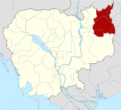 | ||||||||||||||||||||||||||||||||||
| Administrative divisions |
| ||||||||||||||||||||||||||||||||||
This article is issued from Wikipedia - version of the 8/29/2014. The text is available under the Creative Commons Attribution/Share Alike but additional terms may apply for the media files.