Lunenburg Historic District
|
Lunenburg Historic District | |
|
United Parish of Lunenburg | |
  | |
| Location | Lunenburg, Massachusetts |
|---|---|
| Coordinates | 42°35′42″N 71°43′32″W / 42.59500°N 71.72556°WCoordinates: 42°35′42″N 71°43′32″W / 42.59500°N 71.72556°W |
| Architect | Francis,Franklin S.; Francis,Sidney |
| Architectural style | Greek Revival, Italianate, Federal |
| NRHP Reference # | [1] |
| Added to NRHP | August 24, 1988 |
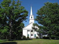
The Lunenburg Historic District is a historic district encompassing the historic center of Lunenburg, Massachusetts. The district is centered on a stretch of Main Street which connects two triangular intersections. It includes many of the town's oldest buildings, including the c. 1724 Cushing House, and the c. 1730 Stillman Stone House. Three of the town's most significant institutional buildings were built before 1850: the town hall (a former Unitarian church), the Congregational church, and the Methodist church.[2] The district is roughly bounded by Leominster Rd., Highland St., Oak Ave., Massachusetts Ave., Main St. and Lancaster Avenue.
The district was added to the National Register of Historic Places in 1988.[1]
See also
References
- 1 2 National Park Service (2008-04-15). "National Register Information System". National Register of Historic Places. National Park Service.
- ↑ "MACRIS inventory record for Lunenburg Historic District". Commonwealth of Massachusetts. Retrieved 2014-03-30.
| Topics | 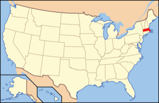 | ||||||||||||||||||||||||||||||
|---|---|---|---|---|---|---|---|---|---|---|---|---|---|---|---|---|---|---|---|---|---|---|---|---|---|---|---|---|---|---|---|
| Lists by county | |||||||||||||||||||||||||||||||
| Lists by city |
| ||||||||||||||||||||||||||||||
| Other lists | |||||||||||||||||||||||||||||||
| |||||||||||||||||||||||||||||||
This article is issued from Wikipedia - version of the 11/26/2016. The text is available under the Creative Commons Attribution/Share Alike but additional terms may apply for the media files.