Luguvalium
Luguvalium was a Roman town in northern Britain in antiquity. It was located within present-day Carlisle, Cumbria, and may have been the capital of the 4th-century province of Valentia.
Name
The Romans called the settlement at what is today Carlisle Luguvalium.[1] This was originally thought to mean "wall[ed town] of Lugus" but has since been explained as a borrowed Brittonic placename reconstructed as *Luguwalion, meaning "[city] of Luguwalos", Luguwalos being a masculine Celtic given name meaning "strength of Lugus".[2] The name apparently continued in use among Brythonic speakers in the Hen Ogledd and Wales and it was during that time that the initial element caer ("fort") was added. The place is mentioned in Welsh sources such as Nennius, who calls it Cair Ligualid,[3] and the Book of Taliesin where it is rendered Caer Liwelyδ[4] (Modern Welsh Caer Liwelydd). (These derived from the original Brittonic name, rather than from its Latin form.[2]) The earliest record of the place in English is as Luel (c. 1050);[5] later medieval forms include Cardeol, Karlioli, and Cærleoil. These appear to suggest that the northern form of the name did not have the final -ydd. (Compare the River Derwent in Cumbria with Derwenydd in Wales, both from Brittonic *Derwentjū.)
History
Prehistoric
There are limited remains of a settlement during the British Iron Age. Before the Romans, the chief city of the Carvetii seems to have been Clifton Dykes.
Roman
Following their earlier conquest of Britain and Boudica's revolt, the Romans erected a timber fort at the site around AD 72. The settlement formed part of the northern leg of the Roman-era Watling Street. Following the fort's demolition around 103, a second timber fort was constructed. About 165, this was replaced by a stone fortress.[6] Timber structures further to the south-east were probably associated military buildings. These were also later replaced in stone. When the civilian settlement in this area was enclosed by a stone wall is unknown, but it is generally assumed to have followed the line of the later medieval wall. The town probably became the civitas capital of the Carvetii tribe some time in the 2nd century and Cair Ligualid was listed among the 28 cities of Britain in Nennius.[7] A single large stone building has been located which may have been for administrative use. Industry included copper working and tanning, while merchants are also in evidence. Inscriptions show there was a Mithraeum in the town and possibly a temple to Mars,[8] who was identified with the local deity Belatucadros.
Medieval
Romano-British occupation of Luguvalium seems to have continued unbroken after the Roman withdrawal from Britain around 410. Possible 5th century buildings have been identified during excavation and Ford identifies the settlement as the court of Urien Rheged's kingdom.[3] Saint Cuthbert visited the town in the 7th century and described the high stone walls and an impressive fountain, presumably fed by a still functioning aqueduct. The place was under the control of a praepositus civitatis.
References
- ↑ Antonine Itinerary
- 1 2 Jackson, Kenneth (1953). Language and History in Early Britain. Edinbugh, UK: Edinburdh University Press. p. 39. ISBN 1-85182-140-6.
- 1 2 Ford, David Nash. "The 28 Cities of Britain" at Britannia. 2000.
- ↑ "Why Was Welsh Literature First Written Down?" in H. Fulton, Medieval Celtic Literature and Society, Dublin: Four Courts Press (2005) ISBN 1 85182 928 8, pp. 15–31.
- ↑ Bede's Lugubalia (c730 AD) is based on the Latin form.
- ↑ Pearce, John. "Locations around Vindolanda". Vindolanda Tablets Online. Retrieved 2007-01-29.
- ↑ Nennius (attrib.). Theodor Mommsen (ed.). Historia Brittonum, VI. Composed after AD 830. (Latin) Hosted at Latin Wikisource.
- ↑ Burnham, Barry C; Wacher, John (1990). The Small Towns of Roman Britain. London: B T Batsford.
Coordinates: 54°53′42″N 2°56′13″W / 54.895°N 2.937°W
| Wall Forts (East to West) | 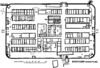 | |
|---|---|---|
| Outpost Forts | ||
| Stanegate Forts |
| |
| Supply Forts | ||
| Cumbrian Coast Forts (North to South) |
| |