Little Ilford
| Little Ilford | |
 Little Ilford |
|
| Population | 16,633 (2011 Census. Ward)[1] |
|---|---|
| OS grid reference | TQ435855 |
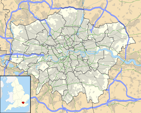
| London borough | Newham |
| Ceremonial county | Greater London |
| Region | London |
| Country | England |
| Sovereign state | United Kingdom |
| Post town | LONDON |
| Postcode district | E12 |
| Dialling code | 020 |
| Police | Metropolitan |
| Fire | London |
| Ambulance | London |
| EU Parliament | London |
| UK Parliament | East Ham |
| London Assembly | City and East |
Coordinates: 51°33′03″N 0°03′18″E / 51.5509°N 0.0549°E
Little Ilford is a district of London, England in the London Borough of Newham and the name of a ward in that borough.[2]
Locale
It is located near to Ilford (historically known as Great Ilford)[3] in the London Borough of Redbridge. They are divided from each other by the North Circular Road and the River Roding, and connected by the A118 road.
There is a large comprehensive school in the area called Little Ilford School.
Little Ilford is served by Church Road which contains a variety of shops, food outlets and a cab office. St Stephens Church is located within the boundary of little Ilford. Transport links include the 147 bus route from Canning Town to Ilford.
Etymology
Little Ilford and Great Ilford have a common etymology. The name is first recorded in the Domesday Book of 1086 as Ilefort and means ford over the Hyle; an old name for the River Roding that means "trickling stream".[3]
History
Little Ilford was a civil parish in the West Ham Rural Sanitary District in Essex from 1875 to 1886, when it became part the East Ham Urban Sanitary District, and after 1894 the East Ham urban district. It was abolished as a civil parish in 1900, becoming part of the parish of East Ham and from 1915 the County Borough of East Ham.[4]
References
- ↑ "Newham Ward population 2011". Neighbourhood Statistics. Office for National Statistics. Retrieved 17 October 2016.
- ↑ Newham London Borough Council - Councillors in Newham by Ward
- 1 2 Mills, A., Oxford Dictionary of London Place Names, (2001)
- ↑ Vision of Britain - East Ham CB (historic map)
| Districts | 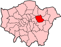 | |
|---|---|---|
| Attractions | ||
| Sports | ||
| Markets | ||
| Parks and open spaces |
| |
| Constituencies | ||
| Tube, rail and DLR stations |
| |
| Other topics | ||