| Name |
Location |
Date Listed |
Grid Ref. [note 1] |
Geo-coordinates |
Notes |
HB Number [note 2] |
Image |
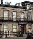
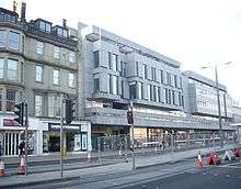
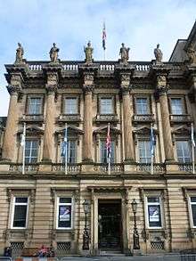
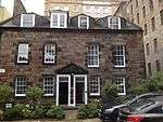
| West Register House |
Charlotte Square |
3 March 1966 |
|
55°57′06″N 3°12′34″W / 55.951602°N 3.209375°W / 55.951602; -3.209375 (West Register House) |
Former St George's Church |
27360 |
 Upload another image
|
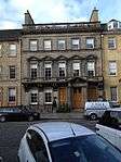
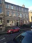
| 3 George Street (Incorporating Former No 13), Standard Life |
|
13 January 1966 |
|
55°57′15″N 3°11′43″W / 55.954256°N 3.195156°W / 55.954256; -3.195156 (3 George Street (Incorporating Former No 13), Standard Life) |
|
28829 |
 Upload another image
|
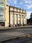
| George Hotel |
19–25 George Street |
12 December 1974 |
|
55°57′14″N 3°11′48″W / 55.953971°N 3.196732°W / 55.953971; -3.196732 (George Hotel) |
|
28830 |
 Upload another image
|
| Clydesdale Bank |
29 and 31 George Street |
13 January 1966 |
|
55°57′14″N 3°11′49″W / 55.953797°N 3.197063°W / 55.953797; -3.197063 (Clydesdale Bank) |
|
28831 |
 Upload another image
|
| 45 George Street |
|
13 January 1966 |
|
55°57′13″N 3°11′55″W / 55.953665°N 3.198677°W / 55.953665; -3.198677 (45 George Street) |
|
28836 |
 Upload another image
|
| 69 and 69A George Street |
|
13 January 1966 |
|
55°57′12″N 3°12′01″W / 55.953254°N 3.200234°W / 55.953254; -3.200234 (69 and 69A George Street) |
|
28844 |
 Upload another image
|
| 91 and 91A George Street |
|
13 January 1966 |
|
55°57′10″N 3°12′08″W / 55.952902°N 3.202289°W / 55.952902; -3.202289 (91 and 91A George Street) |
|
28847 |
 Upload another image
|
| Bank of Scotland |
97–105 George Street |
13 January 1966 |
|
55°57′10″N 3°12′10″W / 55.952906°N 3.202801°W / 55.952906; -3.202801 (Bank of Scotland) |
|
28850 |
 Upload another image
|
| 115 George Street |
|
13 January 1966 |
|
55°57′09″N 3°12′16″W / 55.95263°N 3.20441°W / 55.95263; -3.20441 (115 George Street) |
|
28854 |
 Upload another image
|
| Church of Scotland Offices |
117 to 121 George Street |
13 January 1966 |
|
55°57′10″N 3°12′17″W / 55.952643°N 3.204827°W / 55.952643; -3.204827 (Church of Scotland Offices) |
|
28855 |
 Upload another image
|
| 125 George Street |
|
14 December 1970 |
|
55°57′09″N 3°12′19″W / 55.952558°N 3.205305°W / 55.952558; -3.205305 (125 George Street) |
|
28856 |
 Upload another image
|
| Former Commercial Bank |
14 George Street |
13 January 1966 |
|
55°57′12″N 3°11′44″W / 55.953345°N 3.195544°W / 55.953345; -3.195544 (Former Commercial Bank) |
|
28862 |
 Upload another image
|
| Royal Society of Edinburgh |
22 and 24 George Street |
14 December 1970 |
|
55°57′12″N 3°11′47″W / 55.953389°N 3.196522°W / 55.953389; -3.196522 (Royal Society of Edinburgh) |
|
28864 |
 Upload another image
|
| 26 George Street |
|
13 January 1966 |
|
55°57′12″N 3°11′49″W / 55.953332°N 3.196825°W / 55.953332; -3.196825 (26 George Street) |
|
28865 |
 Upload another image
|
| 30, 30A and 32 George Street |
|
13 January 1966 |
|
55°57′12″N 3°11′51″W / 55.953264°N 3.197431°W / 55.953264; -3.197431 (30, 30A and 32 George Street) |
|
28866 |
 Upload another image
|
| 56 and 58 George Street |
|
13 January 1966 |
|
55°57′11″N 3°11′57″W / 55.952959°N 3.199151°W / 55.952959; -3.199151 (56 and 58 George Street) |
|
28870 |
 Upload another image
|
| Bank of Scotland |
62–66 George Street |
13 January 1966 |
|
55°57′10″N 3°11′58″W / 55.952867°N 3.199453°W / 55.952867; -3.199453 (Bank of Scotland) |
|
28873 |
 Upload another image
|
| National Westminster Bank |
78 and 80 George Street |
13 January 1966 |
|
55°57′09″N 3°12′04″W / 55.952544°N 3.201221°W / 55.952544; -3.201221 (National Westminster Bank) |
|
28876 |
 Upload another image
|
| Northern Lighthouse Board |
84 George Street |
13 January 1966 |
|
55°57′09″N 3°12′06″W / 55.95255°N 3.201541°W / 55.95255; -3.201541 (Northern Lighthouse Board) |
|
28877 |
 Upload another image
|
| 112 George Street |
|
13 January 1966 |
|
55°57′08″N 3°12′15″W / 55.952102°N 3.204186°W / 55.952102; -3.204186 (112 George Street) |
|
28883 |
 Upload another image
|
| Waverley Gate (former General Post Office) |
North Bridge |
14 December 1970 |
|
55°57′11″N 3°11′17″W / 55.952932°N 3.18802°W / 55.952932; -3.18802 (Waverley Gate (former General Post Office)) |
|
27631 |
 Upload another image
|
| General Register House |
Princes Street |
14 December 1970 |
|
55°57′13″N 3°11′21″W / 55.953711°N 3.189293°W / 55.953711; -3.189293 (General Register House) |
Occupied by the General Register Office for Scotland |
27636 |
 Upload another image
|
| New Register House |
West Register Street |
14 December 1970 |
|
55°57′15″N 3°11′25″W / 55.954196°N 3.190189°W / 55.954196; -3.190189 (New Register House) |
Occupied by the General Register Office for Scotland |
27641 |
 Upload another image
|
| Governor's House |
Calton Hill |
14 December 1970 |
|
55°57′11″N 3°11′07″W / 55.953157°N 3.185224°W / 55.953157; -3.185224 (Governor's House) |
|
27646 |
 Upload another image
|
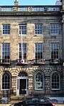
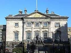
| Royal College of Physicians |
9 and 10 Queen Street |
3 March 1966 |
|
55°57′18″N 3°11′47″W / 55.954899°N 3.196473°W / 55.954899; -3.196473 (Royal College of Physicians) |
|
27732 |
 Upload another image
|
| Royal Scottish Academy |
77A Princes Street |
14 December 1970 |
|
55°57′07″N 3°11′47″W / 55.951818°N 3.196426°W / 55.951818; -3.196426 (Royal Scottish Academy) |
|
27744 |
 Upload another image
|
| Scottish National Portrait Gallery |
Queen Street |
14 December 1970 |
|
55°57′20″N 3°11′37″W / 55.955511°N 3.193609°W / 55.955511; -3.193609 (Scottish National Portrait Gallery) |
|
27764 |
.jpg) Upload another image
See more images
|
| Melville Monument |
St Andrew Square |
13 January 1966 |
|
55°57′15″N 3°11′35″W / 55.954222°N 3.193169°W / 55.954222; -3.193169 (Melville Monument) |
|
27816 |
 Upload another image
|
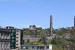
| National Monument of Scotland |
Calton Hill |
19 April 1966 |
|
55°57′17″N 3°10′55″W / 55.954743°N 3.181909°W / 55.954743; -3.181909 (National Monument of Scotland) |
|
27820 |
 Upload another image
See more images
|
| Nelson Monument |
Calton Hill |
19 April 1966 |
|
55°57′15″N 3°10′58″W / 55.954305°N 3.182649°W / 55.954305; -3.182649 (Nelson Monument) |
|
27823 |
 Upload another image
See more images
|
| Playfair's Monument |
Calton Hill |
19 April 1966 |
|
55°57′17″N 3°10′59″W / 55.954795°N 3.183064°W / 55.954795; -3.183064 (Playfair's Monument) |
|
27826 |
 Upload another image
|
| Scott Monument |
East Princes Street Gardens |
14 December 1970 |
|
55°57′09″N 3°11′36″W / 55.952379°N 3.193272°W / 55.952379; -3.193272 (Scott Monument) |
|
27829 |
 Upload another image
See more images
|
| Catherine Sinclair Monument |
Queen Street |
14 December 1970 |
|
55°57′11″N 3°12′27″W / 55.953191°N 3.207615°W / 55.953191; -3.207615 (Catherine Sinclair Monument) |
|
27832 |
 Upload another image
|
| Dugald Stewart's Monument |
Calton Hill |
19 April 1966 |
|
55°57′16″N 3°11′04″W / 55.954512°N 3.184481°W / 55.954512; -3.184481 (Dugald Stewart's Monument) |
|
27835 |
 Upload another image
See more images
|
| Albert Memorial |
Charlotte Square |
3 March 1966 |
|
55°57′06″N 3°12′28″W / 55.951762°N 3.207666°W / 55.951762; -3.207666 (Albert Memorial) |
|
27840 |
 Upload another image
|
| Adam Black Monument |
East Princes Street Gardens |
14 December 1970 |
|
55°57′08″N 3°11′40″W / 55.952179°N 3.194435°W / 55.952179; -3.194435 (Adam Black Monument) |
|
27842 |
 Upload another image
|
| Statue of Dr Chalmers |
George Street |
13 January 1966 |
|
55°57′09″N 3°12′13″W / 55.952467°N 3.20354°W / 55.952467; -3.20354 (Statue of Dr Chalmers) |
|
27847 |
 Upload another image
|
| Statue of George IV |
George Street |
13 January 1966 |
|
55°57′13″N 3°11′50″W / 55.953526°N 3.197279°W / 55.953526; -3.197279 (Statue of George IV) |
|
27854 |
 Upload another image
See more images
|
| Monument to John, 4th Earl of Hopetoun |
St Andrew Square |
13 April 1965 |
|
55°57′16″N 3°11′30″W / 55.954461°N 3.19167°W / 55.954461; -3.19167 (Monument to John, 4th Earl of Hopetoun) |
|
27862 |
 Upload another image
|
| Livingstone Monument |
East Princes Street Gardens |
14 December 1970 |
|
55°57′09″N 3°11′34″W / 55.952473°N 3.192762°W / 55.952473; -3.192762 (Livingstone Monument) |
|
27864 |
 Upload another image
|
| Allan Ramsay Monument |
West Princes Street Gardens |
14 December 1970 |
|
55°57′06″N 3°11′50″W / 55.951701°N 3.197335°W / 55.951701; -3.197335 (Allan Ramsay Monument) |
|
27870 |
 Upload another image
|
| Monument to Duke of Wellington |
Princes Street |
13 January 1966 |
|
55°57′13″N 3°11′21″W / 55.953478°N 3.189174°W / 55.953478; -3.189174 (Monument to Duke of Wellington) |
|
27879 |
 Upload another image
|
| John Wilson Monument |
East Princes Street Gardens |
14 December 1970 |
|
55°57′07″N 3°11′42″W / 55.952073°N 3.195088°W / 55.952073; -3.195088 (John Wilson Monument) |
|
27881 |
 Upload another image
|
| Ross Fountain |
West Princes Street Gardens |
14 December 1970 |
|
55°57′00″N 3°12′11″W / 55.950073°N 3.203066°W / 55.950073; -3.203066 (Ross Fountain) |
|
27911 |
 Upload another image
|
| Old Royal High School |
Calton Hill |
19 April 1966 |
|
55°57′12″N 3°10′52″W / 55.953332°N 3.181066°W / 55.953332; -3.181066 (Old Royal High School) |
Including Lodge, Classroom Block, Retaining/ Boundary Walls, Gateposts and Railings |
27987 |
 Upload another image
|
| 3, 3B Albany Street |
|
24 May 1966 |
|
55°57′24″N 3°11′34″W / 55.956767°N 3.192862°W / 55.956767; -3.192862 (3, 3B Albany Street) |
|
28218 |
 Upload another image
|
| 5-7B Albany Street |
|
24 May 1966 |
|
55°57′25″N 3°11′33″W / 55.956806°N 3.192591°W / 55.956806; -3.192591 (5-7B Albany Street) |
|
28219 |
 Upload another image
|
| 9, 9A, 9B Albany Street |
|
24 May 1966 |
|
55°57′24″N 3°11′33″W / 55.956789°N 3.192447°W / 55.956789; -3.192447 (9, 9A, 9B Albany Street) |
|
28220 |
 Upload another image
|
| 11–19 Albany Street |
|
24 May 1966 |
|
55°57′25″N 3°11′31″W / 55.95693°N 3.191874°W / 55.95693; -3.191874 (11–19 Albany Street) |
|
28221 |
 Upload another image
|
| 21-23A Albany Street |
|
24 May 1966 |
|
55°57′25″N 3°11′29″W / 55.956997°N 3.191444°W / 55.956997; -3.191444 (21-23A Albany Street) |
|
28222 |
 Upload another image
|
| 25, 25B Albany Street |
|
24 May 1966 |
|
55°57′25″N 3°11′29″W / 55.957043°N 3.191333°W / 55.957043; -3.191333 (25, 25B Albany Street) |
|
28223 |
 Upload another image
|
| 27–33 Albany Street |
|
24 May 1966 |
|
55°57′26″N 3°11′27″W / 55.957111°N 3.190807°W / 55.957111; -3.190807 (27–33 Albany Street) |
|
28224 |
 Upload another image
|
| 39–43 Albany Street |
|
24 May 1966 |
|
55°57′26″N 3°11′23″W / 55.95713°N 3.189734°W / 55.95713; -3.189734 (39–43 Albany Street) |
|
28226 |
 Upload another image
|
| 8–16 Albany Street |
|
13 September 1964 |
|
55°57′26″N 3°11′35″W / 55.957126°N 3.192986°W / 55.957126; -3.192986 (8–16 Albany Street) |
|
28229 |
 Upload another image
|
| 18–40 Albany Street |
|
13 September 1964 |
|
55°57′26″N 3°11′31″W / 55.957308°N 3.191822°W / 55.957308; -3.191822 (18–40 Albany Street) |
|
28230 |
 Upload another image
|
| 42–44 Albany Street |
|
13 September 1964 |
|
55°57′27″N 3°11′26″W / 55.957537°N 3.190436°W / 55.957537; -3.190436 (42–44 Albany Street) |
|
28231 |
 Upload another image
|
| 1 and 2 Royal Terrace |
|
14 December 1970 |
|
55°57′24″N 3°10′40″W / 55.956662°N 3.177643°W / 55.956662; -3.177643 (1 and 2 Royal Terrace) |
|
29681 |
 Upload another image
|
| 3 Royal Terrace |
|
14 December 1970 |
|
55°57′24″N 3°10′51″W / 55.956732°N 3.180721°W / 55.956732; -3.180721 (3 Royal Terrace) |
|
49801 |
 Upload another image
|
| 4 Royal Terrace |
|
14 December 1970 |
|
55°57′24″N 3°10′50″W / 55.956742°N 3.180561°W / 55.956742; -3.180561 (4 Royal Terrace) |
|
49802 |
 Upload another image
|
| 5 Royal Terrace |
|
14 December 1970 |
|
55°57′24″N 3°10′50″W / 55.956744°N 3.180417°W / 55.956744; -3.180417 (5 Royal Terrace) |
|
49803 |
 Upload another image
|
| 6 Royal Terrace |
|
14 December 1970 |
|
55°57′24″N 3°10′49″W / 55.956736°N 3.180272°W / 55.956736; -3.180272 (6 Royal Terrace) |
|
49804 |
 Upload another image
|
| 7 Royal Terrace |
|
14 December 1970 |
|
55°57′24″N 3°10′49″W / 55.956728°N 3.180176°W / 55.956728; -3.180176 (7 Royal Terrace) |
|
49805 |
 Upload another image
|
| 8 Royal Terrace |
|
14 December 1970 |
|
55°57′24″N 3°10′48″W / 55.956729°N 3.180064°W / 55.956729; -3.180064 (8 Royal Terrace) |
|
49806 |
 Upload another image
|
| 9 Royal Terrace |
|
14 December 1970 |
|
55°57′24″N 3°10′48″W / 55.956703°N 3.179935°W / 55.956703; -3.179935 (9 Royal Terrace) |
|
49807 |
 Upload another image
|
| 10 Royal Terrace |
|
14 December 1970 |
|
55°57′24″N 3°10′47″W / 55.956705°N 3.179759°W / 55.956705; -3.179759 (10 Royal Terrace) |
|
49808 |
 Upload another image
|
| 11 and 12 Royal Terrace |
|
14 December 1970 |
|
55°57′24″N 3°10′46″W / 55.956716°N 3.179583°W / 55.956716; -3.179583 (11 and 12 Royal Terrace) |
|
49809 |
 Upload another image
|
| 13 Royal Terrace |
|
14 December 1970 |
|
55°57′24″N 3°10′45″W / 55.956709°N 3.179294°W / 55.956709; -3.179294 (13 Royal Terrace) |
|
49810 |
 Upload another image
|
| 14 Royal Terrace |
|
14 December 1970 |
|
55°57′24″N 3°10′45″W / 55.956693°N 3.179134°W / 55.956693; -3.179134 (14 Royal Terrace) |
|
49811 |
 Upload another image
|
| 15 Royal Terrace |
|
14 December 1970 |
|
55°57′24″N 3°10′45″W / 55.956703°N 3.179038°W / 55.956703; -3.179038 (15 Royal Terrace) |
|
49812 |
 Upload another image
|
| Crowne Plaza Hotel (As of 2014; formerly the Royal Terrace Hotel)[1] |
16–22 Royal Terrace |
14 December 1970 |
|
55°57′24″N 3°10′43″W / 55.95668°N 3.178621°W / 55.95668; -3.178621 (Crowne Plaza Hotel (As of 2014; formerly the Royal Terrace Hotel)[2]) |
|
49813 |
 Upload another image
|
| 23 Royal Terrace |
|
14 December 1970 |
|
55°57′24″N 3°10′40″W / 55.956669°N 3.1779°W / 55.956669; -3.1779 (23 Royal Terrace) |
|
49814 |
 Upload another image
|
| 24 Royal Terrace |
|
14 December 1970 |
|
55°57′24″N 3°10′40″W / 55.95667°N 3.177772°W / 55.95667; -3.177772 (24 Royal Terrace) |
|
49815 |
 Upload another image
|
| 25 Royal Terrace |
|
14 December 1970 |
|
55°57′24″N 3°10′40″W / 55.956662°N 3.177643°W / 55.956662; -3.177643 (25 Royal Terrace) |
|
49816 |
 Upload another image
|
| 26 Royal Terrace |
|
14 December 1970 |
|
55°57′24″N 3°10′39″W / 55.956664°N 3.177483°W / 55.956664; -3.177483 (26 Royal Terrace) |
|
49817 |
 Upload another image
|
| 27 Royal Terrace |
|
14 December 1970 |
|
55°57′24″N 3°10′38″W / 55.956656°N 3.177355°W / 55.956656; -3.177355 (27 Royal Terrace) |
|
49818 |
 Upload another image
|
| 28 Royal Terrace |
|
14 December 1970 |
|
55°57′24″N 3°10′38″W / 55.956658°N 3.177195°W / 55.956658; -3.177195 (28 Royal Terrace) |
|
49819 |
 Upload another image
|
| 29 Royal Terrace |
|
14 December 1970 |
|
55°57′24″N 3°10′37″W / 55.95665°N 3.177066°W / 55.95665; -3.177066 (29 Royal Terrace) |
|
49820 |
 Upload another image
|
| 30 Royal Terrace |
|
14 December 1970 |
|
55°57′24″N 3°10′37″W / 55.956651°N 3.176906°W / 55.956651; -3.176906 (30 Royal Terrace) |
|
49821 |
 Upload another image
|
| 31 Royal Terrace |
|
14 December 1970 |
|
55°57′24″N 3°10′36″W / 55.956644°N 3.176746°W / 55.956644; -3.176746 (31 Royal Terrace) |
|
49823 |
 Upload another image
|
| 32 Royal Terrace |
|
14 December 1970 |
|
55°57′24″N 3°10′36″W / 55.956636°N 3.176601°W / 55.956636; -3.176601 (32 Royal Terrace) |
|
49824 |
 Upload another image
|
| 33 Royal Terrace |
|
14 December 1970 |
|
55°57′24″N 3°10′35″W / 55.95662°N 3.176425°W / 55.95662; -3.176425 (33 Royal Terrace) |
|
49825 |
 Upload another image
|
| 34 Royal Terrace |
|
14 December 1970 |
|
55°57′24″N 3°10′35″W / 55.956621°N 3.176265°W / 55.956621; -3.176265 (34 Royal Terrace) |
|
49826 |
 Upload another image
|
| 35 Royal Terrace |
|
14 December 1970 |
|
55°57′24″N 3°10′34″W / 55.956614°N 3.17612°W / 55.956614; -3.17612 (35 Royal Terrace) |
|
49827 |
 Upload another image
|
| 36 Royal Terrace |
|
14 December 1970 |
|
55°57′24″N 3°10′33″W / 55.956616°N 3.175944°W / 55.956616; -3.175944 (36 Royal Terrace) |
|
49828 |
 Upload another image
|
| 37 Royal Terrace |
|
14 December 1970 |
|
55°57′24″N 3°10′33″W / 55.956608°N 3.175784°W / 55.956608; -3.175784 (37 Royal Terrace) |
|
49829 |
 Upload another image
|
| 38 Royal Terrace |
|
14 December 1970 |
|
55°57′24″N 3°10′32″W / 55.956618°N 3.17564°W / 55.956618; -3.17564 (38 Royal Terrace) |
|
49830 |
 Upload another image
|
| 39 Royal Terrace |
|
14 December 1970 |
|
55°57′24″N 3°10′32″W / 55.956611°N 3.175479°W / 55.956611; -3.175479 (39 Royal Terrace) |
|
49831 |
 Upload another image
|
| 40 Royal Terrace |
|
14 December 1970 |
|
55°57′24″N 3°10′31″W / 55.956613°N 3.175319°W / 55.956613; -3.175319 (40 Royal Terrace) |
|
49832 |
 Upload another image
|
| 1 Regent Terrace |
|
16 December 1965 |
|
55°57′18″N 3°10′35″W / 55.954959°N 3.176294°W / 55.954959; -3.176294 (1 Regent Terrace) |
|
29618 |
 Upload another image
|
| 2 Regent Terrace |
|
16 December 1965 |
|
55°57′15″N 3°10′41″W / 55.954214°N 3.178097°W / 55.954214; -3.178097 (2 Regent Terrace) |
|
49765 |
 Upload another image
|
| 3 Regent Terrace |
|
16 December 1965 |
|
55°57′15″N 3°10′41″W / 55.954224°N 3.177938°W / 55.954224; -3.177938 (3 Regent Terrace) |
|
49766 |
 Upload another image
|
| 4 Regent Terrace |
|
16 December 1965 |
|
55°57′15″N 3°10′40″W / 55.954271°N 3.177811°W / 55.954271; -3.177811 (4 Regent Terrace) |
|
49767 |
 Upload another image
|
| 5 Regent Terrace |
|
16 December 1965 |
|
55°57′16″N 3°10′40″W / 55.954352°N 3.177765°W / 55.954352; -3.177765 (5 Regent Terrace) |
|
49768 |
 Upload another image
|
| 6 Regent Terrace |
|
16 December 1965 |
|
55°57′16″N 3°10′40″W / 55.954398°N 3.177639°W / 55.954398; -3.177639 (6 Regent Terrace) |
|
49769 |
 Upload another image
|
| 7 Regent Terrace |
|
16 December 1965 |
|
55°57′16″N 3°10′39″W / 55.954434°N 3.177576°W / 55.954434; -3.177576 (7 Regent Terrace) |
|
49770 |
 Upload another image
|
| 8 Regent Terrace |
|
16 December 1965 |
|
55°57′16″N 3°10′39″W / 55.95448°N 3.177465°W / 55.95448; -3.177465 (8 Regent Terrace) |
|
49771 |
 Upload another image
|
| 9 Regent Terrace |
|
16 December 1965 |
|
55°57′16″N 3°10′39″W / 55.95458°N 3.177372°W / 55.95458; -3.177372 (9 Regent Terrace) |
|
49772 |
 Upload another image
|
| 10 Regent Terrace |
|
16 December 1965 |
|
55°57′17″N 3°10′38″W / 55.9546°N 3.177212°W / 55.9546; -3.177212 (10 Regent Terrace) |
|
49773 |
 Upload another image
|
| 11 Regent Terrace |
|
16 December 1965 |
|
55°57′17″N 3°10′37″W / 55.954628°N 3.177053°W / 55.954628; -3.177053 (11 Regent Terrace) |
|
49774 |
 Upload another image
|
| 12 Regent Terrace |
|
16 December 1965 |
|
55°57′17″N 3°10′37″W / 55.954674°N 3.176958°W / 55.954674; -3.176958 (12 Regent Terrace) |
|
49775 |
 Upload another image
|
| 13 Regent Terrace |
|
16 December 1965 |
|
55°57′17″N 3°10′37″W / 55.954711°N 3.176847°W / 55.954711; -3.176847 (13 Regent Terrace) |
|
49776 |
 Upload another image
|
| 14 Regent Terrace |
|
16 December 1965 |
|
55°57′17″N 3°10′36″W / 55.954757°N 3.176737°W / 55.954757; -3.176737 (14 Regent Terrace) |
|
49777 |
 Upload another image
|
| 15 Regent Terrace |
|
16 December 1965 |
|
55°57′17″N 3°10′36″W / 55.954803°N 3.176626°W / 55.954803; -3.176626 (15 Regent Terrace) |
|
49778 |
 Upload another image
|
| 16 Regent Terrace |
|
16 December 1965 |
|
55°57′17″N 3°10′35″W / 55.954858°N 3.176499°W / 55.954858; -3.176499 (16 Regent Terrace) |
|
49779 |
 Upload another image
|
| 17 Regent Terrace |
|
16 December 1965 |
|
55°57′18″N 3°10′35″W / 55.954913°N 3.176389°W / 55.954913; -3.176389 (17 Regent Terrace) |
|
49780 |
 Upload another image
|
| 18 Regent Terrace |
|
16 December 1965 |
|
55°57′18″N 3°10′35″W / 55.954959°N 3.176294°W / 55.954959; -3.176294 (18 Regent Terrace) |
|
49781 |
 Upload another image
|
| 19 Regent Terrace |
|
16 December 1965 |
|
55°57′18″N 3°10′34″W / 55.955005°N 3.176168°W / 55.955005; -3.176168 (19 Regent Terrace) |
|
49782 |
 Upload another image
|
| 20 Regent Terrace |
|
16 December 1965 |
|
55°57′18″N 3°10′34″W / 55.95506°N 3.176057°W / 55.95506; -3.176057 (20 Regent Terrace) |
|
49783 |
 Upload another image
|
| 21 Regent Terrace |
|
16 December 1965 |
|
55°57′18″N 3°10′33″W / 55.955097°N 3.17593°W / 55.955097; -3.17593 (21 Regent Terrace) |
|
49784 |
 Upload another image
|
| 22 Regent Terrace |
|
16 December 1965 |
|
55°57′19″N 3°10′33″W / 55.955152°N 3.175804°W / 55.955152; -3.175804 (22 Regent Terrace) |
|
49785 |
 Upload another image
|
| 23 Regent Terrace |
|
16 December 1965 |
|
55°57′19″N 3°10′32″W / 55.95518°N 3.175692°W / 55.95518; -3.175692 (23 Regent Terrace) |
|
49786 |
 Upload another image
|
| 24 Regent Terrace |
|
16 December 1965 |
|
55°57′19″N 3°10′32″W / 55.955244°N 3.175582°W / 55.955244; -3.175582 (24 Regent Terrace) |
|
49787 |
 Upload another image
|
| 25 Regent Terrace |
|
16 December 1965 |
|
55°57′19″N 3°10′32″W / 55.955281°N 3.175471°W / 55.955281; -3.175471 (25 Regent Terrace) |
|
49790 |
 Upload another image
|
| 26 Regent Terrace |
|
16 December 1965 |
|
55°57′19″N 3°10′31″W / 55.955327°N 3.175344°W / 55.955327; -3.175344 (26 Regent Terrace) |
|
49791 |
 Upload another image
|
| 27 Regent Terrace |
|
16 December 1965 |
|
55°57′19″N 3°10′31″W / 55.955374°N 3.175218°W / 55.955374; -3.175218 (27 Regent Terrace) |
|
49792 |
 Upload another image
|
| 28 Regent Terrace |
|
16 December 1965 |
|
55°57′20″N 3°10′31″W / 55.955464°N 3.17514°W / 55.955464; -3.17514 (28 Regent Terrace) |
|
49793 |
 Upload another image
|
| 29 Regent Terrace |
|
16 December 1965 |
|
55°57′20″N 3°10′30″W / 55.955492°N 3.175013°W / 55.955492; -3.175013 (29 Regent Terrace) |
|
49794 |
 Upload another image
|
| 30 Regent Terrace |
|
16 December 1965 |
|
55°57′20″N 3°10′30″W / 55.955529°N 3.174886°W / 55.955529; -3.174886 (30 Regent Terrace) |
|
49795 |
 Upload another image
|
| 31 Regent Terrace |
|
16 December 1965 |
|
55°57′20″N 3°10′29″W / 55.955576°N 3.174759°W / 55.955576; -3.174759 (31 Regent Terrace) |
|
49796 |
 Upload another image
|
| 32 Regent Terrace |
|
16 December 1965 |
|
55°57′20″N 3°10′29″W / 55.955613°N 3.174648°W / 55.955613; -3.174648 (32 Regent Terrace) |
|
49797 |
 Upload another image
|
| 33 Regent Terrace |
|
16 December 1965 |
|
55°57′20″N 3°10′28″W / 55.955659°N 3.174538°W / 55.955659; -3.174538 (33 Regent Terrace) |
|
49798 |
 Upload another image
|
| 34 Regent Terrace |
|
16 December 1965 |
|
55°57′21″N 3°10′28″W / 55.955704°N 3.174443°W / 55.955704; -3.174443 (34 Regent Terrace) |
|
49799 |
 Upload another image
|
| 1 Carlton Terrace |
|
16 December 1965 |
|
55°57′22″N 3°10′25″W / 55.956189°N 3.173577°W / 55.956189; -3.173577 (1 Carlton Terrace) |
|
28460 |
 Upload another image
|
| 2, 3, 4 Carlton Terrace |
|
16 December 1965 |
|
55°57′21″N 3°10′27″W / 55.955887°N 3.174096°W / 55.955887; -3.174096 (2, 3, 4 Carlton Terrace) |
|
49746 |
 Upload another image
|
| 5 Carlton Terrace |
|
16 December 1965 |
|
55°57′22″N 3°10′25″W / 55.956008°N 3.173699°W / 55.956008; -3.173699 (5 Carlton Terrace) |
|
49747 |
 Upload another image
|
| 6 Carlton Terrace |
|
16 December 1965 |
|
55°57′22″N 3°10′25″W / 55.95609°N 3.173622°W / 55.95609; -3.173622 (6 Carlton Terrace) |
|
49748 |
 Upload another image
|
| 7 Carlton Terrace |
|
16 December 1965 |
|
55°57′22″N 3°10′25″W / 55.956189°N 3.173577°W / 55.956189; -3.173577 (7 Carlton Terrace) |
|
49749 |
 Upload another image
|
| 8 Carlton Terrace |
|
16 December 1965 |
|
55°57′23″N 3°10′25″W / 55.956261°N 3.173579°W / 55.956261; -3.173579 (8 Carlton Terrace) |
|
49750 |
 Upload another image
|
| 9 Carlton Terrace |
|
16 December 1965 |
|
55°57′23″N 3°10′25″W / 55.956359°N 3.173614°W / 55.956359; -3.173614 (9 Carlton Terrace) |
|
49751 |
 Upload another image
|
| 10 Carlton Terrace |
|
16 December 1965 |
|
55°57′23″N 3°10′25″W / 55.956431°N 3.173664°W / 55.956431; -3.173664 (10 Carlton Terrace) |
|
49752 |
 Upload another image
|
| 11 Carlton Terrace |
|
16 December 1965 |
|
55°57′23″N 3°10′25″W / 55.956511°N 3.173715°W / 55.956511; -3.173715 (11 Carlton Terrace) |
|
49753 |
 Upload another image
|
| 12 Carlton Terrace |
|
16 December 1965 |
|
55°57′24″N 3°10′26″W / 55.956581°N 3.173909°W / 55.956581; -3.173909 (12 Carlton Terrace) |
|
49754 |
 Upload another image
|
| 13 Carlton Terrace |
|
16 December 1965 |
|
55°57′24″N 3°10′27″W / 55.956589°N 3.174069°W / 55.956589; -3.174069 (13 Carlton Terrace) |
|
49755 |
 Upload another image
|
| 14 Carlton Terrace |
|
16 December 1965 |
|
55°57′24″N 3°10′27″W / 55.956596°N 3.174198°W / 55.956596; -3.174198 (14 Carlton Terrace) |
|
49756 |
 Upload another image
|
| 15 Carlton Terrace |
|
16 December 1965 |
|
55°57′24″N 3°10′28″W / 55.956594°N 3.17439°W / 55.956594; -3.17439 (15 Carlton Terrace) |
|
49757 |
 Upload another image
|
| 16 Carlton Terrace |
|
16 December 1965 |
|
55°57′24″N 3°10′28″W / 55.956602°N 3.174534°W / 55.956602; -3.174534 (16 Carlton Terrace) |
|
49758 |
 Upload another image
|
| 17 Carlton Terrace |
|
16 December 1965 |
|
55°57′24″N 3°10′29″W / 55.95661°N 3.174695°W / 55.95661; -3.174695 (17 Carlton Terrace) |
|
49759 |
 Upload another image
|
| 18 Carlton Terrace |
|
16 December 1965 |
|
55°57′24″N 3°10′30″W / 55.95659°N 3.17487°W / 55.95659; -3.17487 (18 Carlton Terrace) |
|
49760 |
 Upload another image
|
| 19 Carlton Terrace |
|
16 December 1965 |
|
55°57′24″N 3°10′30″W / 55.956598°N 3.174983°W / 55.956598; -3.174983 (19 Carlton Terrace) |
|
49761 |
 Upload another image
|
| Robert Louis Stevenson Memorial |
West Princes Street Gardens |
15 October 2001 |
|
55°57′00″N 3°12′08″W / 55.950026°N 3.202312°W / 55.950026; -3.202312 (Robert Louis Stevenson Memorial) |
|
48255 |
 Upload another image
|
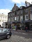
| 87 George Street |
New Town |
13 January 1966 |
|
55°57′11″N 3°12′07″W / 55.952923°N 3.201985°W / 55.952923; -3.201985 (87 George Street) |
|
43287 |
 Upload another image
|
| 5–9 Hill Street |
New Town |
3 March 1966 |
|
55°57′13″N 3°12′07″W / 55.953605°N 3.20207°W / 55.953605; -3.20207 (5–9 Hill Street) |
|
43296 |
 Upload another image
|
| 11 and 13 Hill Street |
New Town |
3 March 1966 |
|
55°57′13″N 3°12′08″W / 55.953576°N 3.20231°W / 55.953576; -3.20231 (11 and 13 Hill Street) |
|
43297 |
 Upload another image
|
| 15 Hill Street |
New Town |
3 March 1966 |
|
55°57′13″N 3°12′10″W / 55.953509°N 3.202644°W / 55.953509; -3.202644 (15 Hill Street) |
|
43298 |
 Upload another image
|
| 6 and 8 Hill Street |
New Town |
3 March 1966 |
|
55°57′12″N 3°12′07″W / 55.953408°N 3.201952°W / 55.953408; -3.201952 (6 and 8 Hill Street) |
|
43299 |
 Upload another image
|
| 10 Hill Street |
New Town |
3 March 1966 |
|
55°57′12″N 3°12′07″W / 55.953398°N 3.202064°W / 55.953398; -3.202064 (10 Hill Street) |
|
43300 |
 Upload another image
|
| 12 Hill Street |
New Town |
3 March 1966 |
|
55°57′12″N 3°12′08″W / 55.95337°N 3.202191°W / 55.95337; -3.202191 (12 Hill Street) |
|
43301 |
 Upload another image
|
| 14 and 16 Hill Street |
New Town |
3 March 1966 |
|
55°57′12″N 3°12′09″W / 55.953332°N 3.202446°W / 55.953332; -3.202446 (14 and 16 Hill Street) |
|
43302 |
 Upload another image
|
| 18 and 20 Hill Street |
New Town |
3 March 1966 |
|
55°57′12″N 3°12′09″W / 55.953312°N 3.20259°W / 55.953312; -3.20259 (18 and 20 Hill Street) |
|
43303 |
 Upload another image
|
| 22 Hill Street |
New Town |
3 March 1966 |
|
55°57′12″N 3°12′10″W / 55.953237°N 3.202908°W / 55.953237; -3.202908 (22 Hill Street) |
|
43304 |
 Upload another image
|
| 24 Hill Street |
New Town |
3 March 1966 |
|
55°57′12″N 3°12′11″W / 55.953209°N 3.203035°W / 55.953209; -3.203035 (24 Hill Street) |
|
43305 |
 Upload another image
|
| 84–87 Princes Street, incorporating the New Club |
Princes Street, New Town |
28 March 1996 |
|
55°57′08″N 3°11′53″W / 55.952161°N 3.198086°W / 55.952161; -3.198086 (84–87 Princes Street, incorporating the New Club) |
|
43322 |
 Upload another image
|
| 9 and 10 St Andrew Square |
|
28 March 1996 |
|
55°57′12″N 3°11′39″W / 55.953447°N 3.194298°W / 55.953447; -3.194298 (9 and 10 St Andrew Square) |
|
43349 |
 Upload another image
|
| Thistle Street, 3 and 4 Thistle Court |
|
13 January 1966 |
|
55°57′16″N 3°11′46″W / 55.954454°N 3.196075°W / 55.954454; -3.196075 (Thistle Street, 3 and 4 Thistle Court) |
|
43351 |
 Upload another image
|
| 15 Young Street |
|
3 March 1966 |
|
55°57′11″N 3°12′20″W / 55.953004°N 3.205591°W / 55.953004; -3.205591 (15 Young Street) |
|
43366 |
 Upload another image
|
| 16 Young Street |
|
3 March 1966 |
|
55°57′10″N 3°12′20″W / 55.952789°N 3.2056°W / 55.952789; -3.2056 (16 Young Street) |
|
43367 |
 Upload another image
|
| 18 Young Street |
|
3 March 1966 |
|
55°57′10″N 3°12′21″W / 55.95276°N 3.205776°W / 55.95276; -3.205776 (18 Young Street) |
|
43368 |
 Upload another image
|
| Cambridge Bar |
20 Young Street |
3 March 1966 |
|
55°57′10″N 3°12′21″W / 55.952741°N 3.205919°W / 55.952741; -3.205919 (Cambridge Bar) |
|
43369 |
 Upload another image
|
| Doric Pavilion |
Queen Street Gardens, New Town |
12 June 1996 |
|
55°57′19″N 3°11′55″W / 55.955372°N 3.198698°W / 55.955372; -3.198698 (Doric Pavilion) |
|
43498 |

|
| St Cuthbert's Church (Church of Scotland) |
Lothian Road |
14 December 1970 |
|
55°56′59″N 3°12′20″W / 55.949591°N 3.205453°W / 55.949591; -3.205453 (St Cuthbert's Church (Church of Scotland)) |
|
27339 |
 Upload another image
See more images
|
| Waverley Station, 4, 17, 31 and 33 Waverley Bridge & 31, 32, 36–39 Market Street including Waverley Bridge and 45 Market Street (Sub-Structure Only) |
|
12 November 1991 |
|
55°57′07″N 3°11′24″W / 55.951952°N 3.18996°W / 55.951952; -3.18996 (Waverley Station, 4, 17, 31 and 33 Waverley Bridge & 31, 32, 36–39 Market Street including Waverley Bridge and 45 Market Street (Sub-Structure Only)) |
|
30270 |
 Upload another image
|
| 28 St Andrew Square |
|
12 December 1974 |
|
55°57′19″N 3°11′35″W / 55.955176°N 3.192942°W / 55.955176; -3.192942 (28 St Andrew Square) |
|
30160 |
 Upload another image
|
| 139 and 141 Princes Street |
|
12 December 1974 |
|
55°57′02″N 3°12′25″W / 55.950602°N 3.206878°W / 55.950602; -3.206878 (139 and 141 Princes Street) |
|
30149 |
.jpg) Upload another image
|
| 71 George Street |
|
12 December 1974 |
|
55°57′12″N 3°12′03″W / 55.953212°N 3.200857°W / 55.953212; -3.200857 (71 George Street) |
|
30102 |
 Upload another image
|
| 90 and 90A George Street |
|
12 December 1974 |
|
55°57′08″N 3°12′07″W / 55.952293°N 3.20203°W / 55.952293; -3.20203 (90 and 90A George Street) |
|
30107 |
 Upload another image
|
| City Art Centre |
1–6 Market Street |
12 December 1974 |
|
55°57′03″N 3°11′21″W / 55.950971°N 3.189193°W / 55.950971; -3.189193 (City Art Centre) |
|
30139 |
 Upload another image
|
| 34–40 Broughton Street |
|
12 December 1974 |
|
55°57′29″N 3°11′23″W / 55.958109°N 3.189828°W / 55.958109; -3.189828 (34–40 Broughton Street) |
|
30070 |
 Upload another image
|
| 42-48A Broughton Street |
|
12 December 1974 |
|
55°57′30″N 3°11′24″W / 55.958411°N 3.19011°W / 55.958411; -3.19011 (42-48A Broughton Street) |
|
30071 |
 Upload another image
|
| Freemasons' Hall |
96 George Street |
12 December 1974 |
|
55°57′08″N 3°12′09″W / 55.95228°N 3.202478°W / 55.95228; -3.202478 (Freemasons' Hall) |
|
30024 |
 Upload another image
|
| 7 Young Street |
|
3 March 1966 |
|
55°57′11″N 3°12′18″W / 55.9531°N 3.205017°W / 55.9531; -3.205017 (7 Young Street) |
|
30000 |
 Upload another image
|
| 13 Young Street |
|
3 March 1966 |
|
55°57′11″N 3°12′20″W / 55.953004°N 3.205591°W / 55.953004; -3.205591 (13 Young Street) |
|
30001 |
 Upload another image
|
| 17 Young Street |
|
3 March 1966 |
|
55°57′11″N 3°12′21″W / 55.952976°N 3.205766°W / 55.952976; -3.205766 (17 Young Street) |
|
30002 |
 Upload another image
|
| 19 Young Street |
|
3 March 1966 |
|
55°57′11″N 3°12′21″W / 55.952947°N 3.205926°W / 55.952947; -3.205926 (19 Young Street) |
|
30003 |
 Upload another image
|
| 21 Young Street |
|
3 March 1966 |
|
55°57′11″N 3°12′22″W / 55.952919°N 3.206101°W / 55.952919; -3.206101 (21 Young Street) |
|
30004 |
 Upload another image
|
| 14 Young Street |
|
3 March 1966 |
|
55°57′10″N 3°12′21″W / 55.952741°N 3.205919°W / 55.952741; -3.205919 (14 Young Street) |
|
30007 |
 Upload another image
|
| 22 Young Street |
|
3 March 1966 |
|
55°57′10″N 3°12′22″W / 55.952712°N 3.206078°W / 55.952712; -3.206078 (22 Young Street) |
|
30008 |
 Upload another image
|
| 1-3C York Place |
|
14 September 1966 |
|
55°57′20″N 3°11′33″W / 55.955692°N 3.192573°W / 55.955692; -3.192573 (1-3C York Place) |
|
29958 |
 Upload another image
|
| 5, 5A York Place |
|
14 September 1966 |
|
55°57′21″N 3°11′32″W / 55.955704°N 3.192253°W / 55.955704; -3.192253 (5, 5A York Place) |
|
29959 |
 Upload another image
|
| 7 York Place |
|
14 September 1966 |
|
55°57′21″N 3°11′31″W / 55.95578°N 3.191839°W / 55.95578; -3.191839 (7 York Place) |
|
29960 |
 Upload another image
|
| 9–13 York Place |
|
14 September 1966 |
|
55°57′21″N 3°11′30″W / 55.9558°N 3.191599°W / 55.9558; -3.191599 (9–13 York Place) |
|
29961 |
 Upload another image
|
| 15-19A York Place |
|
14 September 1966 |
|
55°57′21″N 3°11′28″W / 55.955858°N 3.191201°W / 55.955858; -3.191201 (15-19A York Place) |
|
29962 |
 Upload another image
|
| 21 York Place |
|
14 September 1966 |
|
55°57′21″N 3°11′27″W / 55.955915°N 3.19093°W / 55.955915; -3.19093 (21 York Place) |
|
29963 |
 Upload another image
|
| 27 York Place |
|
14 September 1966 |
|
55°57′22″N 3°11′25″W / 55.95602°N 3.190293°W / 55.95602; -3.190293 (27 York Place) |
|
29964 |
 Upload another image
|
| 29–31 York Place |
|
14 September 1966 |
|
55°57′22″N 3°11′24″W / 55.956066°N 3.190102°W / 55.956066; -3.190102 (29–31 York Place) |
|
29965 |
 Upload another image
|
| 33–37 York Place |
|
14 September 1966 |
|
55°57′22″N 3°11′23″W / 55.956132°N 3.189784°W / 55.956132; -3.189784 (33–37 York Place) |
|
29966 |
 Upload another image
|
| 39–43 York Place |
|
14 September 1966 |
|
55°57′22″N 3°11′22″W / 55.956171°N 3.189497°W / 55.956171; -3.189497 (39–43 York Place) |
|
29967 |
 Upload another image
|
| 47–49 York Place |
|
14 September 1966 |
|
55°57′22″N 3°11′21″W / 55.956229°N 3.189034°W / 55.956229; -3.189034 (47–49 York Place) |
|
29969 |
 Upload another image
|
| 51 York Place |
|
14 September 1966 |
|
55°57′22″N 3°11′20″W / 55.956212°N 3.188921°W / 55.956212; -3.188921 (51 York Place) |
|
29970 |
 Upload another image
|
| 53–55 York Place |
|
14 September 1966 |
|
55°57′23″N 3°11′19″W / 55.956286°N 3.188731°W / 55.956286; -3.188731 (53–55 York Place) |
|
29971 |
 Upload another image
|
| 57-61A York Place |
|
14 September 1966 |
|
55°57′23″N 3°11′19″W / 55.956324°N 3.188572°W / 55.956324; -3.188572 (57-61A York Place) |
|
29972 |
 Upload another image
|
| 63–67 York Place |
|
14 September 1966 |
|
55°57′23″N 3°11′17″W / 55.956381°N 3.18819°W / 55.956381; -3.18819 (63–67 York Place) |
|
29973 |
 Upload another image
|
| 69–73 York Place |
|
14 September 1966 |
|
55°57′23″N 3°11′17″W / 55.956429°N 3.187951°W / 55.956429; -3.187951 (69–73 York Place) |
|
29974 |
 Upload another image
|
| 2-4A York Place |
|
14 September 1966 |
|
55°57′22″N 3°11′34″W / 55.956094°N 3.192778°W / 55.956094; -3.192778 (2-4A York Place) |
|
29975 |
 Upload another image
|
| 6 York Place |
|
14 September 1966 |
|
55°57′22″N 3°11′33″W / 55.956142°N 3.192539°W / 55.956142; -3.192539 (6 York Place) |
|
29976 |
 Upload another image
|
| 8 and 8A York Place |
|
14 September 1966 |
|
55°57′22″N 3°11′33″W / 55.95617°N 3.192396°W / 55.95617; -3.192396 (8 and 8A York Place) |
|
29977 |
 Upload another image
|
| 10 and 10A York Place |
|
14 September 1966 |
|
55°57′22″N 3°11′32″W / 55.95618°N 3.192236°W / 55.95618; -3.192236 (10 and 10A York Place) |
|
29978 |
 Upload another image
|
| 12 York Place |
|
14 September 1966 |
|
55°57′22″N 3°11′31″W / 55.956227°N 3.192061°W / 55.956227; -3.192061 (12 York Place) |
|
29979 |
 Upload another image
|
| 14 York Place |
|
14 September 1966 |
|
55°57′22″N 3°11′31″W / 55.956229°N 3.191901°W / 55.956229; -3.191901 (14 York Place) |
|
29980 |
 Upload another image
|
| 16 York Place |
|
14 September 1966 |
|
55°57′23″N 3°11′30″W / 55.956266°N 3.191742°W / 55.956266; -3.191742 (16 York Place) |
|
29981 |
 Upload another image
|
| 18 York Place |
|
14 September 1966 |
|
55°57′23″N 3°11′30″W / 55.956312°N 3.191615°W / 55.956312; -3.191615 (18 York Place) |
|
29982 |
 Upload another image
|
| 20 York Place |
|
14 September 1966 |
|
55°57′23″N 3°11′29″W / 55.956341°N 3.191392°W / 55.956341; -3.191392 (20 York Place) |
|
29983 |
 Upload another image
|
| 22 York Place |
|
14 September 1966 |
|
55°57′23″N 3°11′28″W / 55.95637°N 3.191217°W / 55.95637; -3.191217 (22 York Place) |
|
29984 |
 Upload another image
|
| 24 York Place |
|
14 September 1966 |
|
55°57′23″N 3°11′28″W / 55.956399°N 3.191025°W / 55.956399; -3.191025 (24 York Place) |
|
29985 |
 Upload another image
|
| 26 York Place |
|
14 September 1966 |
|
55°57′23″N 3°11′27″W / 55.95641°N 3.190849°W / 55.95641; -3.190849 (26 York Place) |
|
29986 |
 Upload another image
|
| 28 York Place |
|
14 September 1966 |
|
55°57′23″N 3°11′27″W / 55.956429°N 3.190738°W / 55.956429; -3.190738 (28 York Place) |
|
29987 |
 Upload another image
|
| 30 York Place |
|
14 September 1966 |
|
55°57′23″N 3°11′26″W / 55.956475°N 3.190547°W / 55.956475; -3.190547 (30 York Place) |
|
29988 |
 Upload another image
|
| Raeburn House |
32 York Place |
14 September 1966 |
|
55°57′24″N 3°11′25″W / 55.956549°N 3.190389°W / 55.956549; -3.190389 (Raeburn House) |
|
29989 |
 Upload another image
|
| 34 York Place |
|
14 September 1966 |
|
55°57′23″N 3°11′25″W / 55.956515°N 3.190212°W / 55.956515; -3.190212 (34 York Place) |
|
29990 |
 Upload another image
|
| 36 York Place |
|
14 September 1966 |
|
55°57′24″N 3°11′24″W / 55.956695°N 3.190137°W / 55.956695; -3.190137 (36 York Place) |
|
29991 |
Upload another image
|
| 38 York Place |
|
14 September 1966 |
|
55°57′24″N 3°11′24″W / 55.956554°N 3.189893°W / 55.956554; -3.189893 (38 York Place) |
|
29992 |
 Upload another image
|
| 40, 42 York Place |
|
14 September 1966 |
|
55°57′24″N 3°11′23″W / 55.956591°N 3.189734°W / 55.956591; -3.189734 (40, 42 York Place) |
|
29993 |
 Upload another image
|
| 1–21 Waterloo Place |
|
19 April 1966 |
|
55°57′13″N 3°11′17″W / 55.953724°N 3.18798°W / 55.953724; -3.18798 (1–21 Waterloo Place) |
|
29895 |
 Upload another image
|
| 23–27 Waterloo Place |
|
19 April 1966 |
|
55°57′14″N 3°11′12″W / 55.953962°N 3.186578°W / 55.953962; -3.186578 (23–27 Waterloo Place) |
|
29896 |
 Upload another image
|
| Calton Convening Rooms |
29 Waterloo Place |
19 April 1966 |
|
55°57′15″N 3°11′09″W / 55.954095°N 3.185781°W / 55.954095; -3.185781 (Calton Convening Rooms) |
|
29897 |
 Upload another image
|
| 6–14 Waterloo Place |
|
14 December 1970 |
|
55°57′12″N 3°11′15″W / 55.953466°N 3.18762°W / 55.953466; -3.18762 (6–14 Waterloo Place) |
|
29898 |
 Upload another image
|
| 16–20 Waterloo Place |
|
14 December 1970 |
|
55°57′13″N 3°11′13″W / 55.953492°N 3.18682°W / 55.953492; -3.18682 (16–20 Waterloo Place) |
|
29899 |
 Upload another image
|
| 7 and 9 North St David Street and Queen Street |
|
14 December 1970 |
|
55°57′19″N 3°11′40″W / 55.955278°N 3.19445°W / 55.955278; -3.19445 (7 and 9 North St David Street and Queen Street) |
|
29727 |
 Upload another image
|
| 23, 24, 25 & 26 St James Square |
|
14 December 1970 |
|
55°57′17″N 3°11′24″W / 55.954809°N 3.190047°W / 55.954809; -3.190047 (23, 24, 25 & 26 St James Square) |
|
29728 |
 Upload another image
|
| 3 and 3A St Andrew Square |
|
14 December 1970 |
|
55°57′12″N 3°11′33″W / 55.953438°N 3.192408°W / 55.953438; -3.192408 (3 and 3A St Andrew Square) |
|
29696 |
 Upload another image
|
| Guardian Royal Exchange |
12, 12A and 13 St Andrew Square |
8 December 1987 |
|
55°57′13″N 3°11′40″W / 55.953742°N 3.194419°W / 55.953742; -3.194419 (Guardian Royal Exchange) |
|
29697 |
.jpg) Upload another image
|
| 21 and 22 St Andrew Square |
|
13 April 1965 |
|
55°57′18″N 3°11′40″W / 55.955126°N 3.194382°W / 55.955126; -3.194382 (21 and 22 St Andrew Square) |
|
29698 |
 Upload another image
|
| 23 and 23A St Andrew Square |
|
13 April 1965 |
|
55°57′18″N 3°11′38″W / 55.955032°N 3.193914°W / 55.955032; -3.193914 (23 and 23A St Andrew Square) |
|
29700 |
 Upload another image
|
| 26 St Andrew Square |
|
13 April 1965 |
|
55°57′18″N 3°11′36″W / 55.955002°N 3.193273°W / 55.955002; -3.193273 (26 St Andrew Square) |
|
29703 |
 Upload another image
|
| 35 St Andrew Square |
|
13 April 1965 |
|
55°57′17″N 3°11′31″W / 55.954639°N 3.191852°W / 55.954639; -3.191852 (35 St Andrew Square) |
|
29704 |
 Upload another image
|
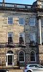
| Dundas House |
36 St Andrew Square |
13 April 1965 |
|
55°57′16″N 3°11′27″W / 55.954567°N 3.190889°W / 55.954567; -3.190889 (Dundas House) |
Head office of the Royal Bank of Scotland |
29705 |
 Upload another image
See more images
|
| Bank of Scotland |
37 St Andrew Square |
13 April 1965 |
|
55°57′15″N 3°11′29″W / 55.954238°N 3.191439°W / 55.954238; -3.191439 (Bank of Scotland) |
|
29706 |
.jpg) Upload another image
|
| Bank of Scotland |
38 and 39 St Andrew Square |
13 April 1965 |
|
55°57′15″N 3°11′30″W / 55.954056°N 3.191658°W / 55.954056; -3.191658 (Bank of Scotland) |
|
29707 |
 Upload another image
|
| Royal Bank of Scotland |
42 St Andrew Square |
8 December 1987 |
|
55°57′14″N 3°11′29″W / 55.953953°N 3.191254°W / 55.953953; -3.191254 (Royal Bank of Scotland) |
|
29708 |
 Upload another image
|
| 1–25 Royal Circus |
|
14 September 1966 |
|
55°57′24″N 3°12′12″W / 55.956674°N 3.203431°W / 55.956674; -3.203431 (1–25 Royal Circus) |
|
29677 |
 Upload another image
|
| 2–32 Royal Circus |
|
14 September 1966 |
|
55°57′27″N 3°12′13″W / 55.957569°N 3.203747°W / 55.957569; -3.203747 (2–32 Royal Circus) |
|
29678 |
 Upload another image
|
| Cafe Royal |
West Register Street |
8 January 1970 |
|
55°57′14″N 3°11′26″W / 55.95377°N 3.190608°W / 55.95377; -3.190608 (Cafe Royal) |
|
29619 |
 Upload another image
|
| Kenilworth Bar |
152 and 154 Rose Street |
12 December 1974 |
|
55°57′06″N 3°12′08″W / 55.951761°N 3.202221°W / 55.951761; -3.202221 (Kenilworth Bar) |
|
29651 |
 Upload another image
|
| 4–6 Queen Street |
|
13 April 1965 |
|
55°57′18″N 3°11′44″W / 55.955079°N 3.195581°W / 55.955079; -3.195581 (4–6 Queen Street) |
Occupied by BBC Scotland |
29532 |
 Upload another image
|
| Royal College of Physicians of Edinburgh |
8 Queen Street |
3 March 1966 |
|
55°57′18″N 3°11′47″W / 55.955054°N 3.196301°W / 55.955054; -3.196301 (Royal College of Physicians of Edinburgh) |
|
29535 |
Upload another image
|
| 11–13 Queen Street |
|
3 March 1966 |
|
55°57′18″N 3°11′48″W / 55.95487°N 3.196728°W / 55.95487; -3.196728 (11–13 Queen Street) |
|
29536 |
 Upload another image
|
| 14 Queen Street |
|
3 March 1966 |
|
55°57′18″N 3°11′50″W / 55.954874°N 3.197225°W / 55.954874; -3.197225 (14 Queen Street) |
|
29538 |
 Upload another image
|
| 18–20 Queen Street |
|
3 March 1966 |
|
55°57′17″N 3°11′55″W / 55.954673°N 3.1985°W / 55.954673; -3.1985 (18–20 Queen Street) |
|
29542 |
 Upload another image
|
| 21 Queen Street |
|
14 December 1970 |
|
55°57′17″N 3°11′55″W / 55.954626°N 3.198739°W / 55.954626; -3.198739 (21 Queen Street) |
|
29543 |
 Upload another image
|
| 22 Queen Street |
|
14 December 1970 |
|
55°57′17″N 3°11′56″W / 55.954597°N 3.198898°W / 55.954597; -3.198898 (22 Queen Street) |
|
29544 |
 Upload another image
|
| 23–25 Queen Street |
|
14 December 1970 |
|
55°57′17″N 3°11′57″W / 55.954586°N 3.199122°W / 55.954586; -3.199122 (23–25 Queen Street) |
|
29545 |
 Upload another image
|
| 26, 26A and 27 Queen Street (including Stewart House) |
|
3 March 1966 |
|
55°57′16″N 3°11′58″W / 55.95452°N 3.199472°W / 55.95452; -3.199472 (26, 26A and 27 Queen Street (including Stewart House)) |
|
29546 |
 Upload another image
|
| 28 and 29 Queen Street |
|
3 March 1966 |
|
55°57′16″N 3°11′59″W / 55.954501°N 3.1996°W / 55.954501; -3.1996 (28 and 29 Queen Street) |
|
29548 |
 Upload another image
|
| 32 and 33 Queen Street |
|
3 March 1966 |
|
55°57′16″N 3°12′01″W / 55.954414°N 3.200157°W / 55.954414; -3.200157 (32 and 33 Queen Street) |
|
29550 |
 Upload another image
|
| 34 Queen Street |
|
3 March 1966 |
|
55°57′16″N 3°12′01″W / 55.954349°N 3.20038°W / 55.954349; -3.20038 (34 Queen Street) |
|
29551 |
 Upload another image
|
| 35–37 Queen Street |
|
3 March 1966 |
|
55°57′16″N 3°12′02″W / 55.95432°N 3.200603°W / 55.95432; -3.200603 (35–37 Queen Street) |
|
29552 |
 Upload another image
|
| 38 Queen Street |
|
3 March 1966 |
|
55°57′15″N 3°12′03″W / 55.954264°N 3.200841°W / 55.954264; -3.200841 (38 Queen Street) |
|
29553 |
 Upload another image
|
| 39 and 39A Queen Street |
|
3 March 1966 |
|
55°57′15″N 3°12′05″W / 55.95415°N 3.201479°W / 55.95415; -3.201479 (39 and 39A Queen Street) |
|
29554 |
 Upload another image
|
| 40–42 (Inclusive), with 40A and 42A Queen Street |
|
3 March 1966 |
|
55°57′15″N 3°12′06″W / 55.954129°N 3.20175°W / 55.954129; -3.20175 (40–42 (Inclusive), with 40A and 42A Queen Street) |
|
29555 |
Upload another image
|
| 43 (Hogarth House) and 44 Queen Street |
|
3 March 1966 |
|
55°57′15″N 3°12′08″W / 55.954072°N 3.202117°W / 55.954072; -3.202117 (43 (Hogarth House) and 44 Queen Street) |
|
29556 |
 Upload another image
|
| 45–47 Queen Street |
|
3 March 1966 |
|
55°57′14″N 3°12′08″W / 55.954025°N 3.202307°W / 55.954025; -3.202307 (45–47 Queen Street) |
|
29557 |
 Upload another image
|
| 48 Queen Street |
|
3 March 1966 |
|
55°57′14″N 3°12′09″W / 55.953978°N 3.202514°W / 55.953978; -3.202514 (48 Queen Street) |
the offices of Francis Brodie Imlach |
29558 |
 Upload another image
|
| 49, 49A, 50 and 50A Queen Street |
|
3 March 1966 |
|
55°57′14″N 3°12′10″W / 55.953994°N 3.202723°W / 55.953994; -3.202723 (49, 49A, 50 and 50A Queen Street) |
|
29559 |
 Upload another image
|
| 51 Queen Street |
|
3 March 1966 |
|
55°57′14″N 3°12′11″W / 55.953911°N 3.202961°W / 55.953911; -3.202961 (51 Queen Street) |
|
29560 |
 Upload another image
|
| 52 and 53 Queen Street |
|
3 March 1966 |
|
55°57′14″N 3°12′11″W / 55.953865°N 3.203087°W / 55.953865; -3.203087 (52 and 53 Queen Street) |
|
29561 |
 Upload another image
|
| 54 Queen Street |
|
3 March 1966 |
|
55°57′14″N 3°12′12″W / 55.953826°N 3.203358°W / 55.953826; -3.203358 (54 Queen Street) |
|
29562 |
 Upload another image
|
| 55–57 Queen Street |
|
3 March 1966 |
|
55°57′14″N 3°12′13″W / 55.953789°N 3.203501°W / 55.953789; -3.203501 (55–57 Queen Street) |
|
29563 |
 Upload another image
|
| 58 Queen Street |
|
3 March 1966 |
|
55°57′14″N 3°12′14″W / 55.953786°N 3.20379°W / 55.953786; -3.20379 (58 Queen Street) |
|
29564 |
 Upload another image
|
| 60 Queen Street and 58A, 60 and 62 North Castle Street |
|
3 March 1966 |
|
55°57′13″N 3°12′16″W / 55.95359°N 3.20452°W / 55.95359; -3.20452 (60 Queen Street and 58A, 60 and 62 North Castle Street) |
|
29566 |
 Upload another image
|
| 61, 61A, 62 & 63 Queen Street |
|
3 March 1966 |
|
55°57′13″N 3°12′17″W / 55.953578°N 3.204792°W / 55.953578; -3.204792 (61, 61A, 62 & 63 Queen Street) |
|
29567 |
 Upload another image
|
| 64 Queen Street |
|
3 March 1966 |
|
55°57′13″N 3°12′18″W / 55.95354°N 3.204999°W / 55.95354; -3.204999 (64 Queen Street) |
|
29568 |
 Upload another image
|
| 65 Queen Street |
|
3 March 1966 |
|
55°57′13″N 3°12′19″W / 55.953512°N 3.20519°W / 55.953512; -3.20519 (65 Queen Street) |
|
29569 |
 Upload another image
|
| 66 and 67 Queen Street, with 33 and 35 Young Street Lane North |
|
3 March 1966 |
|
55°57′13″N 3°12′19″W / 55.953483°N 3.205302°W / 55.953483; -3.205302 (66 and 67 Queen Street, with 33 and 35 Young Street Lane North) |
|
29570 |
 Upload another image
|
| 74–77 (Inclusive) Queen Street |
|
3 March 1966 |
|
55°57′11″N 3°12′23″W / 55.953051°N 3.206329°W / 55.953051; -3.206329 (74–77 (Inclusive) Queen Street) |
|
29571 |
 Upload another image
|
| 78 and 78A Queen Street |
|
3 March 1966 |
|
55°57′12″N 3°12′24″W / 55.953253°N 3.2068°W / 55.953253; -3.2068 (78 and 78A Queen Street) |
|
29573 |
 Upload another image
|
| 79, 79A and 80 Queen Street and 5 and 6 North Charlotte Street |
|
3 March 1966 |
|
55°57′11″N 3°12′25″W / 55.953072°N 3.206986°W / 55.953072; -3.206986 (79, 79A and 80 Queen Street and 5 and 6 North Charlotte Street) |
|
29574 |
 Upload another image
|
| 30 Princes Street |
Formerly Forsyth's |
14 September 1966 |
|
55°57′11″N 3°11′31″W / 55.95302°N 3.191946°W / 55.95302; -3.191946 (30 Princes Street) |
|
29503 |
.jpg) Upload another image
|
| Jenners Department Store |
47–52 Princes Street |
14 December 1970 |
|
55°57′11″N 3°11′39″W / 55.953107°N 3.194159°W / 55.953107; -3.194159 (Jenners Department Store) |
|
29505 |
 Upload another image
|
| Romanes and Paterson |
61-2 Princes Street |
19 December 1979 |
|
55°57′10″N 3°11′43″W / 55.952665°N 3.195219°W / 55.952665; -3.195219 (Romanes and Paterson) |
|
29506 |
.jpg) Upload another image
|
| 94–96 Princes Street |
|
19 December 1979 |
|
55°57′07″N 3°11′57″W / 55.9519°N 3.199087°W / 55.9519; -3.199087 (94–96 Princes Street) |
|
29507 |
 Upload another image
|
| St Andrew's and St George's Church |
George Street |
13 January 1966 |
|
55°57′15″N 3°11′45″W / 55.954123°N 3.195888°W / 55.954123; -3.195888 (St Andrew's and St George's Church) |
|
27283 |
 Upload another image
|
| Assembly Rooms |
54 George Street |
13 January 1966 |
|
55°57′10″N 3°11′55″W / 55.95282°N 3.198683°W / 55.95282; -3.198683 (Assembly Rooms) |
|
27567 |
 Upload another image
|
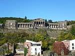
| City Observatory |
Calton Hill |
19 April 1966 |
|
55°57′18″N 3°11′01″W / 55.954988°N 3.18355°W / 55.954988; -3.18355 (City Observatory) |
|
27603 |
 Upload another image
See more images
|
| Observatory House (Old Observatory), City Observatory |
Calton Hill |
19 April 1966 |
|
55°57′17″N 3°11′03″W / 55.954803°N 3.184137°W / 55.954803; -3.184137 (Observatory House (Old Observatory), City Observatory) |
|
27608 |
 Upload another image
See more images
|
| National Gallery of Scotland |
The Mound |
14 December 1970 |
|
55°57′03″N 3°11′44″W / 55.9509°N 3.195661°W / 55.9509; -3.195661 (National Gallery of Scotland) |
|
27679 |
 Upload another image
See more images
|
| 39–43 North Castle Street |
|
3 March 1966 |
|
55°57′11″N 3°12′12″W / 55.952972°N 3.203412°W / 55.952972; -3.203412 (39–43 North Castle Street) |
|
28464 |
 Upload another image
|
| 45, 45A, 47, 49 and 49A North Castle Street |
|
3 March 1966 |
|
55°57′11″N 3°12′12″W / 55.953107°N 3.203416°W / 55.953107; -3.203416 (45, 45A, 47, 49 and 49A North Castle Street) |
|
28465 |
 Upload another image
|
| 51–55 North Castle Street |
|
3 March 1966 |
|
55°57′12″N 3°12′13″W / 55.953356°N 3.203616°W / 55.953356; -3.203616 (51–55 North Castle Street) |
|
28466 |
 Upload another image
|
| 57–61 North Castle Street |
|
3 March 1966 |
|
55°57′13″N 3°12′13″W / 55.953535°N 3.203718°W / 55.953535; -3.203718 (57–61 North Castle Street) |
|
28467 |
 Upload another image
|
| 63–69 North Castle Street |
|
3 March 1966 |
|
55°57′13″N 3°12′14″W / 55.953722°N 3.203852°W / 55.953722; -3.203852 (63–69 North Castle Street) |
|
28468 |
 Upload another image
|
| 16–20 and 20A Castle Street and Connery's Bar, Rose Street |
|
3 March 1966 |
|
55°57′06″N 3°12′13″W / 55.951587°N 3.203497°W / 55.951587; -3.203497 (16–20 and 20A Castle Street and Connery's Bar, Rose Street) |
|
28472 |
 Upload another image
|
| 28 Castle Street |
|
3 March 1966 |
|
55°57′07″N 3°12′13″W / 55.951936°N 3.203636°W / 55.951936; -3.203636 (28 Castle Street) |
|
28474 |
 Upload another image
|
| 36–40 North Castle Street |
|
3 March 1966 |
|
55°57′10″N 3°12′15″W / 55.952874°N 3.204194°W / 55.952874; -3.204194 (36–40 North Castle Street) |
|
28476 |
 Upload another image
|
| 42–46 North Castle Street |
|
3 March 1966 |
|
55°57′11″N 3°12′16″W / 55.952988°N 3.204485°W / 55.952988; -3.204485 (42–46 North Castle Street) |
|
28477 |
 Upload another image
|
| 48–52 North Castle Street |
|
3 March 1966 |
|
55°57′12″N 3°12′16″W / 55.953304°N 3.204399°W / 55.953304; -3.204399 (48–52 North Castle Street) |
|
28478 |
 Upload another image
|
| 54–58 and 58A North Castle Street |
|
3 March 1966 |
|
55°57′12″N 3°12′16″W / 55.953438°N 3.204467°W / 55.953438; -3.204467 (54–58 and 58A North Castle Street) |
|
28479 |
 Upload another image
|
| 1–11 Charlotte Square |
|
3 March 1966 |
|
55°57′09″N 3°12′28″W / 55.952616°N 3.207661°W / 55.952616; -3.207661 (1–11 Charlotte Square) |
|
28502 |
 Upload another image
|
| 12–17 Charlotte Square |
|
3 March 1966 |
|
55°57′07″N 3°12′34″W / 55.951926°N 3.209321°W / 55.951926; -3.209321 (12–17 Charlotte Square) |
|
28503 |
 Upload another image
|
| 18–23 Charlotte Square |
|
3 March 1966 |
|
55°57′04″N 3°12′33″W / 55.951234°N 3.209235°W / 55.951234; -3.209235 (18–23 Charlotte Square) |
|
28504 |
 Upload another image
|
| 24–32 Charlotte Square, 13–19 Hope Street and 14 and 16 South Charlotte Street |
|
3 March 1966 |
|
55°57′03″N 3°12′29″W / 55.950879°N 3.207927°W / 55.950879; -3.207927 (24–32 Charlotte Square, 13–19 Hope Street and 14 and 16 South Charlotte Street) |
|
28505 |
 Upload another image
|
| 33–39 Charlotte Square and 142–146 George Street |
|
3 March 1966 |
|
55°57′05″N 3°12′22″W / 55.951437°N 3.205975°W / 55.951437; -3.205975 (33–39 Charlotte Square and 142–146 George Street) |
|
28506 |
 Upload another image
|
| 40–46 Charlotte Square and 143 George Street |
|
3 March 1966 |
|
55°57′08″N 3°12′23″W / 55.952178°N 3.206446°W / 55.952178; -3.206446 (40–46 Charlotte Square and 143 George Street) |
|
28507 |
 Upload another image
|
| 1 North Charlotte Street |
|
3 March 1966 |
|
55°57′10″N 3°12′24″W / 55.952787°N 3.206721°W / 55.952787; -3.206721 (1 North Charlotte Street) |
|
28508 |
 Upload another image
|
| 2–4 North Charlotte Street |
|
3 March 1966 |
|
55°57′10″N 3°12′24″W / 55.952867°N 3.20674°W / 55.952867; -3.20674 (2–4 North Charlotte Street) |
|
28509 |
 Upload another image
|
| 5–9 South Charlotte Street |
|
3 March 1966 |
|
55°57′03″N 3°12′21″W / 55.950927°N 3.205783°W / 55.950927; -3.205783 (5–9 South Charlotte Street) |
|
28512 |
 Upload another image
|
| 11 and 13 South Charlotte Street |
|
3 March 1966 |
|
55°57′04″N 3°12′21″W / 55.951124°N 3.205837°W / 55.951124; -3.205837 (11 and 13 South Charlotte Street) |
|
28514 |
 Upload another image
|
| 15 South Charlotte Street |
|
3 March 1966 |
|
55°57′04″N 3°12′21″W / 55.951195°N 3.205887°W / 55.951195; -3.205887 (15 South Charlotte Street) |
|
28515 |
 Upload another image
|
| 12 South Charlotte Street |
|
3 March 1966 |
|
55°57′04″N 3°12′24″W / 55.950973°N 3.206537°W / 55.950973; -3.206537 (12 South Charlotte Street) |
|
28516 |
 Upload another image
|
| 1 and 2 Thistle Court |
Thistle Street |
13 January 1966 |
|
55°57′16″N 3°11′43″W / 55.95457°N 3.195229°W / 55.95457; -3.195229 (1 and 2 Thistle Court) |
|
29836 |
 Upload another image
|
| The Playhouse Theatre |
18–22 Greenside Place |
12 December 1974 |
|
55°57′24″N 3°11′05″W / 55.956773°N 3.184838°W / 55.956773; -3.184838 (The Playhouse Theatre) |
|
30029 |
 Upload another image
|
| 1-13A Royal Crescent |
|
22 September 1965 |
|
55°57′34″N 3°11′48″W / 55.959534°N 3.196632°W / 55.959534; -3.196632 (1-13A Royal Crescent) |
|
29679 |
 Upload another image
|
| 15-23A Royal Crescent |
|
22 September 1965 |
|
55°57′34″N 3°11′52″W / 55.959417°N 3.197653°W / 55.959417; -3.197653 (15-23A Royal Crescent) |
|
29680 |
 Upload another image
|
| 1–8 Randolph Crescent, with 2 and 3–9 Randolph Lane |
|
14 December 1970 |
|
55°57′06″N 3°12′39″W / 55.951642°N 3.210737°W / 55.951642; -3.210737 (1–8 Randolph Crescent, with 2 and 3–9 Randolph Lane) |
|
29600 |
 Upload another image
|
| 9–17 Randolph Crescent |
|
14 December 1970 |
|
55°57′08″N 3°12′46″W / 55.952206°N 3.212757°W / 55.952206; -3.212757 (9–17 Randolph Crescent) |
|
29601 |
 Upload another image
|
| 1–8 Randolph Place, and 1 Randolph Crescent, with 1, 1A Randolph Lane |
|
14 December 1970 |
|
55°57′05″N 3°12′37″W / 55.951521°N 3.210269°W / 55.951521; -3.210269 (1–8 Randolph Place, and 1 Randolph Crescent, with 1, 1A Randolph Lane) |
|
29602 |
 Upload another image
|
| 49 Northumberland Street |
|
24 May 1966 |
|
55°57′24″N 3°12′01″W / 55.956793°N 3.200407°W / 55.956793; -3.200407 (49 Northumberland Street) |
|
29480 |
 Upload another image
|
| 1 Northumberland Street |
|
22 September 1965 |
|
55°57′27″N 3°11′47″W / 55.957479°N 3.19636°W / 55.957479; -3.19636 (1 Northumberland Street) |
|
29445 |
 Upload another image
|
| 3-17A Northumberland Street |
|
22 September 1965 |
|
55°57′27″N 3°11′48″W / 55.957459°N 3.196632°W / 55.957459; -3.196632 (3-17A Northumberland Street) |
|
29446 |
 Upload another image
|
| 19–33 Northumberland Street |
|
22 September 1965 |
|
55°57′26″N 3°11′52″W / 55.957286°N 3.197748°W / 55.957286; -3.197748 (19–33 Northumberland Street) |
|
29447 |
 Upload another image
|
| 39–41 Northumberland Street |
|
24 May 1966 |
|
55°57′25″N 3°11′59″W / 55.956916°N 3.199802°W / 55.956916; -3.199802 (39–41 Northumberland Street) |
|
29448 |
 Upload another image
|
| 43–47 Northumberland Street |
|
24 May 1966 |
|
55°57′25″N 3°12′00″W / 55.956869°N 3.199993°W / 55.956869; -3.199993 (43–47 Northumberland Street) |
|
29449 |
 Upload another image
|
| 51–61 Northumberland Street |
|
24 May 1966 |
|
55°57′24″N 3°12′04″W / 55.956696°N 3.201125°W / 55.956696; -3.201125 (51–61 Northumberland Street) |
|
29451 |
Upload another image
|
| 63 and 65 Northumberland Street |
|
24 May 1966 |
|
55°57′24″N 3°12′06″W / 55.956647°N 3.201556°W / 55.956647; -3.201556 (63 and 65 Northumberland Street) |
|
29452 |
 Upload another image
|
| 67 and 69 Northumberland Street |
|
24 May 1966 |
|
55°57′24″N 3°12′07″W / 55.956581°N 3.201906°W / 55.956581; -3.201906 (67 and 69 Northumberland Street) |
|
29453 |
 Upload another image
|
| 6–12 Northumberland Street |
|
30 September 1964 |
|
55°57′25″N 3°11′50″W / 55.957011°N 3.197355°W / 55.957011; -3.197355 (6–12 Northumberland Street) |
|
29454 |
 Upload another image
|
| 14–26 Northumberland Street |
|
30 September 1964 |
|
55°57′25″N 3°11′52″W / 55.956925°N 3.197881°W / 55.956925; -3.197881 (14–26 Northumberland Street) |
|
29455 |
 Upload another image
|
| 28-30A Northumberland Street |
|
30 September 1964 |
|
55°57′25″N 3°11′55″W / 55.956821°N 3.198486°W / 55.956821; -3.198486 (28-30A Northumberland Street) |
|
29456 |
 Upload another image
|
| 38-40A Northumberland Street |
|
24 May 1966 |
|
55°57′24″N 3°11′59″W / 55.956621°N 3.199617°W / 55.956621; -3.199617 (38-40A Northumberland Street) |
|
29457 |
 Upload another image
|
| 42–68 Northumberland Street |
|
24 May 1966 |
|
55°57′23″N 3°12′04″W / 55.9564°N 3.201036°W / 55.9564; -3.201036 (42–68 Northumberland Street) |
|
29458 |
 Upload another image
|
| 70 Northumberland Street |
|
24 May 1966 |
|
55°57′23″N 3°12′06″W / 55.956278°N 3.201641°W / 55.956278; -3.201641 (70 Northumberland Street) |
|
29459 |
 Upload another image
|
| 2–5 Northumberland Place |
|
30 September 1964 |
|
55°57′26″N 3°11′45″W / 55.95726°N 3.195857°W / 55.95726; -3.195857 (2–5 Northumberland Place) |
|
29444 |
 Upload another image
|
| 5 and 7 Nelson Street |
|
22 September 1965 |
|
55°57′25″N 3°11′45″W / 55.956944°N 3.195943°W / 55.956944; -3.195943 (5 and 7 Nelson Street) |
|
29384 |
 Upload another image
|
| 9–13 Nelson Street |
|
22 September 1965 |
|
55°57′25″N 3°11′46″W / 55.957069°N 3.196027°W / 55.957069; -3.196027 (9–13 Nelson Street) |
|
29385 |
 Upload another image
|
| 15, 17 and 17A Nelson Street |
|
22 September 1965 |
|
55°57′26″N 3°11′46″W / 55.957203°N 3.196095°W / 55.957203; -3.196095 (15, 17 and 17A Nelson Street) |
|
29386 |
 Upload another image
|
| 19–23 Nelson Street |
|
22 September 1965 |
|
55°57′27″N 3°11′44″W / 55.957486°N 3.195656°W / 55.957486; -3.195656 (19–23 Nelson Street) |
|
29387 |
 Upload another image
|
| 25–29 Nelson Street |
|
22 September 1965 |
|
55°57′28″N 3°11′44″W / 55.957665°N 3.195693°W / 55.957665; -3.195693 (25–29 Nelson Street) |
|
29388 |
 Upload another image
|
| 10–14 Nelson Street |
|
22 September 1965 |
|
55°57′25″N 3°11′48″W / 55.956973°N 3.196729°W / 55.956973; -3.196729 (10–14 Nelson Street) |
|
29390 |
 Upload another image
|
| 16 and 18 Nelson Street |
|
22 September 1965 |
|
55°57′26″N 3°11′49″W / 55.957133°N 3.19683°W / 55.957133; -3.19683 (16 and 18 Nelson Street) |
|
29391 |
 Upload another image
|
| 24–28 Nelson Street |
|
22 September 1965 |
|
55°57′28″N 3°11′47″W / 55.957685°N 3.196495°W / 55.957685; -3.196495 (24–28 Nelson Street) |
|
29392 |
 Upload another image
|
| 1-18A Moray Place, and 10 Doune Terrace, with 1–7 Gloucester Square, and 5-10A Gloucester Lane |
|
3 October 1967 |
|
55°57′19″N 3°12′26″W / 55.955314°N 3.207361°W / 55.955314; -3.207361 (1-18A Moray Place, and 10 Doune Terrace, with 1–7 Gloucester Square, and 5-10A Gloucester Lane) |
|
29368 |
 Upload another image
|
| 19-36A Moray Place |
|
3 October 1967 |
|
55°57′19″N 3°12′36″W / 55.955289°N 3.20997°W / 55.955289; -3.20997 (19-36A Moray Place) |
|
29369 |
 Upload another image
|
| 37–43 Moray Place |
|
3 October 1967 |
|
55°57′14″N 3°12′29″W / 55.953842°N 3.208164°W / 55.953842; -3.208164 (37–43 Moray Place) |
|
29370 |
Upload another image
|
| 44-50A Moray Place, with 6 and 7 Wemyss Place Mews |
|
3 October 1967 |
|
55°57′14″N 3°12′27″W / 55.954027°N 3.207609°W / 55.954027; -3.207609 (44-50A Moray Place, with 6 and 7 Wemyss Place Mews) |
|
29371 |
 Upload another image
|
| 1–41 London Street |
|
22 April 1965 |
|
55°57′31″N 3°11′35″W / 55.958697°N 3.193098°W / 55.958697; -3.193098 (1–41 London Street) |
|
29260 |
 Upload another image
|
| 2–36 London Street |
|
22 April 1965 |
|
55°57′33″N 3°11′32″W / 55.959298°N 3.1923°W / 55.959298; -3.1923 (2–36 London Street) |
|
29261 |
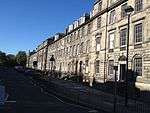 Upload another image
|
| 42–54 London Street |
|
22 April 1965 |
|
55°57′33″N 3°11′28″W / 55.959039°N 3.191218°W / 55.959039; -3.191218 (42–54 London Street) |
|
29262 |
 Upload another image
|
| Gayfield House |
18 East London Street |
22 September 1965 |
|
55°57′37″N 3°11′15″W / 55.960198°N 3.187474°W / 55.960198; -3.187474 (Gayfield House) |
|
29263 |
 Upload another image
See more images
|
| 1–5 Gloucester Place |
|
3 October 1967 |
|
55°57′23″N 3°12′24″W / 55.95639°N 3.206657°W / 55.95639; -3.206657 (1–5 Gloucester Place) |
|
29141 |
 Upload another image
|
| 2 Gloucester Place |
|
3 October 1967 |
|
55°57′25″N 3°12′24″W / 55.956911°N 3.206738°W / 55.956911; -3.206738 (2 Gloucester Place) |
|
29142 |
 Upload another image
|
| 5-9A India Street |
|
3 October 1967 |
|
55°57′19″N 3°12′18″W / 55.955237°N 3.205116°W / 55.955237; -3.205116 (5-9A India Street) |
|
29127 |
 Upload another image
|
| 11–15 India Street |
|
3 October 1967 |
|
55°57′20″N 3°12′19″W / 55.955425°N 3.205186°W / 55.955425; -3.205186 (11–15 India Street) |
|
29128 |
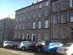 Upload another image
|
| 17-21A India Street |
|
3 October 1967 |
|
55°57′21″N 3°12′19″W / 55.955747°N 3.205388°W / 55.955747; -3.205388 (17-21A India Street) |
|
29129 |
 Upload another image
|
| 23-27A India Street |
|
3 October 1967 |
|
55°57′21″N 3°12′20″W / 55.955971°N 3.205475°W / 55.955971; -3.205475 (23-27A India Street) |
|
29130 |
 Upload another image
|
| 4–10 India Street |
|
3 October 1967 |
|
55°57′18″N 3°12′21″W / 55.955087°N 3.205768°W / 55.955087; -3.205768 (4–10 India Street) |
|
29131 |
 Upload another image
|
| 12 India Street |
|
3 October 1967 |
|
55°57′19″N 3°12′21″W / 55.955194°N 3.205867°W / 55.955194; -3.205867 (12 India Street) |
|
29132 |
 Upload another image
|
| 14 India Street |
|
3 October 1967 |
|
55°57′19″N 3°12′21″W / 55.955265°N 3.205934°W / 55.955265; -3.205934 (14 India Street) |
|
29133 |
 Upload another image
|
| 16 India Street |
|
3 October 1967 |
|
55°57′19″N 3°12′22″W / 55.955355°N 3.206°W / 55.955355; -3.206 (16 India Street) |
|
29134 |
 Upload another image
|
| 18 India Street |
|
3 October 1967 |
|
55°57′20″N 3°12′22″W / 55.955426°N 3.206035°W / 55.955426; -3.206035 (18 India Street) |
|
29135 |
 Upload another image
|
| 20–24 India Street |
|
3 October 1967 |
|
55°57′20″N 3°12′22″W / 55.955525°N 3.20607°W / 55.955525; -3.20607 (20–24 India Street) |
|
29136 |
 Upload another image
|
| 26–30 India Street |
|
3 October 1967 |
|
55°57′21″N 3°12′22″W / 55.955793°N 3.20619°W / 55.955793; -3.20619 (26–30 India Street) |
|
29137 |
 Upload another image
|
| 32 India Street |
|
3 October 1967 |
|
55°57′21″N 3°12′23″W / 55.955953°N 3.206339°W / 55.955953; -3.206339 (32 India Street) |
|
29138 |
 Upload another image
|
| 34 India Street |
|
3 October 1967 |
|
55°57′22″N 3°12′23″W / 55.956025°N 3.206358°W / 55.956025; -3.206358 (34 India Street) |
|
29139 |
 Upload another image
|
| 36–42 India Street |
|
3 October 1967 |
|
55°57′22″N 3°12′23″W / 55.956106°N 3.206392°W / 55.956106; -3.206392 (36–42 India Street) |
|
29140 |
 Upload another image
|
| 54–60 India Street |
|
3 October 1967 |
|
55°57′25″N 3°12′25″W / 55.957017°N 3.206869°W / 55.957017; -3.206869 (54–60 India Street) |
|
29144 |
 Upload another image
|
| 3–7 Howe Street |
|
10 November 1966 |
|
55°57′21″N 3°12′06″W / 55.955811°N 3.201626°W / 55.955811; -3.201626 (3–7 Howe Street) |
|
29107 |
 Upload another image
|
| 11 and 13 Howe Street |
|
10 November 1966 |
|
55°57′21″N 3°12′06″W / 55.955971°N 3.201727°W / 55.955971; -3.201727 (11 and 13 Howe Street) |
|
29109 |
 Upload another image
|
| 19 and 19B Howe Street |
|
10 November 1966 |
|
55°57′22″N 3°12′07″W / 55.95623°N 3.201943°W / 55.95623; -3.201943 (19 and 19B Howe Street) |
|
29111 |
 Upload another image
|
| 21-23B Howe Street |
|
10 November 1966 |
|
55°57′24″N 3°12′07″W / 55.956561°N 3.202034°W / 55.956561; -3.202034 (21-23B Howe Street) |
|
29112 |
 Upload another image
|
| 25–29 Howe Street |
|
10 November 1966 |
|
55°57′24″N 3°12′08″W / 55.956731°N 3.202135°W / 55.956731; -3.202135 (25–29 Howe Street) |
|
29113 |
 Upload another image
|
| 31–37 Howe Street |
|
10 November 1966 |
|
55°57′25″N 3°12′08″W / 55.956919°N 3.202221°W / 55.956919; -3.202221 (31–37 Howe Street) |
|
29114 |
 Upload another image
|
| 32–38 Howe Street |
|
10 November 1966 |
|
55°57′23″N 3°12′10″W / 55.95651°N 3.202721°W / 55.95651; -3.202721 (32–38 Howe Street) |
|
29121 |
 Upload another image
|
| 6–10 Hope Street |
|
3 March 1966 |
|
55°57′02″N 3°12′31″W / 55.950648°N 3.208593°W / 55.950648; -3.208593 (6–10 Hope Street) |
|
29093 |
 Upload another image
|
| 12–16 Hope Street |
|
3 March 1966 |
|
55°57′03″N 3°12′32″W / 55.950808°N 3.208758°W / 55.950808; -3.208758 (12–16 Hope Street) |
|
29094 |
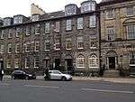 Upload another image
|
| 71 Hanover Street |
|
13 January 1966 |
|
55°57′14″N 3°11′50″W / 55.953914°N 3.197099°W / 55.953914; -3.197099 (71 Hanover Street) |
|
28999 |
 Upload another image
|
| 79–89 Hanover Street |
|
24 March 1966 |
|
55°57′15″N 3°11′50″W / 55.954103°N 3.197105°W / 55.954103; -3.197105 (79–89 Hanover Street) |
|
29001 |
 Upload another image
|
| 113–123 (odd nos, including 117A) Hanover Street |
|
3 March 1966 |
|
55°57′17″N 3°11′51″W / 55.954754°N 3.197557°W / 55.954754; -3.197557 (113–123 (odd nos, including 117A) Hanover Street) |
|
29004 |
 Upload another image
|
| 28 and 30 Hanover Street |
|
24 March 1966 |
|
55°57′10″N 3°11′51″W / 55.952796°N 3.197449°W / 55.952796; -3.197449 (28 and 30 Hanover Street) |
|
29007 |
 Upload another image
|
| 1–19 Heriot Row |
|
24 May 1966 |
|
55°57′22″N 3°12′00″W / 55.956194°N 3.200068°W / 55.956194; -3.200068 (1–19 Heriot Row) |
|
29025 |
 Upload another image
|
| 20–42 Heriot Row |
|
24 May 1966 |
|
55°57′18″N 3°12′18″W / 55.955059°N 3.20495°W / 55.955059; -3.20495 (20–42 Heriot Row) |
|
29026 |
 Upload another image
|
| 43–47 Heriot Row |
|
24 May 1966 |
|
55°57′18″N 3°12′20″W / 55.954972°N 3.205652°W / 55.954972; -3.205652 (43–47 Heriot Row) |
|
29027 |
 Upload another image
|
| 1 and 3 Hill Street |
|
3 March 1966 |
|
55°57′13″N 3°12′07″W / 55.953605°N 3.20207°W / 55.953605; -3.20207 (1 and 3 Hill Street) |
|
29080 |
 Upload another image
|
| Edinburgh Lodge No 1 |
17, 19 and 19A Hill Street |
3 March 1966 |
|
55°57′13″N 3°12′10″W / 55.953481°N 3.202803°W / 55.953481; -3.202803 (Edinburgh Lodge No 1) |
|
29081 |
 Upload another image
|
| 21 and 23 Hill Street |
|
14 December 1970 |
|
55°57′12″N 3°12′11″W / 55.953433°N 3.203122°W / 55.953433; -3.203122 (21 and 23 Hill Street) |
|
29082 |
 Upload another image
|
| 2 and 4 Hill Street |
|
3 March 1966 |
|
55°57′12″N 3°12′07″W / 55.953428°N 3.201825°W / 55.953428; -3.201825 (2 and 4 Hill Street) |
|
29083 |
 Upload another image
|
| 3–41 Great King Street |
|
15 July 1965 |
|
55°57′28″N 3°11′52″W / 55.957869°N 3.197894°W / 55.957869; -3.197894 (3–41 Great King Street) |
|
28962 |
 Upload another image
|
| 45–89 Great King Street |
|
24 May 1966 |
|
55°57′27″N 3°12′00″W / 55.957544°N 3.199918°W / 55.957544; -3.199918 (45–89 Great King Street) |
|
28963 |
 Upload another image
|
| 2-42A Great King Street |
|
15 July 1965 |
|
55°57′30″N 3°11′53″W / 55.95828°N 3.198099°W / 55.95828; -3.198099 (2-42A Great King Street) |
|
28964 |
 Upload another image
|
| 44–86 Great King Street |
|
24 May 1966 |
|
55°57′29″N 3°12′00″W / 55.957983°N 3.199964°W / 55.957983; -3.199964 (44–86 Great King Street) |
|
28965 |
 Upload another image
|
| 1–5 Great Stuart Street |
|
14 December 1970 |
|
55°57′14″N 3°12′36″W / 55.95385°N 3.210038°W / 55.95385; -3.210038 (1–5 Great Stuart Street) |
|
28966 |
 Upload another image
|
| 7–19 Great Stuart Street |
|
14 December 1970 |
|
55°57′10″N 3°12′40″W / 55.952833°N 3.211207°W / 55.952833; -3.211207 (7–19 Great Stuart Street) |
|
28967 |
 Upload another image
|
| 2–6 Great Stuart Street |
|
14 December 1970 |
|
55°57′13″N 3°12′33″W / 55.953742°N 3.209217°W / 55.953742; -3.209217 (2–6 Great Stuart Street) |
|
28968 |
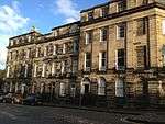 Upload another image
|
| 8–20 Great Stuart Street |
|
14 December 1970 |
|
55°57′08″N 3°12′40″W / 55.952232°N 3.211028°W / 55.952232; -3.211028 (8–20 Great Stuart Street) |
|
28969 |
 Upload another image
|
| 7–15 Gloucester Place |
|
3 October 1967 |
|
55°57′23″N 3°12′26″W / 55.956258°N 3.207294°W / 55.956258; -3.207294 (7–15 Gloucester Place) |
|
28925 |
 Upload another image
|
| 4–14 Gloucester Place |
|
3 October 1967 |
|
55°57′24″N 3°12′28″W / 55.956722°N 3.207645°W / 55.956722; -3.207645 (4–14 Gloucester Place) |
|
28926 |
 Upload another image
|
| 6–11 Glenfinlas Street |
|
14 December 1970 |
|
55°57′10″N 3°12′35″W / 55.952749°N 3.209619°W / 55.952749; -3.209619 (6–11 Glenfinlas Street) |
|
28922 |
 Upload another image
|
| 1–5 Gayfield Place and 33-33A Gayfield Square |
|
19 April 1966 |
|
55°57′32″N 3°11′04″W / 55.958925°N 3.184391°W / 55.958925; -3.184391 (1–5 Gayfield Place and 33-33A Gayfield Square) |
|
28798 |
 Upload another image
|
| 12-17A Gayfield Square |
|
19 April 1966 |
|
55°57′35″N 3°11′08″W / 55.959613°N 3.185678°W / 55.959613; -3.185678 (12-17A Gayfield Square) |
|
28805 |
 Upload another image
|
| 24, 25 and 26 Gayfield Square |
|
19 April 1966 |
|
55°57′34″N 3°11′07″W / 55.959473°N 3.185289°W / 55.959473; -3.185289 (24, 25 and 26 Gayfield Square) |
|
28807 |
 Upload another image
|
| 43–49 Frederick Street |
|
24 March 1966 |
|
55°57′13″N 3°12′02″W / 55.953657°N 3.200438°W / 55.953657; -3.200438 (43–49 Frederick Street) |
|
28785 |
 Upload another image
|
| 58–62 and 62A Frederick Street |
|
24 March 1966 |
|
55°57′14″N 3°12′05″W / 55.953927°N 3.201327°W / 55.953927; -3.201327 (58–62 and 62A Frederick Street) |
|
28796 |
 Upload another image
|
| 41A-45 Broughton Street |
|
16 June 1966 |
|
55°57′28″N 3°11′11″W / 55.957873°N 3.186265°W / 55.957873; -3.186265 (41A-45 Broughton Street) |
|
28772 |
 Upload another image
|
| 1–11 Forres Street |
|
14 December 1970 |
|
55°57′14″N 3°12′27″W / 55.954027°N 3.207609°W / 55.954027; -3.207609 (1–11 Forres Street) |
|
28768 |
.jpg) Upload another image
|
| 2–10 Forres Street |
|
14 December 1970 |
|
55°57′13″N 3°12′29″W / 55.953503°N 3.207945°W / 55.953503; -3.207945 (2–10 Forres Street) |
|
28769 |
 Upload another image
|
| 23-23C Dundas Street |
|
18 August 1964 |
|
55°57′25″N 3°11′56″W / 55.957078°N 3.198862°W / 55.957078; -3.198862 (23-23C Dundas Street) |
|
28706 |
 Upload another image
|
| 53–65 Dundas Street |
|
13 September 1964 |
|
55°57′30″N 3°11′58″W / 55.958276°N 3.199428°W / 55.958276; -3.199428 (53–65 Dundas Street) |
|
28709 |
 Upload another image
|
| 67–77 Dundas Street |
|
13 September 1964 |
|
55°57′31″N 3°11′59″W / 55.958553°N 3.199613°W / 55.958553; -3.199613 (67–77 Dundas Street) |
|
28710 |
 Upload another image
|
| 68–76 Dundas Street |
|
10 November 1966 |
|
55°57′30″N 3°12′01″W / 55.958367°N 3.2002°W / 55.958367; -3.2002 (68–76 Dundas Street) |
|
28720 |
 Upload another image
|
| 78-86A Dundas Street |
|
10 November 1966 |
|
55°57′31″N 3°12′02″W / 55.958662°N 3.200449°W / 55.958662; -3.200449 (78-86A Dundas Street) |
|
28721 |
 Upload another image
|
| 1–7 Dundonald Street |
|
22 September 1965 |
|
55°57′32″N 3°11′50″W / 55.958972°N 3.197143°W / 55.958972; -3.197143 (1–7 Dundonald Street) |
|
28723 |
 Upload another image
|
| 30–34 Elder Street |
|
14 December 1970 |
|
55°57′21″N 3°11′27″W / 55.955772°N 3.19083°W / 55.955772; -3.19083 (30–34 Elder Street) |
|
28731 |
 Upload another image
|
| 4 Dublin Street |
|
18 August 1964 |
|
55°57′21″N 3°11′37″W / 55.955953°N 3.193494°W / 55.955953; -3.193494 (4 Dublin Street) |
|
28688 |
 Upload another image
|
| 1–10 Drummond Place |
|
22 April 1965 |
|
55°57′29″N 3°11′40″W / 55.958019°N 3.194471°W / 55.958019; -3.194471 (1–10 Drummond Place) |
|
28665 |
 Upload another image
|
| 11–15 Drummond Place |
|
22 April 1965 |
|
55°57′28″N 3°11′48″W / 55.957783°N 3.19653°W / 55.957783; -3.19653 (11–15 Drummond Place) |
|
28666 |
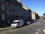 Upload another image
|
| 16–20 Drummond Place |
|
22 April 1965 |
|
55°57′31″N 3°11′49″W / 55.958651°N 3.196957°W / 55.958651; -3.196957 (16–20 Drummond Place) |
|
28667 |
 Upload another image
|
| 21–30 Drummond Place |
|
22 April 1965 |
|
55°57′33″N 3°11′43″W / 55.959133°N 3.195386°W / 55.959133; -3.195386 (21–30 Drummond Place) |
|
28668 |
 Upload another image
|
| 31-36A Drummond Place |
|
22 April 1965 |
|
55°57′33″N 3°11′38″W / 55.959256°N 3.193868°W / 55.959256; -3.193868 (31-36A Drummond Place) |
|
28669 |
 Upload another image
|
| 37–42 Drummond Place |
|
22 April 1965 |
|
55°57′31″N 3°11′36″W / 55.958497°N 3.19338°W / 55.958497; -3.19338 (37–42 Drummond Place) |
|
28670 |
 Upload another image
|
| 1-9C Doune Terrace, with 8–11 Gloucester Square |
|
3 October 1967 |
|
55°57′21″N 3°12′28″W / 55.95594°N 3.207668°W / 55.95594; -3.207668 (1-9C Doune Terrace, with 8–11 Gloucester Square) |
|
28659 |
 Upload another image
|
| 1–11 Darnaway Street |
|
3 October 1967 |
|
55°57′17″N 3°12′25″W / 55.95485°N 3.207042°W / 55.95485; -3.207042 (1–11 Darnaway Street) |
|
28632 |
 Upload another image
|
| 2–12 Darnaway Street, with 8–10 Wemyss Place Mews |
|
3 October 1967 |
|
55°57′16″N 3°12′23″W / 55.954505°N 3.206519°W / 55.954505; -3.206519 (2–12 Darnaway Street, with 8–10 Wemyss Place Mews) |
|
28633 |
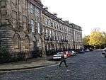 Upload another image
|
| 36-62B Cumberland Street |
|
10 November 1966 |
|
55°57′31″N 3°12′05″W / 55.958536°N 3.20139°W / 55.958536; -3.20139 (36-62B Cumberland Street) |
|
28614 |
 Upload another image
|
| Rock House |
28 Calton Hill |
19 April 1966 |
|
55°57′16″N 3°11′07″W / 55.954315°N 3.185356°W / 55.954315; -3.185356 (Rock House) |
|
28411 |
 Upload another image
|
| 35 and 37 Broughton Street |
|
16 June 1966 |
|
55°57′26″N 3°11′17″W / 55.957308°N 3.188042°W / 55.957308; -3.188042 (35 and 37 Broughton Street) |
|
28361 |
 Upload another image
|
| 10–12 Broughton Street |
|
16 June 1966 |
|
55°57′25″N 3°11′18″W / 55.956999°N 3.188449°W / 55.956999; -3.188449 (10–12 Broughton Street) |
|
28366 |
 Upload another image
|
| 4–12 Broughton Place |
|
16 June 1966 |
|
55°57′32″N 3°11′22″W / 55.958752°N 3.18932°W / 55.958752; -3.18932 (4–12 Broughton Place) |
|
28355 |
 Upload another image
|
| 1–11 Albyn Place |
|
14 December 1970 |
|
55°57′13″N 3°12′25″W / 55.953693°N 3.206814°W / 55.953693; -3.206814 (1–11 Albyn Place) |
|
28234 |
 Upload another image
|
| 1-15B Ainslie Place |
|
14 December 1970 |
|
55°57′11″N 3°12′40″W / 55.95303°N 3.211229°W / 55.95303; -3.211229 (1-15B Ainslie Place) |
|
28213 |
 Upload another image
|
| 16–20 Ainslie Place, and 13–14 Glenfinlas Street |
|
14 December 1970 |
|
55°57′10″N 3°12′37″W / 55.952699°N 3.21021°W / 55.952699; -3.21021 (16–20 Ainslie Place, and 13–14 Glenfinlas Street) |
|
28214 |
 Upload another image
|
| 21-25A Ainslie Place |
|
14 December 1970 |
|
55°57′12″N 3°12′33″W / 55.953337°N 3.209269°W / 55.953337; -3.209269 (21-25A Ainslie Place) |
|
28215 |
 Upload another image
|
| 2–7 Abercromby Place |
|
14 December 1970 |
|
55°57′24″N 3°11′38″W / 55.956568°N 3.193978°W / 55.956568; -3.193978 (2–7 Abercromby Place) |
|
28210 |
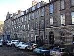 Upload another image
|
| 8 and 8A-20 Abercromby Place |
|
18 August 1964 |
|
55°57′24″N 3°11′45″W / 55.956792°N 3.195874°W / 55.956792; -3.195874 (8 and 8A-20 Abercromby Place) |
|
28211 |
 Upload another image
|
| 21–34 Abercromby Place |
|
18 August 1964 |
|
55°57′22″N 3°11′54″W / 55.956175°N 3.19837°W / 55.956175; -3.19837 (21–34 Abercromby Place) |
|
28212 |
 Upload another image
|
| St John's Church (Episcopal) |
Lothian Road |
14 December 1970 |
|
55°57′00″N 3°12′22″W / 55.950017°N 3.206059°W / 55.950017; -3.206059 (St John's Church (Episcopal)) |
|
27401 |
 Upload another image
|
| Statue of William Pitt |
George Street |
13 January 1966 |
|
55°57′11″N 3°12′01″W / 55.952992°N 3.200402°W / 55.952992; -3.200402 (Statue of William Pitt) |
|
27868 |
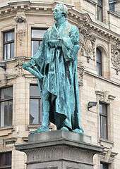 Upload another image
|
| Former St George's Chapel (Episcopal) |
5B York Place |
14 September 1966 |
|
55°57′21″N 3°11′31″W / 55.955734°N 3.191982°W / 55.955734; -3.191982 (Former St George's Chapel (Episcopal)) |
|
27374 |
 Upload another image
|
| St Paul's and St George's (Scottish Episcopal) Church |
York Place |
24 May 1966 |
|
55°57′24″N 3°11′19″W / 55.9567°N 3.188712°W / 55.9567; -3.188712 (St Paul's and St George's (Scottish Episcopal) Church) |
|
27509 |
 Upload another image
|
| Former Albany Street Chapel |
24A Broughton Street |
24 May 1966 |
|
55°57′27″N 3°11′20″W / 55.957434°N 3.189007°W / 55.957434; -3.189007 (Former Albany Street Chapel) |
|
27157 |
 Upload another image
|
| 45-57A Albany Street |
|
24 May 1966 |
|
55°57′27″N 3°11′21″W / 55.957387°N 3.189166°W / 55.957387; -3.189166 (45-57A Albany Street) |
|
46114 |
 Upload another image
|
| Glasite Meeting House |
33 Barony Street |
30 September 1964 |
|
55°57′28″N 3°11′30″W / 55.957832°N 3.191534°W / 55.957832; -3.191534 (Glasite Meeting House) |
|
26973 |
 Upload another image
|
| 14–18 Broughton Place |
|
16 June 1966 |
|
55°57′32″N 3°11′20″W / 55.958845°N 3.188906°W / 55.958845; -3.188906 (14–18 Broughton Place) |
|
45928 |
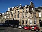 Upload another image
|
| 20–28 Broughton Place |
|
16 June 1966 |
|
55°57′32″N 3°11′19″W / 55.958957°N 3.188525°W / 55.958957; -3.188525 (20–28 Broughton Place) |
|
45929 |
 Upload another image
|
| 30–34 Broughton Place |
|
16 June 1966 |
|
55°57′33″N 3°11′17″W / 55.959052°N 3.187983°W / 55.959052; -3.187983 (30–34 Broughton Place) |
|
45930 |
 Upload another image
|
| 1–11 St Colme Street |
|
14 December 1970 |
|
55°57′12″N 3°12′30″W / 55.953391°N 3.208326°W / 55.953391; -3.208326 (1–11 St Colme Street) |
|
29724 |
 Upload another image
|
| 1–11 Wemyss Place |
|
14 December 1970 |
|
55°57′14″N 3°12′21″W / 55.953945°N 3.20586°W / 55.953945; -3.20586 (1–11 Wemyss Place) |
|
29901 |
 Upload another image
|
| Moray Place Bank Gardens, Railings and Gates |
|
31 March 1999 |
|
55°57′17″N 3°12′31″W / 55.954817°N 3.20861°W / 55.954817; -3.20861 (Moray Place Bank Gardens, Railings and Gates) |
|
46120 |
.jpg) Upload another image
|
| 4–8 Nelson Street |
|
22 September 1965 |
|
55°57′25″N 3°11′48″W / 55.956821°N 3.196628°W / 55.956821; -3.196628 (4–8 Nelson Street) |
|
49491 |
 Upload another image
|
| Greenside Parish Church |
Royal Terrace |
16 December 1965 |
|
55°57′25″N 3°10′56″W / 55.956907°N 3.182103°W / 55.956907; -3.182103 (Greenside Parish Church) |
|
27007 |
 Upload another image
|
| 1–5 Blenheim Place |
|
16 December 1965 |
|
55°57′27″N 3°11′03″W / 55.957614°N 3.184239°W / 55.957614; -3.184239 (1–5 Blenheim Place) |
|
28334 |
 Upload another image
|
| 6–10 Blenheim Place and 2 and 3 Greenside End |
|
16 December 1965 |
|
55°57′27″N 3°10′59″W / 55.957418°N 3.183144°W / 55.957418; -3.183144 (6–10 Blenheim Place and 2 and 3 Greenside End) |
|
28335 |
 Upload another image
|
| 27, 28 and 29 Gayfield Square |
Leith Walk |
19 April 1966 |
|
55°57′33″N 3°11′06″W / 55.959288°N 3.184979°W / 55.959288; -3.184979 (27, 28 and 29 Gayfield Square) |
|
49149 |
 Upload another image
|
| 30, 31 and 32 Gayfield Square |
Leith Walk |
19 April 1966 |
|
55°57′33″N 3°11′05″W / 55.959093°N 3.184669°W / 55.959093; -3.184669 (30, 31 and 32 Gayfield Square) |
|
49150 |
 Upload another image
|
| 1–3 Annandale Street |
|
19 April 1966 |
|
55°57′34″N 3°11′02″W / 55.959578°N 3.183755°W / 55.959578; -3.183755 (1–3 Annandale Street) |
|
28252 |
 Upload another image
|
| 5–9 Annandale Street |
|
19 April 1966 |
|
55°57′35″N 3°11′03″W / 55.959772°N 3.184145°W / 55.959772; -3.184145 (5–9 Annandale Street) |
|
28253 |
 Upload another image
|
| 6-10A Annandale Street |
|
19 April 1966 |
|
55°57′36″N 3°11′00″W / 55.959985°N 3.183447°W / 55.959985; -3.183447 (6-10A Annandale Street) |
|
28254 |
 Upload another image
|
| 18-22A Annandale Street |
|
19 April 1966 |
|
55°57′37″N 3°11′02″W / 55.960304°N 3.183969°W / 55.960304; -3.183969 (18-22A Annandale Street) |
|
28255 |
 Upload another image
|
| Formerly Broughton Place Church and Offices |
33 and 35 Broughton Place |
16 June 1966 |
|
55°57′33″N 3°11′14″W / 55.959148°N 3.187345°W / 55.959148; -3.187345 (Formerly Broughton Place Church and Offices) |
|
26771 |
 Upload another image
|
| St Stephen's Church (Church of Scotland) |
St Stephen Street and St Vincent Street |
14 December 1970 |
|
55°57′31″N 3°12′13″W / 55.958703°N 3.203526°W / 55.958703; -3.203526 (St Stephen's Church (Church of Scotland)) |
|
27527 |
.jpg) Upload another image
See more images
|
| 1–11 Bellevue Crescent |
|
22 September 1965 |
|
55°57′36″N 3°11′34″W / 55.960011°N 3.192898°W / 55.960011; -3.192898 (1–11 Bellevue Crescent) |
|
28285 |
 Upload another image
|
| 15–27 Bellevue Crescent, and 5–9 Cornwallis Place |
|
22 September 1965 |
|
55°57′39″N 3°11′40″W / 55.96077°N 3.194315°W / 55.96077; -3.194315 (15–27 Bellevue Crescent, and 5–9 Cornwallis Place) |
|
28286 |
 Upload another image
|
| St Mary's Church (Church of Scotland) |
13 Bellevue Crescent |
22 September 1965 |
|
55°57′37″N 3°11′37″W / 55.960192°N 3.193625°W / 55.960192; -3.193625 (St Mary's Church (Church of Scotland)) |
|
27461 |
 Upload another image
|
| 1–10 Mansfield Place |
|
22 September 1965 |
|
55°57′35″N 3°11′30″W / 55.959662°N 3.191798°W / 55.959662; -3.191798 (1–10 Mansfield Place) |
|
29302 |
 Upload another image
|
