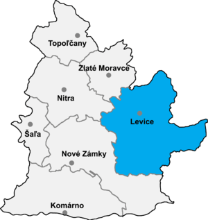
Levice District
| Levice District | |
|---|---|
| District | |
 | |
| Country | Slovakia |
| Region (kraj) | Nitra Region |
| Area | |
| • Total | 1,551 km2 (599 sq mi) |
| Population (2001) | |
| • Total | 120,021 |
| • Density | 77/km2 (200/sq mi) |
| Time zone | CET (UTC+1) |
| • Summer (DST) | CEST (UTC+2) |
| Telephone prefix | 36 |
Levice District (Slovak: okres Levice; Hungarian: Lévai járás) is a district in the Nitra Region of western Slovakia. It is the largest of Slovakia's 79 districts. The west of the district was in the Hungarian county of Bars until 1918, while the east of the district was in Hont County: Farná in the south was in the county of Esztergom (Ostrihom).
Municipalities
- Bajka
- Bátovce
- Beša
- Bielovce
- Bohunice
- Bory
- Brhlovce
- Čajkov
- Čaka
- Čata
- Demandice
- Devičany
- Dolná Seč
- Dolné Semerovce
- Dolný Pial
- Domadice
- Drženice
- Farná
- Hokovce
- Hontianska Vrbica
- Hontianske Trsťany
- Horná Seč
- Horné Semerovce
- Horné Turovce
- Horný Pial
- Hrkovce
- Hronovce
- Hronské Kľačany
- Hronské Kosihy
- Iňa
- Ipeľské Úľany
- Ipeľský Sokolec
- Jabloňovce
- Jesenské
- Jur nad Hronom
- Kalná nad Hronom
- Keť
- Kozárovce
- Krškany
- Kubáňovo
- Kukučínov
- Kuraľany
- Levice
- Lok
- Lontov
- Lula
- Málaš
- Malé Kozmálovce
- Malé Ludince
- Mýtne Ludany
- Nová Dedina
- Nový Tekov
- Nýrovce
- Ondrejovce
- Pastovce
- Pečenice
- Plášťovce
- Plavé Vozokany
- Podlužany
- Pohronský Ruskov
- Pukanec
- Rybník
- Santovka
- Sazdice
- Sikenica
- Slatina
- Starý Hrádok
- Starý Tekov
- Šahy
- Šalov
- Šarovce
- Tehla
- Tekovské Lužany
- Tekovský Hrádok
- Tlmače
- Tupá
- Turá
- Uhliská
- Veľké Kozmálovce
- Veľké Ludince
- Veľké Turovce
- Veľký Ďur
- Vyškovce nad Ipľom
- Vyšné nad Hronom
- Zalaba
- Zbrojníky
- Želiezovce
- Žemberovce
- Žemliare
Source: Lacika, Ján (2005). Slovaquie en bref. Priroda. ISBN 80-07-01377-6.
Districts of Nitra Region | ||
|---|---|---|
Coordinates: 48°12′59″N 18°36′29″E / 48.21639°N 18.60806°E
This article is issued from Wikipedia - version of the 10/25/2016. The text is available under the Creative Commons Attribution/Share Alike but additional terms may apply for the media files.