Laligurans
| Laligurans लालीगुराँस | |
|---|---|
| Municipality | |
 | |
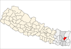
 Laligurans Location in Nepal | |
| Coordinates: 27°08′N 87°26′E / 27.14°N 87.43°ECoordinates: 27°08′N 87°26′E / 27.14°N 87.43°E | |
| Country |
|
| Zone | Kosi Zone |
| District | Terhathum |
| Population (2011) | |
| • Total | 16,934 |
| Time zone | Nepal Time (UTC+5:45) |
| Postal code | 57103 |
| Area code(s) | 026 |
Laligurans[1] is a municipality in Terhathum District in the Kosi Zone of eastern Nepal. After the government announcement the municipality was established on 19 September 2015 by merging the existing Basantapur, Phulek, Dangpa, Sungnam and Solma village development committees (VDCs).[2][3] The center of the municipality is establish in Basantpur. At the time of the 2011 Nepal census after merging the five VDCs population it had a total population of 16,934 persons.[4] After the government decision the number of municipalities has reached 217 in Nepal.[5]
Tourism
Basantpur is major tourist place to watch Mountains and interesting place surround it. Rich Limbu culture attract tourist to reside there.[6]Lasune is one of the most important attractive place for internal and external tourism. Lasune Bazar ,Lasun Stamba ,Tea Garden ,Patle Pokhari, Kala Pani , Tinjure Hill , Rat Pokhari , Kesari Taar ,Dhap Taar etc are naturally beautiful places .
References
- ↑ "Govt declares 26 new municipalities". EKantipur. 19 September 2015.
- ↑ "26 new Municipalities announced". The Rising Nepal. Retrieved 2015-09-18.
- ↑ "Govt announces 26 municipalities" (PDF). The Kathmandu Post. Retrieved 2015-09-18.
- ↑ Central Bureau of Statistics of Nepal: National Population and Housing Census 2011
- ↑ "Govt adds 26 municipalities, 1 sub metropolis". Setopati. Retrieved 18 September 2015.
- ↑ "Basantpur Tour". Mount Kailash.
External links
Headquarter: Myanglung | ||
 | ||