La Coudre, Deux-Sèvres
| La Coudre | |
|---|---|
|
The church in La Coudre | |
 La Coudre | |
|
Location within Nouvelle-Aquitaine region 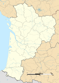 La Coudre | |
| Coordinates: 46°56′50″N 0°28′10″W / 46.9472°N 0.4694°WCoordinates: 46°56′50″N 0°28′10″W / 46.9472°N 0.4694°W | |
| Country | France |
| Region | Nouvelle-Aquitaine |
| Department | Deux-Sèvres |
| Arrondissement | Bressuire |
| Canton | Argenton-les-Vallées |
| Government | |
| • Mayor (2008–2014) | Robert Girault |
| Area1 | 8.40 km2 (3.24 sq mi) |
| Population (2006)2 | 223 |
| • Density | 27/km2 (69/sq mi) |
| Time zone | CET (UTC+1) |
| • Summer (DST) | CEST (UTC+2) |
| INSEE/Postal code | 79099 / 79150 |
| Elevation |
88–155 m (289–509 ft) (avg. 130 m or 430 ft) |
|
1 French Land Register data, which excludes lakes, ponds, glaciers > 1 km² (0.386 sq mi or 247 acres) and river estuaries. 2 Population without double counting: residents of multiple communes (e.g., students and military personnel) only counted once. | |

La Coudre is a former commune in the Deux-Sèvres department in western France. On 1 January 2016, it was merged into the new commune Argentonnay.[1]
See also
References
- ↑ Arrêté préfectoral 17 November 2015 (French)
| Wikimedia Commons has media related to La Coudre (Deux-Sèvres). |
This article is issued from Wikipedia - version of the 11/19/2016. The text is available under the Creative Commons Attribution/Share Alike but additional terms may apply for the media files.