Kura Puñusqa
| Kura Puñusqa | |
|---|---|
 Kura Puñusqa Location within Bolivia | |
| Highest point | |
| Elevation | 4,562 m (14,967 ft) [1] |
| Coordinates | 19°50′50″S 65°45′23″W / 19.84722°S 65.75639°WCoordinates: 19°50′50″S 65°45′23″W / 19.84722°S 65.75639°W |
| Geography | |
| Location |
Bolivia, Potosí Department |
| Parent range | Andes |
Kura Puñusqa (Quechua kura priest, puñuy to sleep, -sqa a suffix,[2][3] 'a priest who fell asleep', also spelled Cura Puñuskha) is a 4,562-metre-high (14,967 ft) mountain in the Bolivian Andes. It is located in the Potosí Department, José María Linares Province, Caiza "D" Municipality. The Jalsuri River originates near the mountain. Its waters flow to the Jatun Mayu.[1][4]
References
- 1 2 Bolivian IGM map 1:50,000 Estancia Kollpa 6434-III
- ↑ Leoncio Gutiérrez Camacho, Leonidas Mantilla Gutierrez, Shara Huaman Jullunila, Apurimaqpaq Runasimi Taqe, Diccionario de Quechua Apurimeño, Versión Prelimar, 2007
- ↑ Teofilo Laime Ajacopa, Diccionario Bilingüe Iskay simipi yuyayk'ancha, La Paz, 2007 (Quechua-Spanish dictionary)
- ↑ "Caiza "D"". INE, Bolivia. Retrieved April 28, 2016.
Capital: Potosí | ||
| Provinces | 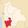 | |
| Municipalities (and seats) |
| |
This article is issued from Wikipedia - version of the 4/29/2016. The text is available under the Creative Commons Attribution/Share Alike but additional terms may apply for the media files.