Koiladi
| Koiladi कोइलाडी | |
|---|---|
| Village development committee | |
| Nickname(s): rajput village | |
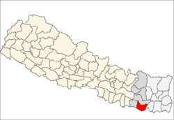
 Koiladi Location in Nepal | |
| Coordinates: 26°29′N 86°49′E / 26.48°N 86.81°ECoordinates: 26°29′N 86°49′E / 26.48°N 86.81°E | |
| Country |
|
| Zone | Sagarmatha Zone |
| District | Saptari District |
| Population (1991) | |
| • Total | 3,765 |
| Time zone | Nepal Time (UTC+5:45) |
| Postal code | 56407 |
| Area code(s) | 031 |
Koiladi is a village development committee in Saptari District in the Sagarmatha Zone of south-eastern Nepal. At the time of the 1991 Nepal census it had a population of 3765 people living in 678 individual households.[1]
References
- ↑ "Nepal Census 2001". Nepal's Village Development Committees. Digital Himalaya. Retrieved 22 November 2008.
This article is issued from Wikipedia - version of the 6/10/2016. The text is available under the Creative Commons Attribution/Share Alike but additional terms may apply for the media files.