Katariri
| Katariri | |
|---|---|
 Katariri Location within Bolivia | |
| Highest point | |
| Elevation | 3,224 m (10,577 ft) [1] |
| Coordinates | 18°31′09″S 65°32′51″W / 18.51917°S 65.54750°WCoordinates: 18°31′09″S 65°32′51″W / 18.51917°S 65.54750°W |
| Geography | |
| Location |
Bolivia, Potosí Department |
| Parent range | Andes |
Katariri (Aymara katari a big viper,[2] -ri a suffix, also spelled Catariri) is a 3,224 m (10,577 ft) high a mountain in the Bolivian Andes. It is located on the border of the Chuquisaca Department, Oropeza Province, Poroma Municipality, and the Potosí Department, Chayanta Province, Ravelo Municipality. It lies northeast of Chullpa Urqu[1][3]
References
- 1 2 Bolivia IGM map 1:50,000 Toromani 6438-II
- ↑ Radio San Gabriel, "Instituto Radiofonico de Promoción Aymara" (IRPA) 1993, Republicado por Instituto de las Lenguas y Literaturas Andinas-Amazónicas (ILLLA-A) 2011, Transcripción del Vocabulario de la Lengua Aymara, P. Ludovico Bertonio 1612 (Spanish-Aymara-Aymara-Spanish dictionary)
- ↑ "Poroma". INE, Bolivia. Retrieved April 16, 2016.
Capital: Potosí | ||
| Provinces | 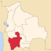 | |
| Municipalities (and seats) |
| |
This article is issued from Wikipedia - version of the 4/16/2016. The text is available under the Creative Commons Attribution/Share Alike but additional terms may apply for the media files.