Jatun Q'asa (Potosí)
This article is about the mountain in the Potosí mountain range, Potosí Municipality, Tomás Frías Province, Potosí Department, Bolivia. For other uses, see Jatun Q'asa.
| Jatun Q'asa | |
|---|---|
 Jatun Q'asa Location in Bolivia | |
| Highest point | |
| Elevation | 5,023 m (16,480 ft) [1] |
| Coordinates | 19°39′56″S 65°39′26″W / 19.66556°S 65.65722°WCoordinates: 19°39′56″S 65°39′26″W / 19.66556°S 65.65722°W |
| Geography | |
| Location |
Bolivia, Potosí Department |
| Parent range | Andes, Khari Khari mountain range |
Jatun Q'asa (Quechua jatun, hatun big, great, q'asa mountain pass, "great mountain pass", hispanicized spelling Jatún Casa) is a mountain in the Khari Khari mountain range of the Bolivian Andes, about 5,023 m (16,480 ft) high. It is located in the Potosí Department, Tomás Frías Province, Potosí Municipality. It lies north of the plain called Jatun Molino Pampa and the Sip'uruni River. Jatun Q'asa lies near Q'illu Q'asa, Q'illu Urqu and Yuraq Yuraq.[1][2]
References
Capital: Potosí | ||
| Provinces | 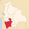 | |
| Municipalities (and seats) |
| |
This article is issued from Wikipedia - version of the 12/6/2015. The text is available under the Creative Commons Attribution/Share Alike but additional terms may apply for the media files.