Hirtstein
| Hirtstein | |
|---|---|
 Hirtstein from south-east | |
| Highest point | |
| Elevation | 890 m (2,920 ft) [1] |
| Coordinates | 50°33′08.6″N 13°11′35.2″E / 50.552389°N 13.193111°ECoordinates: 50°33′08.6″N 13°11′35.2″E / 50.552389°N 13.193111°E |
| Geography | |
| Parent range | Ore Mountains |
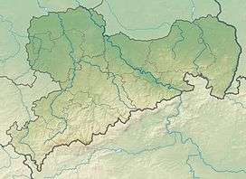
Hirtstein is a mountain of Saxony, in southeastern Germany. It is situated near the village Satzung, in the Ore Mountains, about 1.5 km from the border to the Czech Republic. Its elevation is 890 m.[1]
Geology
Hirtstein is a gneiss knoll with an intrusion of volcanic rock, commonly referred to as basalt[2] and specifically identified as clinopyroxene-melanephelinite,[3] whose fan shape has been exposed by quarry operations. This formation was deemed worthy of protection already in the 19th century and was spared from quarrying.[4] In 2006 it was declared a National Geotope of Germany.[5] Minerals such as augite, magnetite, nepheline, olivine and perovskite have been identified in samples from the basaltic fan of Hirtstein.[6]
Tourism
The mountain restaurant Hirtsteinbaude was opened on 11 September 1927. It offers accommodation for tourists.[7]
In winter, several cross-country ski runs are prepared around the mountain. A short downhill ski, sledding, and snow tube run with a ski lift is located next to the restaurant.[8] The cross-border long-distance skiing trail Skimagistrale Erzgebirge/Krušné hory[9] and the long-distance footpath Kammweg Erzgebirge-Vogtland[10] traverse Hirtstein.
Gallery
 Basalt fan in a former quarry
 Triangulation post
.jpg) Hirtsteinbaude mountain restaurant
Hirtsteinbaude mountain restaurant Hirtstein seen from Jelení hora
References
- 1 2 Homepage of Satzung
- ↑ Carl Friedrich Naumann (1845). Geognostische Beschreibung des Königreiches Sachsen und der angränzenden Länderabtheilungen. 2. Dresden and Leipzig: Arnold. pp. 484 f.
- ↑ Roman Rönick, Axel D. Renno (2010). "Clinopyroxene from basaltic rocks of the Erzgebirge-Krušné hory Mts. – implications for modelling of the magmatic plumbing system" (PDF). Journal of Geosciences. 55: 231–249. doi:10.3190/jgeosci.077.
- ↑ Gerald Urban (2009). "Der Hirtstein bei Satzung - ein verhinderter Vulkan". Erzgebirgische Heimatblätter (2): 2 f. ISSN 0232-6078.
- ↑ Liste der Nationalen Geotope Deutschlands ausgezeichnet am 12. Mai 2006 in Hannover at the Wayback Machine (archived December 26, 2007)
- ↑ "Typlokalität Hirtstein, Fundortbeschreibung und Mineralliste". Mineralienatlas. 2005.
- ↑ "Hirtsteinbaude. Berggasthof & Pension". Retrieved 2015-05-25.
- ↑ "Die Hirtstein-Loipen". Ringo Porstmann.
- ↑ Clemens Hohner (ed.). "Kammloipe, Skimagistrale und Osterzgebirgsloipe - Skiwandern auf dem Erzgebirgskamm". Retrieved 2016-05-25.
- ↑ "Etappe 6: "Von Kühnhaide nach Satzung"". Tourismusverband Vogtland e.V., Tourismusverband Erzgebirge e.V. Retrieved 2016-05-25.