Grade II* listed buildings in Breckland

There are over 20,000 Grade II* listed buildings in England. This page is a list of 102 of these buildings in the district of Breckland in Norfolk.

List of buildings

Name Location Type Completed [note 1]Date designated Grid ref.[note 2]
Geo-coordinates
Entry number [note 3]Image
Attleborough Hall Attleborough Country house 16th century 21 July 1951 TM0504896273
52°31′33″N 1°01′16″E / 52.525726°N 1.021214°E / 52.525726; 1.021214 (Attleborough Hall)
1342452
Bridge and walls to moat at Attleborough Hall Attleborough Bridge Mid-16th century 1 October 1979 TM0510796286
52°31′33″N 1°01′20″E / 52.525821°N 1.02209°E / 52.525821; 1.02209 (Bridge and walls to moat at Attleborough Hall)
1169012
Banham Hall Banham Manor house Late 16th century 21 July 1951 TM0698389129
52°27′39″N 1°02′43″E / 52.460862°N 1.045257°E / 52.460862; 1.045257 (Banham Hall)
1306687
Kings Head Cottage Banham House 17th century 9 February 1984 TM0656287619
52°26′51″N 1°02′17″E / 52.447466°N 1.038136°E / 52.447466; 1.038136 (Kings Head Cottage)
1342453
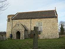
Church of St Peter Bittering, Beeston with Bittering Parish church 12th and 13th century 30 May 1960 TF9376817526
52°43′14″N 0°52′03″E / 52.720672°N 0.867618°E / 52.720672; 0.867618 (Church of St Peter)
1342520
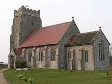
Church of St Mary East Bilney, Beetley Church 14th century 30 May 1960 TF9553419536
52°44′17″N 0°53′42″E / 52.738083°N 0.894927°E / 52.738083; 0.894927 (Church of St Mary)
1342554
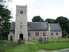
Church of St Swithin Bintree Parish church 14th century 30 May 1960 TG0171623446
52°46′15″N 0°59′20″E / 52.770915°N 0.988768°E / 52.770915; 0.988768 (Church of St Swithin)
1077371
Blo' Norton Hall Blo' Norton Country house Mid-16th century 21 July 1951 TM0082679633
52°22′40″N 0°56′57″E / 52.377903°N 0.949064°E / 52.377903; 0.949064 (Blo' Norton Hall)
1077439
Church Farmhouse Blo' Norton Farmhouse Late 15th century 21 July 1951 TM0121279795
52°22′45″N 0°57′17″E / 52.379216°N 0.954824°E / 52.379216; 0.954824 (Church Farmhouse)
1077441
Church of St Andrew Blo' Norton Parish church 13th century 16 July 1958 TM0122279698
52°22′42″N 0°57′18″E / 52.378341°N 0.954912°E / 52.378341; 0.954912 (Church of St Andrew)
1077440
Clock tower to north of Shadwell Court Brettenham Clock tower 1856–60 18 March 1983 TL9286883163
52°24′45″N 0°50′04″E / 52.412457°N 0.834336°E / 52.412457; 0.834336 (Clock tower to north of Shadwell Court)
1342781
The College Brettenham House 19th century 21 July 1951 TL9238881217
52°23′43″N 0°49′34″E / 52.395152°N 0.826171°E / 52.395152; 0.826171 (The College)
1076907
Church of St Mary Bridgham Parish church 14th century 16 July 1958 TL9577385826
52°26′07″N 0°52′43″E / 52.435336°N 0.878549°E / 52.435336; 0.878549 (Church of St Mary)
1076909
Brisley Hall Brisley Farmhouse 17th century and earlier 4 December 1951 TF9527621374
52°45′17″N 0°53′32″E / 52.754678°N 0.892203°E / 52.754678; 0.892203 (Brisley Hall)
1342482
Bylaugh Hall Bylaugh Park, Bylaugh Country house 1850–52 15 April 1982 TG0353618751
52°43′41″N 1°00′46″E / 52.728086°N 1.012796°E / 52.728086; 1.012796 (Bylaugh Hall)
1077349
Farm buildings at Park Farm Bylaugh Farm buildings c.1850 15 May 1999 TG0301118424
52°43′31″N 1°00′17″E / 52.725347°N 1.00483°E / 52.725347; 1.00483 (Farm buildings at Park Farm)
1379764
Caston Windmill and Granary Caston Mill 1864 21 July 1951 TL9511198159
52°32′47″N 0°52′34″E / 52.546306°N 0.876043°E / 52.546306; 0.876043 (Caston Windmill and Granary)
1076787
Church of All Saints Cockley Cley Parish church 13th century and later 23 June 1960 TF7917804186
52°36′21″N 0°38′41″E / 52.605902°N 0.644606°E / 52.605902; 0.644606 (Church of All Saints)
1077261
Church of St Mary Colkirk Parish church 14th century and later 30 May 1960 TF9178526549
52°48′09″N 0°50′37″E / 52.80239°N 0.843572°E / 52.80239; 0.843572 (Church of St Mary)
1077464
Hall Farmhouse Colkirk Farmhouse 16th century 4 December 1951 TF9245426676
52°48′12″N 0°51′13″E / 52.803293°N 0.853557°E / 52.803293; 0.853557 (Hall Farmhouse)
1304756
Pattesley House Pattesley, Colkirk Farmhouse 14th century and later 4 December 1951 TF8984424107
52°46′52″N 0°48′48″E / 52.781151°N 0.8134°E / 52.781151; 0.8134 (Pattesley House)
1077468
Church of St Andrew Southburgh, Cranworth Parish church 14th century and later 30 May 1960 TG0032104832
52°36′16″N 0°57′24″E / 52.604325°N 0.956801°E / 52.604325; 0.956801 (Church of St Andrew)
1172040
Letton Hall Cranworth Country house 1783–89 4 December 1951 TF9717605872
52°36′53″N 0°54′40″E / 52.614812°N 0.911042°E / 52.614812; 0.911042 (Letton Hall)
1077342
Dereham Maltings (Crisp Malting Group) Dereham Industrial building 1870 and 1894 27 July 2000 TF9941913130
52°40′45″N 0°56′55″E / 52.679154°N 0.948509°E / 52.679154; 0.948509 (Dereham Maltings (Crisp Malting Group))
1246348
West Hall Didlington House 17th century 18 February 1987 TL7977294025
52°30′52″N 0°38′52″E / 52.514458°N 0.647864°E / 52.514458; 0.647864 (West Hall)
1171962
Old Hall East Tuddenham Farmhouse 16th century 4 December 1951 TG0880711092
52°39′26″N 1°05′09″E / 52.657327°N 1.085878°E / 52.657327; 1.085878 (Old Hall)
1077351
Church of St Thomas Foxley Parish church 14th century and later 30 May 1960 TG0395221714
52°45′16″N 1°01′15″E / 52.754528°N 1.020787°E / 52.754528; 1.020787 (Church of St Thomas)
1169955
Church of All Saints Great Fransham, Fransham Parish church Late 13th century and later 30 May 1960 TF8989013104
52°40′56″N 0°48′28″E / 52.682341°N 0.807723°E / 52.682341; 0.807723 (Church of All Saints)
1077471
Hyde Hall Great Fransham, Fransham Farmhouse Mid-18th century 14 June 1984 TF9163412919
52°40′48″N 0°50′00″E / 52.680067°N 0.833381°E / 52.680067; 0.833381 (Hyde Hall)
1077469
The Old Hall Little Fransham, Fransham Farmhouse 16th century 4 December 1951 TF9028111866
52°40′16″N 0°48′46″E / 52.671088°N 0.812785°E / 52.671088; 0.812785 (The Old Hall)
1152599
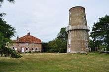
Garboldisham Windmill Garboldisham Windmill c.1780 16 July 1958 TM0027580472
52°23′08″N 0°56′29″E / 52.385637°N 0.941481°E / 52.385637; 0.941481 (Garboldisham Windmill)
1168497
Jacques Garboldisham Cross passage house c.1490 21 July 1951 TM0035181964
52°23′56″N 0°56′37″E / 52.399005°N 0.943488°E / 52.399005; 0.943488 (Jacques)
1077445
Church of St Margaret Garvestone Parish church 14th century 30 May 1960 TG0238207362
52°37′35″N 0°59′19″E / 52.626275°N 0.988739°E / 52.626275; 0.988739 (Church of St Margaret)
1305274
Guntons Farmhouse Garvestone Farmhouse 18th century 4 December 1951 TG0162906868
52°37′20″N 0°58′38″E / 52.62212°N 0.977329°E / 52.62212; 0.977329 (Guntons Farmhouse)
1342566
Reymerston Old Hall Farmhouse Reymerston, Garvestone Farmhouse 1620 4 December 1951 TG0144206352
52°37′03″N 0°58′27″E / 52.617557°N 0.974256°E / 52.617557; 0.974256 (Reymerston Old Hall Farmhouse)
1342565
Church of St Andrew Guist Parish church 13th century and later 30 May 1960 TG0002025606
52°47′27″N 0°57′54″E / 52.790937°N 0.964982°E / 52.790937; 0.964982 (Church of St Andrew)
1306255
Church of St Mary Bodney, Hilborough Parish church 14th century and later 23 June 1960 TL8311898835
52°33′24″N 0°41′59″E / 52.556539°N 0.699765°E / 52.556539; 0.699765 (Church of St Mary)
1077285
Hilborough Hall Hilborough House 1779 9 July 1951 TF8276700304
52°34′11″N 0°41′43″E / 52.569848°N 0.695403°E / 52.569848; 0.695403 (Hilborough Hall)
1077283
Hilborough Mill Hilborough Mill house 1819 30 October 1985 TL8272699928
52°33′59″N 0°41′41″E / 52.566485°N 0.694591°E / 52.566485; 0.694591 (Hilborough Mill)
1342591
Church of St Andrew Hoe Parish church 13th century 30 May 1960 TF9975616421
52°42′31″N 0°57′20″E / 52.708576°N 0.955483°E / 52.708576; 0.955483 (Church of St Andrew)
1077329
Church of St Margaret Worthing, Hoe Parish church 12th century and later 30 May 1960 TF9949619530
52°44′12″N 0°57′13″E / 52.736583°N 0.953526°E / 52.736583; 0.953526 (Church of St Margaret)
1342577
Church of St Edmund Horningtoft Parish church 13th century 14 June 1984 TF9361323080
52°46′14″N 0°52′07″E / 52.770593°N 0.868601°E / 52.770593; 0.868601 (Church of St Edmund)
1304480
Church of St Peter Ickburgh Parish church 14th century 23 June 1960 TL8164495067
52°31′24″N 0°40′34″E / 52.523195°N 0.675988°E / 52.523195; 0.675988 (Church of St Peter)
1077286
Kenninghall Place Kenninghall House 1505–25 21 July 1951 TM0691785620
52°25′46″N 1°02′32″E / 52.429386°N 1.042114°E / 52.429386; 1.042114 (Kenninghall Place)
1077419
Church of St Andrew Kilverstone Parish church 12th century 16 July 1958 TL8938684014
52°25′17″N 0°47′01″E / 52.421314°N 0.783688°E / 52.421314; 0.783688 (Church of St Andrew)
1342788
Church of St Nicholas West Lexham, Lexham Parish church 14th century, restored 1891 30 May 1960 TF8425617211
52°43′16″N 0°43′36″E / 52.721164°N 0.726779°E / 52.721164; 0.726779 (Church of St Nicholas)
1077485
Pumphouse Little Cressingham Pump house Early 19th century 3 April 1987 TF8696700215
52°34′03″N 0°45′26″E / 52.567623°N 0.757249°E / 52.567623; 0.757249 (Pumphouse)
1077226
Wind and Water Mill Little Cressingham Watermill c.1820 9 July 1951 TF8697900213
52°34′03″N 0°45′27″E / 52.567601°N 0.757425°E / 52.567601; 0.757425 (Wind and Water Mill)
1152133
Dunham Lodge Little Dunham Country house 1783 4 December 1951 TF8772912849
52°40′51″N 0°46′32″E / 52.680804°N 0.77565°E / 52.680804; 0.77565 (Dunham Lodge)
1077493
Church of St Peter Little Ellingham Parish church Early 14th century 16 November 1983 TM0050899155
52°33′12″N 0°57′22″E / 52.553289°N 0.956125°E / 52.553289; 0.956125 (Church of St Peter)
1342423
Church of St Andrew and St Peter Longham Parish church 15th century and later 30 May 1960 TF9318716189
52°42′32″N 0°51′30″E / 52.708875°N 0.858242°E / 52.708875; 0.858242 (Church of St Andrew and St Peter)
1077331
Church of Our Lady of Consolation Lynford Roman Catholic church 1879 18 February 1987 TL8188293306
52°30′26″N 0°40′43″E / 52.507302°N 0.67853°E / 52.507302; 0.67853 (Church of Our Lady of Consolation)
1077247
Church of St Margaret Lyng Parish church 13th century and later 30 May 1960 TG0690617855
52°43′08″N 1°03′43″E / 52.718765°N 1.062062°E / 52.718765; 1.062062 (Church of St Margaret)
1169125
Ivy Farmhouse Mattishall House First half of 18th century 4 December 1951 TG0437610901
52°39′26″N 1°01′13″E / 52.657299°N 1.020346°E / 52.657299; 1.020346 (Ivy Farmhouse)
1077328
Merton Hall Gatehouse Merton Gatehouse 1620 21 July 1951 TL9111697765
52°32′39″N 0°49′01″E / 52.544184°N 0.816977°E / 52.544184; 0.816977 (Merton Hall Gatehouse)
1076830
Cross in the churchyard 10 metres west of tower of Church of St John the Baptist Mileham Cross 15th century 14 June 1984 TF9217619584
52°44′23″N 0°50′43″E / 52.739717°N 0.845281°E / 52.739717; 0.845281 (Cross in the churchyard 10 metres west of tower of Church of St John the Baptist)
1342489
Church of St Leonard Mundford Parish church 14th century 23 June 1960 TL8005293801
52°30′44″N 0°39′07″E / 52.512354°N 0.651865°E / 52.512354; 0.651865 (Church of St Leonard)
1342617
Narborough Hall Narborough Country house Late 16th century 9 July 1951 TF7493713142
52°41′16″N 0°35′12″E / 52.687713°N 0.58679°E / 52.687713; 0.58679 (Narborough Hall)
1077305
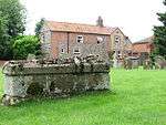
Table tomb approximately 14 metres south of aisle of All Saints' Church Necton Chest tomb 14th century 3 April 1987 TF8785809729
52°39′10″N 0°46′33″E / 52.652745°N 0.775779°E / 52.652745; 0.775779 (Table tomb approximately 14 metres south of aisle of All Saints' Church)
1077228
Market House New Buckenham Toll house 1559 9 February 1984 TM0885390443
52°28′19″N 1°04′25″E / 52.471947°N 1.073562°E / 52.471947; 1.073562 (Market House)
1306640
Shettles North Elmham Farmhouse 15th century 4 December 1951 TF9849621067
52°45′03″N 0°56′23″E / 52.75075°N 0.939665°E / 52.75075; 0.939665 (Shettles)
1170168
Church of St Andrew North Pickenham Parish church Pre-1863 23 June 1960 TF8655406920
52°37′41″N 0°45′18″E / 52.627971°N 0.754939°E / 52.627971; 0.754939 (Church of St Andrew)
1077229
Abbey Farmhouse Old Buckenham Farmhouse c.1550–60 16 July 1958 TM0710492556
52°29′30″N 1°02′57″E / 52.491581°N 1.049163°E / 52.491581; 1.049163 (Abbey Farmhouse)
1169388
Old Buckenham Windmill Old Buckenham Windmill 1818 21 July 1951 TM0623590987
52°28′40″N 1°02′07″E / 52.477825°N 1.035412°E / 52.477825; 1.035412 (Old Buckenham Windmill)
1342467
Church of St. John Evangelist Ovington Parish church 12th century 16 July 1958 TF9254402594
52°35′13″N 0°50′27″E / 52.58704°N 0.84081°E / 52.58704; 0.84081 (Church of St. John Evangelist)
1076798
Church of the Immaculate Conception of the Blessed Virgin Mary and St Margaret, Oxburgh Hall Oxburgh Hall Park, Oxborough Roman Catholic chapel 1838 23 June 1960 TF7414701269
52°34′53″N 0°34′08″E / 52.58134°N 0.568859°E / 52.58134; 0.568859 (Church of the Immaculate Conception of the Blessed Virgin Mary and St Margaret, Oxburgh Hall)
1342587
Park boundary wall including tower and gateway, Oxburgh Hall Oxburgh Hall Park, Oxborough Tower 15th century 23 October 1985 TF7398601224
52°34′52″N 0°33′59″E / 52.580987°N 0.566461°E / 52.580987; 0.566461 (Park boundary wall including tower and gateway, Oxburgh Hall)
1306374
Church of All Saints, including tower Hargham, Quidenham Church 14th century 16 July 1958 TM0199291350
52°28′58″N 0°58′24″E / 52.482669°N 0.973245°E / 52.482669; 0.973245 (Church of All Saints, including tower)
1077512
Church of St Andrew Quidenham Parish church Late 11th century 16 July 1958 TM0284087675
52°26′58″N 0°59′01″E / 52.449362°N 0.983482°E / 52.449362; 0.983482 (Church of St Andrew)
1169567
Church of St Mary Eccles, Quidenham Parish church 12th century 16 July 1958 TM0191389356
52°27′53″N 0°58′15″E / 52.464797°N 0.970877°E / 52.464797; 0.970877 (Church of St Mary)
1077510
Wilby Hall Wilby, Quidenham Country house Late 16th century 9 February 1984 TM0327390555
52°28′30″N 0°59′30″E / 52.475057°N 0.991598°E / 52.475057; 0.991598 (Wilby Hall)
1077519
Church of St Peter Riddlesworth Parish church Early 14th century 16 July 1958 TL9666681284
52°23′39″N 0°53′20″E / 52.394235°N 0.888999°E / 52.394235; 0.888999 (Church of St Peter)
1077393
Dovecote to Rougham Hall Rougham Dovecote c.1690 4 December 1951 TF8298320606
52°45′07″N 0°42′35″E / 52.752081°N 0.709844°E / 52.752081; 0.709844 (Dovecote to Rougham Hall)
1342500
Church of St Botolph Stow Bedon Parish church 12th century 21 July 1958 TL9614695574
52°31′22″N 0°53′23″E / 52.522725°N 0.889761°E / 52.522725; 0.889761 (Church of St Botolph)
1077585
Manor House including attached service range to east Swaffham House c.1740 17 January 1973 TF8241909030
52°38′54″N 0°41′42″E / 52.648323°N 0.695083°E / 52.648323; 0.695083 (Manor House including attached service range to east)
1269575
Oakleigh House Swaffham House Early 17th century 10 January 1951 TF8182608997
52°38′54″N 0°41′11″E / 52.648225°N 0.68631°E / 52.648225; 0.68631 (Oakleigh House)
1269627
Bell Hotel Thetford Jettied house Mid-15th century 3 April 1951 TL8692483124
52°24′51″N 0°44′49″E / 52.414168°N 0.74703°E / 52.414168; 0.74703 (Bell Hotel)
1195935
Church of St Cuthbert Thetford Parish church Early 13th century 3 April 1951 TL8712083067
52°24′49″N 0°45′00″E / 52.413589°N 0.749876°E / 52.413589; 0.749876 (Church of St Cuthbert)
1207726
Church of St Mary the Less Thetford Parish church 11th century 3 April 1951 TL8678982822
52°24′41″N 0°44′42″E / 52.411502°N 0.744879°E / 52.411502; 0.744879 (Church of St Mary the Less)
1297899
Church of St Peter Thetford Parish church 14th century 3 April 1951 TL8692783176
52°24′53″N 0°44′50″E / 52.414634°N 0.747103°E / 52.414634; 0.747103 (Church of St Peter)
1219326
Fulmerston's Almshouses Thetford Almshouse 1610 3 April 1951 TL8682282858
52°24′43″N 0°44′43″E / 52.411814°N 0.745384°E / 52.411814; 0.745384 (Fulmerston's Almshouses)
1279468
Nunnery Place ruin approximately 10 metres south-east of the Nunnery Nunnery Place, Thetford Benedictine nunnery c.1160–1540 3 April 1951 TL8731682222
52°24′21″N 0°45′08″E / 52.405934°N 0.752282°E / 52.405934; 0.752282 (Nunnery Place ruin approximately 10 metres south-east of the Nunnery)
1195915
Roman Catholic Church of St Mary Thetford Roman Catholic church 1826 3 April 1951 TL8666182844
52°24′42″N 0°44′35″E / 52.411743°N 0.743012°E / 52.411743; 0.743012 (Roman Catholic Church of St Mary)
1207963
The Nunnery Nunnery Place, Thetford House Early 17th century 3 April 1951 TL8730282260
52°24′23″N 0°45′08″E / 52.40628°N 0.752098°E / 52.40628; 0.752098 (The Nunnery)
1208030
Thetford Warren Lodge Thetford Gamekeeper's lodge Early 15th century 10 March 1971 TL8392984066
52°25′25″N 0°42′13″E / 52.423641°N 0.703564°E / 52.423641; 0.703564 (Thetford Warren Lodge)
1297876
3 and 5 Castle Street Thetford House Late 15th century 3 April 1951 TL8722483061
52°24′49″N 0°45′05″E / 52.4135°N 0.7514°E / 52.4135; 0.7514 (3 and 5 Castle Street)
1207558
3 and 4 Market Place Thetford Apartment 16th century 3 April 1951 TL8718883087
52°24′49″N 0°45′03″E / 52.413745°N 0.750886°E / 52.413745; 0.750886 (3 and 4 Market Place)
1207841
College Farmhouse Thompson House 1350 21 July 1951 TL9323296594
52°31′59″N 0°50′51″E / 52.532924°N 0.84746°E / 52.532924; 0.84746 (College Farmhouse)
1076807
Church of St Andrew Tottington Parish church 14th century 16 July 1958 TL8939795521
52°31′29″N 0°47′25″E / 52.524635°N 0.790381°E / 52.524635; 0.790381 (Church of St Andrew)
1342814
Church of St Nicholas Twyford Parish church 14th century 30 May 1960 TG0167724610
52°46′53″N 0°59′20″E / 52.78138°N 0.988907°E / 52.78138; 0.988907 (Church of St Nicholas)
1170307
Church of St. Mary Watton Parish church 12th century 16 July 1958 TF9213500943
52°34′20″N 0°50′02″E / 52.57236°N 0.833824°E / 52.57236; 0.833824 (Church of St. Mary)
1153046
Church of All Saints Weasenham All Saints Parish church 14th century, restored 1905–06 30 May 1960 TF8508021612
52°45′37″N 0°44′29″E / 52.7604°N 0.741445°E / 52.7604; 0.741445 (Church of All Saints)
1306499
Church of St Peter Weasenham St. Peter Parish church 13th century 30 May 1960 TF8561822355
52°46′01″N 0°44′59″E / 52.766887°N 0.749828°E / 52.766887; 0.749828 (Church of St Peter)
1169531
Church of St Mary Weeting-with-Broomhill Parish church 14th century 23 June 1960 TL7766989192
52°28′18″N 0°36′52″E / 52.471744°N 0.614331°E / 52.471744; 0.614331 (Church of St Mary)
1172178
Church of St Andrew Wellingham Parish church Late 13th century and later 30 May 1960 TF8709822257
52°45′56″N 0°46′18″E / 52.765497°N 0.771681°E / 52.765497; 0.771681 (Church of St Andrew)
1077456
Church of St Peter and Paul Wendling Parish church 14th century, Norman fragments 30 May 1960 TF9313413134
52°40′53″N 0°51′20″E / 52.681465°N 0.855667°E / 52.681465; 0.855667 (Church of St Peter and Paul)
1077339
Church of St Andrew Westfield, Whinburgh and Westfield Parish church 14th century 30 May 1960 TF9929709919
52°39′01″N 0°56′41″E / 52.650372°N 0.944767°E / 52.650372; 0.944767 (Church of St Andrew)
1077294
Old Hall Whinburgh and Westfield Farmhouse c.1600 4 December 1951 TG0150807909
52°37′53″N 0°58′34″E / 52.63151°N 0.976178°E / 52.63151; 0.976178 (Old Hall)
1152045
Church of St Mary Whissonsett Parish church Early 14th century and later 30 May 1960 TF9191923345
52°46′25″N 0°50′37″E / 52.773576°N 0.843679°E / 52.773576; 0.843679 (Church of St Mary)
1077436
Church of St Andrew Illington, Wretham Parish church Early 15th century 16 July 1958 TL9481189994
52°28′23″N 0°52′01″E / 52.473103°N 0.866847°E / 52.473103; 0.866847 (Church of St Andrew)
1170666
Church of St Ethelbert Wretham Parish church 12th century 16 July 1958 TL9150590632
52°28′48″N 0°49′07″E / 52.48°N 0.818603°E / 52.48; 0.818603 (Church of St Ethelbert)
1170650
Holland's Hall Bakerfield Green, Yaxham Farmhouse Late 16th century 4 December 1951 TG0289109506
52°38′43″N 0°59′51″E / 52.645333°N 0.997565°E / 52.645333; 0.997565 (Holland's Hall)
1152070

See also

Notes

  1. The date given is the date used by Historic England as significant for the initial building or that of an important part in the structure's description.
  2. Sometimes known as OSGB36, the grid reference is based on the British national grid reference system used by the Ordnance Survey.
  3. The "List Entry Number" is a unique number assigned to each listed building and scheduled monument by Historic England.

Media related to Grade II* listed buildings in Norfolk, England at Wikimedia Commons

This article is issued from Wikipedia - version of the 11/6/2016. The text is available under the Creative Commons Attribution/Share Alike but additional terms may apply for the media files.