Farm to Market Road 360
| ||||
|---|---|---|---|---|
| Route information | ||||
| Maintained by TxDOT | ||||
| Length: | 8.808 mi[1] (14.175 km) | |||
| Existed: | June 18, 1945[1] – present | |||
| Major junctions | ||||
| South end: |
| |||
|
| ||||
| North end: |
| |||
| Location | ||||
| Counties: | Fort Bend | |||
| Highway system | ||||
| ||||

Farm to Market Road 360 (FM 360) is a state highway in the U.S. state of Texas that stays within Fort Bend County. The two-lane highway begins at State Highway 36 (SH 36) in Needville and proceeds northwest before ending at a U.S. Route 59 (US 59) overpass to the southwest of Beasley.
Route description
FM 360 is a two-lane highway for its entire length. The road starts at a traffic signal on SH 36 in Needville and is concurrent with Main Street. After going 0.4 miles (0.6 km) to the northwest, FM 360 comes to a traffic signal at FM 1236, which is also called School Street. Between SH 36 and School Street, the highway passes a church, homes, businesses, and the municipal offices. For seven more blocks after School Street, FM 360 goes through a residential part of Needville. After an open space, the highway passes a few more residential streets before entering the countryside. FM 360 continues straight to the northeast, without so much as a jog, until it approaches the US 59 overpass southwest of Beasley. In this long stretch, FM 360 intersects with the following section-line roads at right angles, in order: Williams School, Brinkmeyer, Modena-School, Wernecke and Vincik-Ehlert Roads. In the last hundred yards, the highway bends to the north, passes under US 59 and meets Loop 540 on the other side. US 59 is accessible to the northeast and southwest via entrance ramps.[2]
-
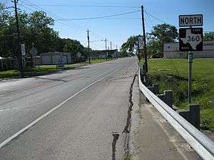
Northeast on FM 360 just north of Highway 36 in Needville
-
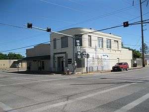
Kanak Law Building at FM 360 and FM 1236 in Needville
-

US 59 overpass at the end of FM 360 near Beasley
History
FM 360 was originally designated on June 18, 1945, to start at SH 36 in Needville, run 8 miles (12.9 km) to the northeast and end at US 59. On March 29, 1953 a 0.56 miles (0.90 km) long spur connection between FM 360 and SH 36 along School Street was added to the state highway system. On December 31, 1958, the spur connection was transferred to FM 1236.[1]
Major intersections
The entire highway is in Fort Bend County.
| Location | mi | km | Destinations | Notes | |
|---|---|---|---|---|---|
| Needville | 0.0 | 0.0 | Southern terminus of FM 360 | ||
| 0.4 | 0.64 | Northern terminus of FM 1236 | |||
| Beasley | 8.8 | 14.2 | Northern terminus of FM 360 | ||
| 1.000 mi = 1.609 km; 1.000 km = 0.621 mi | |||||
See also
 Texas portal
 U.S. Roads portal
References
- 1 2 3 Transportation Planning and Programming Division (n.d.). "Farm to Market Road No. 360". Highway Designation Files. Texas Department of Transportation. Retrieved April 23, 2013.
- ↑ Google (April 23, 2013). "Farm to Market Road 360" (Map). Google Maps. Google. Retrieved April 23, 2013.