Eddleston
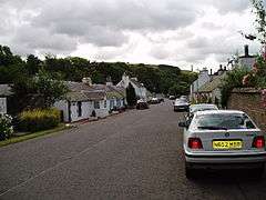
Eddleston (Scottish Gaelic: Baile Ghille Mhoire) is a small village and civil parish in the Scottish Borders area of Scotland. It lies 4 miles (6.4 km) north of Peebles and 9 miles (14 km) south of Penicuik on the A703, which passes through the centre of the village. Nearby is the Great Polish Map of Scotland, a large terrain map. The Eddleston Water runs through the village.
According to the 2001 census, there were 129 households, with a population of 335 people, 47% male and 53% female. Eddleston contains a few farms outside of the village centre. Barony Castle (also known by its earlier name of Black Barony), in the village, dates back to the 16th century, and was the property of the Murray Baronets, as was nearby Cringletie, which is now a hotel.
Etymology
Eddleston's earliest recorded name was Penteiacob, in Old Welsh or Brittonic, and meant "headland of James's house". The Anglo-Gaelic of Gillemorestun of the 12th century AD meant "town of St Mary's lad", and gave rise to the current Gaelic name for the village, Baile Ghille Mhoire. It became Edulfstun in 1189 when it was granted to Edulf, son of Utred. This became Edoluestone (circa 1200) and Edwylstone (circa 1305), and was eventually fully Anglicised to Eddleston by the 14th century.
The Great Polish Map of Scotland
The Great Polish Map of Scotland is a three-dimensional concrete map in the grounds of the Barony Castle Hotel. It was constructed by Polish geographers in the mid-1970s. The map was conceived partly in recognition of the hospitality afforded to Polish soldiers during the Second World War. The idea for the map originated with Jan Tomasik who was the proprietor of the hotel from 1968-1981. It was constructed over a three-year period from 1974. In September 2012 the Scottish Culture Secretary announced that the map had been awarded category B listed status.[1][2]
Surnames
Most common surnames in Eddleston at the time of the United Kingdom Census of 1881,[3] by order of incidence:
See also
- Darnhall Mains
- List of places in the Scottish Borders
- List of places in Scotland
- List of rivers of Scotland
References
- ↑ Great Polish Map of Scotland Granted listed status "BBC News", Accessed 17 September 2012
- ↑ "Great Polish Map of Scotland". Historic Scotland. Retrieved 24 July 2013.
- ↑ Most Common Surnames in Eddleston
- Mulholland, H (1970), The microlithic industries of the Tweed Valley
External links
| Wikimedia Commons has media related to Eddleston. |
| Wikimedia Commons has media related to Great Polish Map of Scotland (sculpture). |
- National Archives of Scotland record of Eddleston
- RCAHMS record of Eddleston Railway Bridge
- Scottish Borders Council leaflet: Improving the Eddleston Water for People and Wildlife
- Peebles Old Parish Church of Scotland
- Web Historian site for Eddleston Parish
- Borders Family History Society: Eddleston
Coordinates: 55°42′43″N 3°12′23″W / 55.71198°N 3.20651°W