Cape Muzon
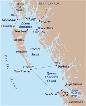
Cape Muzon is a cape located in the Alexander Archipelago of the U.S. state of Alaska. It is the southernmost point of Dall Island and the headland marking the northwestern extremity of the Dixon Entrance.[1] The boundary line separating Alaska from Canada runs very close to Cape Muzon,[2] although according to the Alaska Boundary Treaty Cape Muzon is defined precisely as the western end of the so-called A-B Line, part of the Canada–United States border.
The name comes from Jacinto Caamaño, who named it Cabo de Muñoz in 1792. George Vancouver adopted Caamaño's place names and apparently transposed two letters, making Muzon. In 1787 George Dixon called it Cape Pitt. It has been known by other names such as Cape Irving, Kaigani, Caiganee, and Kygane.[3] Its native name was published in Russian as Mys Kaygany by Captain Tebenkov in 1852.[4]
See also
References
- ↑ U.S. Coast and Geodetic Survey (1917). United States Coast Pilot: Alaska. Dixon Entrance to Yakutat Bay, Part 1. United States Government Printing Office. p. 44. OCLC 4222079.
- ↑ Reminiscences of Alaska, Captain Thomas J. Maher, C&GS, Stories and Tales of the Coast & Geodetic Survey, NOAA
- ↑ Baker, Marcus (1906). Geographic Dictionary of Alaska. United States Government Printing Office. p. 450. OCLC 4712386.
- ↑ U.S. Geological Survey Geographic Names Information System: Cape Muzon
Coordinates: 54°40′4″N 132°41′20″W / 54.66778°N 132.68889°W