Cantin
| Cantin | ||
|---|---|---|
 | ||
| ||
 Cantin | ||
|
Location within Hauts-de-France region 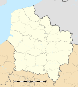 Cantin | ||
| Coordinates: 50°19′N 3°07′E / 50.31°N 3.12°ECoordinates: 50°19′N 3°07′E / 50.31°N 3.12°E | ||
| Country | France | |
| Region | Hauts-de-France | |
| Department | Nord | |
| Arrondissement | Douai | |
| Canton | Arleux | |
| Intercommunality | Douaisis | |
| Government | ||
| • Mayor (2001–2008) | Christian Courtecuisse | |
| Area1 | 9.32 km2 (3.60 sq mi) | |
| Population (1999)2 | 1,328 | |
| • Density | 140/km2 (370/sq mi) | |
| Time zone | CET (UTC+1) | |
| • Summer (DST) | CEST (UTC+2) | |
| INSEE/Postal code | 59126 / 59169 | |
| Elevation |
37–76 m (121–249 ft) (avg. 58 m or 190 ft) | |
|
1 French Land Register data, which excludes lakes, ponds, glaciers > 1 km² (0.386 sq mi or 247 acres) and river estuaries. 2 Population without double counting: residents of multiple communes (e.g., students and military personnel) only counted once. | ||
Cantin is a commune of the Hauts-de-France region in the Nord department in northern France.
It is 8 km (5.0 mi) southeast of Douai.
Population
| Year | 1962 | 1968 | 1975 | 1982 | 1990 | 1999 | 2007 |
| Population | 912 | 1246 | 1395 | 1397 | 1373 | 1327 | 1449 |
Heraldry
_Nord-France.svg.png) |
The arms of Cantin are blazoned : Vert, in dexter base an eagle volant bendwise argent and in canton a sun Or. |
See also
References
| Wikimedia Commons has media related to Cantin. |
This article is issued from Wikipedia - version of the 11/17/2016. The text is available under the Creative Commons Attribution/Share Alike but additional terms may apply for the media files.