Borgarnes
| Borgarnes | |
|---|---|
| Town | |
|
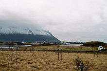
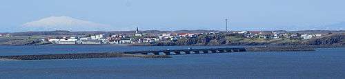
View of Borgarnes | |
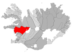 Location of the Municipality of Borgarbyggð | |
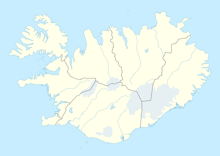 Borgarnes Location in Iceland | |
| Coordinates: 64°32′N 21°55′W / 64.533°N 21.917°W | |
| Country | Iceland |
| Constituency[1] | Northwest Constituency |
| Region[2] | Western Region |
| Municipality | Borgarbyggð |
| Population (2015) | |
| • Total | 1,875 |
| Time zone | GMT (UTC+0) |
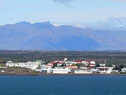
Borgarnes (Icelandic pronunciation: [ˈpɔrkarˌnɛs]) is a town located on a peninsula at the shore of Borgarfjörður in Iceland.
It has a population of 1,763 (as of January 2011). The town is located 60 km north of the capital Reykjavík and is connected to other places in Iceland through the second largest bridge in Iceland, Borgarfjarðarbrú. Borgarnes is the biggest town in the Borgarbyggð municipality.
Magnus Scheving, former European gymnastics champion & CEO of LazyTown Entertainment is from the town.
History of Borgarnes
Borgarnes is first noted in Egils Saga but in the saga it is called Digranes. The first Settler to live there was called Grani, a shipmate of Skallagrímur, the first landlord and settler of the Borgarfjörður-area. There is no known history of settlement in Borgarnes after Grani's days until the 19th century.
Just after Iceland gained freedom from the Danish trading monopoly, there was a great demand for a trading place in the area and the Danish King authorized Borgarnes as a trading place in 1861.
The first major building built in Borgarnes was a canning factory. It was built in 1857 but was torn down a few years later. A trading house was built in Borgarnes in 1877, and a few years later settlement in Borgarnes began in earnest.
In 1913, Borgarnes officially became a town called Borgarneshreppur but had its name changed to Borgarnesbær in 1987. Later on, in 1994, Borgarnesbær united with Hraunhreppur, Norðurárdalshreppur, and Stafholtstungnahreppur under the name Borgarbyggð, using the Borgarnes seal and offices. In 1998, Álftaneshreppur, Borgarhreppur and Þverárhlíðarhreppur also became a part of Borgarbyggð.
Economy

Kaupfélag Borgfirðinga (KB)
Kaupfélag Borgfirðinga was founded in 1904 as a mutual company. It was the biggest supplier of work in Borgarnes in the 20th century. Like among most local mutual companies (and members of SÍS, the Federation of Iceland Cooperatives Societies) in Iceland, Kaupfélag Borgfirðinga had shops, supermarkets, petrol stations, a slaughterhouse, a milk processing factory, a bakery, etc. under its name. KB also had shares in many other factories and companies in the Borgarnes area and elsewhere in Iceland. At the end of the 20th century, KB's financial powers and status began to decline and it was changed to a holding company called KB Borgarnesi EHF. The KB logo and trademark will no longer be used for what is left of KB's operations in the beginning of 2005.
Major industries in Borgarnes
Borgarnes is the center of commerce for a large part of western Iceland. The town's economy is mostly based on service to people traveling from Reykjavík, farmers and owners of summer houses in the countryside around the town, and also various industries.
Shops and Trading
- Geirabakarí. A bakery and coffee house.
- Hagkaup. A clothing and speciality store.
- Nettó. Supermarket
- Húsasmiðjan, Hardware store
- Framköllunarþjónustan, Photographic processing
- N1, supermarket, gasoline and fresh food service station, formerly Esso and Hyrnan
- OLÍS, gas station. Hosts also Grill 66 fast food restaurant.
- Bónus, A discount supermarket, owned by Baugur Group
- Vínbúð, Alcohol store, owned by the Icelandic Government
- Tvest, an electronics store selling, amongst other things, computers and TVs.
- Ljómalind, a Farmers Market Cooperative.
Banking
- Arion Banki.
Manufacturing
- Loftorka. Concrete; premade house walls, pipes etc.
- Borgarnes Kjötvörur (former Kjötiðnaðarstöð KB). Various kinds of meats
- Eðalfiskur. Salmon processing
- Límtré/Vírnet. Aluminium and other industrial building manufacturing.
Government
- Ráðhús Borgarbyggðar. Borgarbyggð City Hall.
- Sýslumaðurinn á Vesturlandi. Commissioners office West Iceland.
- Lögreglan í Borganesi. Police Station in Borgarnes. The Chief of Police is Úlfar Lúðvíksson.
- Vegagerðin. The Icelandic Road and Coastal Administration.
Climate
| Climate data for Borgarnes | |||||||||||||
|---|---|---|---|---|---|---|---|---|---|---|---|---|---|
| Month | Jan | Feb | Mar | Apr | May | Jun | Jul | Aug | Sep | Oct | Nov | Dec | Year |
| Average high °C (°F) | 2 (36) |
3 (37) |
3 (38) |
7 (44) |
11 (52) |
13 (56) |
16 (60) |
15 (59) |
12 (54) |
7 (44) |
3 (38) |
3 (38) |
8 (46) |
| Average low °C (°F) | −4 (24) |
−4 (24) |
−3 (27) |
−1 (31) |
3 (37) |
6 (43) |
8 (46) |
7 (44) |
4 (40) |
0 (32) |
−3 (27) |
−2 (28) |
1 (34) |
| Average precipitation mm (inches) | 97 (3.8) |
94 (3.7) |
69 (2.7) |
41 (1.6) |
30 (1.2) |
48 (1.9) |
38 (1.5) |
71 (2.8) |
109 (4.3) |
89 (3.5) |
109 (4.3) |
91 (3.6) |
886 (34.9) |
| Source: Weatherbase [3] | |||||||||||||
Transportation
The second-largest bridge in Iceland, Borgarfjarðarbrú connects Borgarnes to Route 1 (the Ring Road) and connects it with other parts of the country. The Borgarnes Harbour has not been used for transportation for years so all transportation to and from Borgarnes is by land.
Sports clubs and youth associations
- Skallagrímur. The biggest sports club in Borgarnes. Badminton, athletics, basketball, football (soccer), swimming and other activities like acting.
- Kveldúlfur. The sports club of the handicapped in Borgarnes.
- Golfklúbbur Borgarness. The Borgarnes Golf Club.
- Mýgrútur FC. Football club.
Tourist attractions
Visitor attractions in Borgarnes[4] include:
- The Settlement Centre – a museum featuring twin themes: the settlement of Iceland; and an Egils saga exhibition. It was opened by actor and playwright Kjartan Ragnarsson and his wife in 2006.[5]
- Museum Borgarfjörður – A unique exhibition centered on the life and surroundings of children in Iceland in the 20th century. The photographs are presented in an unusual way, mounted on walls in which cabinets behind some photographs contain objects and further information. Visitors can move around the walls and discover how children lived, laughed and worked over the past 100 years.[6]
- Bjössaróló Park – a children's play park created by carpenter and environmental pioneer Björn Hjörtur Guðmundsson, who built all the play equipment himself from salvaged discarded materials, teaching children the value of recycling, frugality and inventiveness.[5]
See also
| Wikimedia Commons has media related to Borgarnes. |
| Wikivoyage has a travel guide for Borgarnes. |
References
- ↑ Political division
- ↑ Mainly statistical division
- ↑ "Weatherbase: Historical Weather for Borgarnes, Iceland". Weatherbase. 2011. Retrieved on November 24, 2011.
- ↑ Fran Parnell; Brandon Presser (1 May 2010). Iceland. Lonely Planet. p. 160. ISBN 978-1-74104-455-3. Retrieved 28 June 2012.
- 1 2 Rebecca Louder (17 August 2010). "A Borganestastic Day – Learning and playing around Borgarfjörður". The Reykjavik Grapevine Travel. Retrieved 24 June 2012.
- ↑ Children for 100 years (exhibition in Borgarfjörður Museum)
Coordinates: 64°32′N 21°55′W / 64.533°N 21.917°W