Blairsville, Georgia
| Blairsville, Georgia | |
|---|---|
| City | |
|
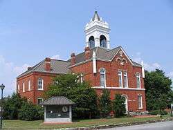
Historic Union County Courthouse | |
| Nickname(s): City of Mountains | |
| Motto: A Place for All Seasons | |
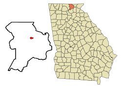 Location in Union County and the state of Georgia | |
| Coordinates: 34°52′32″N 83°57′24″W / 34.87556°N 83.95667°WCoordinates: 34°52′32″N 83°57′24″W / 34.87556°N 83.95667°W | |
| Country | United States |
| State | Georgia |
| County | Union |
| Area | |
| • Total | 1.1 sq mi (2.8 km2) |
| • Land | 1.1 sq mi (2.8 km2) |
| • Water | 0 sq mi (0 km2) |
| Elevation | 1,883 ft (574 m) |
| Population (2010) | |
| • Total | 652 |
| • Density | 599.1/sq mi (235.4/km2) |
| Time zone | Eastern (EST) (UTC-5) |
| • Summer (DST) | EDT (UTC-4) |
| ZIP codes | 30512, 30514 |
| Area code(s) | 706 |
| FIPS code | 13-08480[1] |
| GNIS feature ID | 0331184[2] |
Blairsville is a city in Union County, Georgia, United States. As of the 2010 census, the city had a population of 652.[3] The city is the county seat of Union County.[4]
History
.JPG)
The town is named after Revolutionary War veteran James Blair.[5][6][7][8]
On 26 December 1835, the Georgia General Assembly designated Blairsville as the Union county seat (Ga. Laws 1835, p. 113).
Although the neighboring city of Dahlonega was known as the first site of gold in the United States, the Blairsville area was known to have the purest gold in the mountains. Assayers in Washington, D.C. could tell by looking that gold ore was from the Coosa Mines because it was “the yellowest gold” submitted and its brilliant color set it apart.[9]
In the late 18th century the Collins family and the Dyer family settled in the area.
Many houses from the early 19th century still stand, or have been moved/or restored in another area of the county to help with preservation.
Blairsville's town square is home to the original courthouse, several local businesses, the Seasons Inn Motel, and a local old diner called the "Hole In The Wall".
Geography
According to the United States Census Bureau, the city has a total area of 1.1 square miles (2.8 km2), all of it land.
Climate
Blairsville has a humid subtropical climate, yet, due to its elevation of 1,883 feet (574 m), typically records far lower temperatures at night than what is encountered in much of the Southeastern U.S, and has slightly higher precipitation totals (56 inches or 1,420 millimetres annually) than most locations in the state; the average diurnal temperature variation exceeds 25 °F (14 °C) in each of the spring and autumn months. However, measurable snow does not occur in the majority of years. The monthly daily mean temperature ranges from 36.8 °F (2.7 °C) in January to 73.3 °F (22.9 °C) in July. There are 7.6 days of 90 °F (32 °C) highs and 4.6 days where the high fails to rise above freezing annually.
| Climate data for Blairsville, Georgia (1981–2010 normals) | |||||||||||||
|---|---|---|---|---|---|---|---|---|---|---|---|---|---|
| Month | Jan | Feb | Mar | Apr | May | Jun | Jul | Aug | Sep | Oct | Nov | Dec | Year |
| Average high °F (°C) | 48.8 (9.3) |
52.4 (11.3) |
59.6 (15.3) |
68.0 (20) |
75.3 (24.1) |
81.7 (27.6) |
84.5 (29.2) |
83.8 (28.8) |
78.5 (25.8) |
69.6 (20.9) |
60.6 (15.9) |
51.1 (10.6) |
67.9 (19.9) |
| Average low °F (°C) | 24.8 (−4) |
28.2 (−2.1) |
34.1 (1.2) |
40.6 (4.8) |
49.7 (9.8) |
58.1 (14.5) |
62.2 (16.8) |
61.3 (16.3) |
54.7 (12.6) |
42.8 (6) |
34.6 (1.4) |
27.8 (−2.3) |
43.3 (6.3) |
| Average precipitation inches (mm) | 5.27 (133.9) |
4.84 (122.9) |
5.11 (129.8) |
4.40 (111.8) |
4.25 (108) |
4.82 (122.4) |
4.60 (116.8) |
4.62 (117.3) |
4.47 (113.5) |
3.74 (95) |
4.99 (126.7) |
4.86 (123.4) |
55.97 (1,421.5) |
| Average precipitation days (≥ 0.01 in) | 11.0 | 10.7 | 11.2 | 10.8 | 11.4 | 12.0 | 11.9 | 10.8 | 9.1 | 8.5 | 10.0 | 11.6 | 129.0 |
| Source: NOAA[10] | |||||||||||||
Demographics
| Historical population | |||
|---|---|---|---|
| Census | Pop. | %± | |
| 1880 | 101 | — | |
| 1890 | 114 | 12.9% | |
| 1900 | 141 | 23.7% | |
| 1910 | 203 | 44.0% | |
| 1920 | 230 | 13.3% | |
| 1930 | 298 | 29.6% | |
| 1940 | 458 | 53.7% | |
| 1950 | 430 | −6.1% | |
| 1960 | 437 | 1.6% | |
| 1970 | 491 | 12.4% | |
| 1980 | 530 | 7.9% | |
| 1990 | 564 | 6.4% | |
| 2000 | 659 | 16.8% | |
| 2010 | 652 | −1.1% | |
| Est. 2015 | 554 | [11] | −15.0% |
As of the census[1] of 2010, there were 652 people residing in the city. The population density was 529 people per square mile (240.0/km²).[13] The racial makeup of the city was: White alone - 577 (88.5%), African American - 30 (4.6%), Hispanic - 30 (4.6%), Two or more other races - 10 (1.5%), American Indian alone - 4 (0.6%), Asian - 1 (0.2%).[14]
There were 226 households out of which 23.0% had children under the age of 18 living with them, 27.4% were married couples living together, 15.5% had a female householder with no husband present, and 54.9% were non-families. 50.4% of all households were made up of individuals and 22.1% had someone living alone who was 65 years of age or older. The average household size was 1.95 and the average family size was 2.92.
In the city the population was spread out with 14.3% under the age of 18, 15.2% from 18 to 24, 39.0% from 25 to 44, 17.6% from 45 to 64, and 14.0% who were 65 years of age or older. The median age was 35 years. For every 100 females there were 151.5 males. For every 100 females age 18 and over, there were 167.8 males.
The median income for a household in the city was $14,120, and the median income for a family was $24,712. Males had a median income of $21,953 versus $28,125 for females. The per capita income for the city was $13,865. About 16.8% of families and 26.3% of the population were below the poverty line, including 32.2% of those under age 18 and 23.7% of those age 65 or over.
Arts and culture
Annual cultural events
- The Sorghum Festival[15] is held every year on the second and third weekends in October, celebrating the sorghum harvest and showcasing rural mountain culture and skills such as bluegrass music and clogging.
- The Spring Arts and Crafts Festival is held every year during the last weekend in May. Assorted artists from all over North Georgia participate, as well as local artists, restaurants and businesses. Held on the historic town square, there are activities for children and musical acts that will appeal to everyone.
- The Green Bean Festival[16] is held every year on the last weekend in July. It features beauty pageants, green bean pizza eating contests, a canning contest, a green bean recipe contest, a tractor parade, fresh produce, crafts, and lots of activities for the kids.
Points of interest
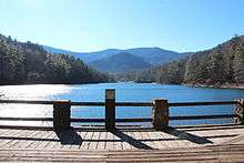
Nearby Lake Nottely is a TVA reservoir and a local recreational resource.
The Appalachian Trail in Georgia has elevations that vary from about 2500 to 4,500 feet (1,400 m) with many steep climbs and extends some 75 miles (121 km) through the Chattahoochee National Forest.
Butternut Creek Golf Course is an 18-hole mountainside public golf course located within the city limits.
Encompassing nearly two-thirds of the county, the Chattahoochee National Forest has winding trails that lead visitors through scenic mountains, rushing rivers, and cascading waterfalls. This is where you can step back in time with nature and walk where the Cherokee Indians once lived.
Brasstown Bald is the highest mountain peak in Georgia. It has a park with a picnic area and a small observation tower near the peak with a movie chronicling the change of seasons and the impact of pollution on the mountain. The peak may be reached by bus or by walking from a point halfway to the top, beyond which private vehicles are not allowed.
Vogel State Park is a park located on Highway 19/129 approximately eleven miles (18 km) south of Blairsville. It is centered around Lake Trahlyta.
Amenities:
- Approximately five miles (8 km) of hiking trails
- Access to the Appalachian Trail
- Paddleboat rentals and fishing
- Miniature golf course
- 35 rental cabins
- 103 campsites
The park has seasonal programs:
- Fall Festival
- Pioneer Christmas
- Kids Fishing Rodeo
- Summer Saturday music events
- September All-Day Mountain Music Festival
Education
Blairsville is in close proximity to several colleges including a North Georgia Technical College campus in town,[17] Young Harris College in Young Harris,[18] and the University of North Georgia in Dahlonega.[19]
The public education system for Blairsville falls under the jurisdiction of the Union County School District, which is a relatively small school district, managing five schools in the system.[20]
The Union County School District holds pre-school to grade twelve, and consists of two elementary schools, a middle school, and two high schools.[21] The district has 172 full-time teachers and over 2,598 students.[22]
- Union County Elementary School
- Union County Primary School
- Union County Middle School
- Union County High School
- Woody Gap High/Elementary School
Blairsville is home to one alternative school, the Mountain Education Center High School, which is an evening school.[23]
Union County schools are acclaimed for their excellence and making an impact in the local community through their excellence and dedication. [24]
The Union County Public Library is part of the Mountain Regional Library System, which manages four libraries in the region. Union County Public Library is a member of Georgia Library PINES (the Public Information Network for Electronic Services) along with Mountain Regional Library in Young Harris, Towns County Public Library in Hiawassee, and Fannin County Public Library in Blue Ridge.[25][26]
- The Mountain Area Christian Academy, in Morganton, Georgia[27]
- Eastgate Life Academy, in Hiawassee, Georgia
- Murphy Adventist Christian School, in Murphy, North Carolina[28]
Infrastructure
Transportation
Blairsville sits on Zell Miller Mountain Parkway (GA 515) which runs from Cherokee County / Pickens County Border, to Young Harris Georgia. U.S. Route 76 also runs through Blairsville, being cosigned to 515.
Blairsville is also intersected by U.S. Route 129, a 582 mile long stretch of highway that connects Chiefland, Florida to Knoxville, Tennessee.
Blairsville is home to Blairsville Airport (ICAO: KDZJ[29], FAA LID: DZJ formerly 46A).[30]
Media
The Blairsville area is served by a few local television stations, two newspapers, magazines, and numerous local radio stations that serve several genres of music including sports, news, and talk radio.
There are three local newspapers. North Georgia News is the primary newspaper for the area.[31] Montefino Magazine is an upscale publication based out of Blairsville that covers Blairsville, Union County and surrounding areas. [32]
Blairsville has 12 Local radio stations. WUCG-FM 93.1 is based in Blairsville, 1210-AM (WDGR), 89.5-FM (WNGU), and 104.3-FM (WZTR) are based in Dahlonega, Georgia. WCVP-AM (600), WCNG-FM (102.7), and WKRK-AM (1320) are based in Murphy, North Carolina. 95.1-FM (WJRB) is based in Young Harris, Georgia, while 105.1FM (WNGA) and 89.9FM (WTFH) are based in Helen. 1230-AM/97.7FM (WJUL) is based in Hiawasee. 103.9-FM(WPPL) is based in Blue Ridge.
One local television station is W50AB (channel 50), based in Hiawassee, Georgia.
See also
References
- 1 2 "American FactFinder". United States Census Bureau. Archived from the original on 2013-09-11. Retrieved 2008-01-31.
- ↑ "US Board on Geographic Names". United States Geological Survey. 2007-10-25. Retrieved 2008-01-31.
- ↑ American FactFinder - Results
- ↑ "Find a County". National Association of Counties. Archived from the original on 2011-05-31. Retrieved 2011-06-07.
- ↑ https://books.google.com/books?id=EMEBAAAAMAAJ&pg=PA192&dq=Blairsville,+Georgia+%22James+Blair%22&hl=en&sa=X&ei=z4ZVVKTPAcz1oATTxoCoDQ&ved=0CDMQ6AEwAg#v=onepage&q=Blairsville%2C%20Georgia%20%22James%20Blair%22&f=false
- ↑ https://books.google.com/books?id=32coAAAAYAAJ&pg=PA338&dq=Blairsville,+Georgia+%22James+Blair%22&hl=en&sa=X&ei=XIZVVMbjNdC0oQSQp4CoBg&ved=0CCIQ6AEwAQ#v=onepage&q=Blairsville%2C%20Georgia%20%22James%20Blair%22&f=false
- ↑ http://www.zoominfo.com/p/Moses-Guest/340158575
- ↑ https://books.google.com/books?id=c6PBnS_rh1wC&pg=PA13&dq=James+Blair+%22Georgia%22&hl=en&sa=X&ei=gYVVVL6lE8OwogTfh4LYAg&ved=0CB0Q6AEwAA#v=onepage&q=James%20Blair%20%22Georgia%22&f=false
- ↑ Dyer Jones, Ethelene. "Gold in Union County". unioncountyhistory.org. Retrieved 10 February 2015.
- ↑ "Station Name: GA BLAIRSVILLE EXP STN". National Oceanic and Atmospheric Administration. Retrieved 2013-04-01.
- ↑ "Annual Estimates of the Resident Population for Incorporated Places: April 1, 2010 to July 1, 2015". Retrieved July 2, 2016.
- ↑ "Census of Population and Housing". Census.gov. Archived from the original on May 11, 2015. Retrieved June 4, 2015.
- ↑ "City-Data". City-data.com.
- ↑ "City-Data". City-data.com.
- ↑ "www.blairsvillesorghumfestival.com". www.blairsvillesorghumfestival.com. Retrieved 2016-10-03.
- ↑ "greenbeanfestival.com". greenbeanfestival.com. Retrieved 2012-04-29.
- ↑ "North Georgia Technical College". Northgatech.edu. Retrieved 2011-09-30.
- ↑ "Young Harris College". Yhc.edu. Retrieved 2011-09-30.
- ↑ "University of North Georgia". ung.edu. Retrieved 2013-10-05.
- ↑ "Union County Schools Website". Ucschools.org. Retrieved 2012-04-29.
- ↑ Georgia Board of Education, Retrieved June 29, 2010.
- ↑ School Stats, Retrieved June 29, 2010.
- ↑ "Mountain Education Center High School". Mountaineducationcenter.net. Retrieved 2011-09-30.
- ↑ "Union County High School". Montefino Magazine. Retrieved 2016-08-12.
- ↑ "Union County Public Library Website". Georgia.educationbug.org. 2007-06-01. Retrieved 2011-09-30.
- ↑ "Mountain Regional Library System". Mountainregionallibrary.org. Retrieved 2011-09-30.
- ↑ "Mountain Area Christian Academy". Macalions.org. 2011-09-23. Retrieved 2011-09-30.
- ↑ "Murphy Adventist Christian School". Murphy Adventist Christian School. Retrieved 2011-09-30.
- ↑ Airport information for KDZJ at AirNav
- ↑ "KDZJ - Blairsville Airport". AirNav. Retrieved 2012-07-13.
- ↑ "North Georgia News". Nganews.com. Retrieved 2012-04-29.
- ↑ "Montefino Magazine". CPXMarketing. Retrieved 2016-08-12.
External links
| Wikimedia Commons has media related to Blairsville, Georgia. |
- Blairsville, GA City Website
- Blairsville, GA Website
- Blairsville Chamber of Commerce
- Blairsville Downtown Development Authority
- Vogel State Park Georgia State Parks and Historic Sites
- Stories and Events from the North Georgia News
- Montefino Magazine
Municipalities and communities of Union County, Georgia, United States | ||
|---|---|---|
| City | 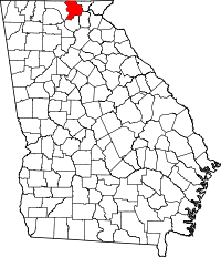 | |
| Unincorporated community |
| |