Blackmill Loch
National grid reference NR94549588
| Blackmill Loch | |
|---|---|
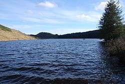 | |
| Location | Minard, Scotland |
| Coordinates | 56°06′39″N 5°17′57″W / 56.1107°N 5.2991°WCoordinates: 56°06′39″N 5°17′57″W / 56.1107°N 5.2991°W |
| Type | Reservoir |
| Basin countries | Scotland, United Kingdom |
| Surface area | 130000 sq. metres |
| Surface elevation | 139 metres |
Blackmill Loch is an impounding reservoir constructed in 1964 and is one source of freshwater loch for the Lochgair Hydroelectric Scheme.
See also
Sources
This article is issued from Wikipedia - version of the 11/28/2016. The text is available under the Creative Commons Attribution/Share Alike but additional terms may apply for the media files.