Beltisloe
Coordinates: 52°49′N 0°33′W / 52.81°N 0.55°W
| Beltisloe | |
|---|---|
|
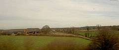
Burton-le-Coggles Typical Beltisloe countryside | |
 Beltisloe | |
| OS grid reference | SK9725 |
| |
Beltisloe is a Deanery of the Diocese of Lincoln in England,[1] and a former Wapentake.[2]
The Wapentake of Beltisloe, was an old administrative division of the English county of Lincolnshire.[3] In England a wapentake was the division of a shire for administrative, military and judicial purposes under the common law.[4] The term wapentake is of Scandinavian origin and meant the taking of weapons; it later signified the clash of arms by which the people assembled in a local court expressed assent. Danish influence was strong in those English counties where wapentakes existed.[5]
The Wapentake of Beltisloe was bounded on the north by Winnibriggs and Threo Wapentake; on the east by Aveland Wapentake; on the south by Ness Wapentake and Rutland and on the west by Grantham soke and Leicestershire. This wapentake contained the market town of Corby Glen and the villages of Basingthorpe, Bitchfield, Burton Coggles, Castle Bytham, Little Bytham, Careby, Creeton, Edenham, Gunby, Irnham, Lavington, Skillington, Stainby, Swayfield, Swinstead, Witham on the Hill, North Witham and South Witham.[3]
See also
Notes
- ↑ "Deanery details on Diocese web site".
- ↑ "Notes about the wapentake from 'Introduction: Lost vills and other forgotten places', Final Concords of the County of Lincoln: 1244-1272 (1920), ed:C.W. Foster, pp. L-LXV.".
- 1 2 Allen.History of the County of Lincoln. p.277
- ↑ Vision of Britain.
- ↑ Encyclopaedia Britannica.
References
- Allen, Thomas (1834). The History of the County of Lincoln: From the earliest period to the present time. Volume 2. John Saunders Jnr.
- "Administrative Units Typology | Status definition: Wapentake". Vision of Britain. Retrieved 2010-05-24.
- "Wapentake". Britannica. Retrieved 2010-05-24.