Bellentre
| Bellentre | |
|---|---|
|
The church in Bellentre | |
 Bellentre | |
|
Location within Auvergne-Rhône-Alpes region 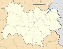 Bellentre | |
| Coordinates: 45°34′14″N 6°42′52″E / 45.5706°N 6.7144°ECoordinates: 45°34′14″N 6°42′52″E / 45.5706°N 6.7144°E | |
| Country | France |
| Region | Auvergne-Rhône-Alpes |
| Department | Savoie |
| Arrondissement | Albertville |
| Canton | Bourg-Saint-Maurice |
| Area1 | 23.94 km2 (9.24 sq mi) |
| Population (2006)2 | 947 |
| • Density | 40/km2 (100/sq mi) |
| Time zone | CET (UTC+1) |
| • Summer (DST) | CEST (UTC+2) |
| INSEE/Postal code | 73038 / 73210 |
| Elevation |
699–3,011 m (2,293–9,879 ft) (avg. 743 m or 2,438 ft) |
|
1 French Land Register data, which excludes lakes, ponds, glaciers > 1 km² (0.386 sq mi or 247 acres) and river estuaries. 2 Population without double counting: residents of multiple communes (e.g., students and military personnel) only counted once. | |
.JPG)
Bellentre is a former commune in the Savoie department in the region of Auvergne-Rhône-Alpes in south-eastern France. On 1 January 2016, it was merged into the new commune of La Plagne-Tarentaise.[1]
Geography
Situated in the Tarentaise Valley, the commune stretches over villages of Montchavin Les Coches and parts of the ski resort of La Plagne.
Neighbouring communes are Landry to the north-east, Les Chapelles, Bourg-Saint-Maurice and Valezan to the north, Mâcot-la-Plagne to the west, Champagny-en-Vanoise to the south and Peisey-Nancroix to the east.
See also
References
- ↑ Arrêté préfectoral 10 November 2015
External links
| Wikimedia Commons has media related to Bellentre. |
This article is issued from Wikipedia - version of the 10/30/2016. The text is available under the Creative Commons Attribution/Share Alike but additional terms may apply for the media files.