Battle of Red Ford
| Battle of Red Ford | |||||||
|---|---|---|---|---|---|---|---|
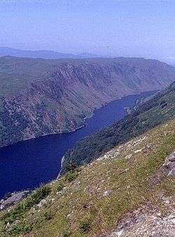 Loch Awe where the battle is said to have taken place | |||||||
| |||||||
| Belligerents | |||||||
| Clan MacDougall | Clan Campbell | ||||||
| Commanders and leaders | |||||||
| Alasdair MacDubhgaill | Cailean Mór | ||||||
| Strength | |||||||
| Unknown | Unknown | ||||||
| Casualties and losses | |||||||
| Unknown | Unknown | ||||||
The Battle of Red Ford or Battle of the String of Lorne was a battle in 1294 between Clan Campbell and Clan MacDougall in Lorne, Scotland.[1] The battle was fought over disputed lands. It ended in defeat of the Clan Campbell of Lochawe.[2] The battle was on the borders of Loch Awe and Lorne, with the site and battle named Red Ford (Scottish Gaelic: Ath Dearg) after the ford which ran red with blood where the battle took place.[2]
Background
Clan MacDougall having allied itself with John Balliol in his a competitor for the Scottish crown, upon his coronation in 1292, the chief of Clan MacDougall, Alasdair MacDubhgaill was rewarded by being appointed Sheriff of Argyll in 1293.[3] Having the influences of power, Clan MacDougall extended their influence and due to this, Clan Campbell and other Highland clans found themselves in dispute with Clan MacDougall.
Battle
Although no exact details of the battle are at hand, a great many lives were lost on both sides and the ford ran red with blood of the fallen and the wounded. Cailean Mór Caimbeul (Sir Colin Campbell) was killed in battle.[2][1]
Aftermath
After the battle, Innis Chonnell Castle was seized by the MacDougalls. Sir Colin Campbell's body was carried to the church of St. Peter the Deacon at Kilchrenan and buried there.[4]
Notes
References
- Patterson, Raymond Campbell (2008). The Lords of the Isles, A history of Clan Donald. Edinburgh: Birlinn Limited. ISBN 1-84158-718-4.
- Adam, Frank (1970). The Clans, Septs, and Regiments of the Scottish Highlands. Edinburgh and London: Johnston and Bacon. ISBN 0-7179-4500-6.
- Maughan, William Charles (1897). Annals of Garelochside, being an account historical and topographical of the parishes of Row, Rosneath and Cardross. Paisley and London: Alexander Gardner.
Coordinates: 56°18′26″N 5°12′40″W / 56.3073°N 5.2110°W