Balnakeil
| Balnakeil | |
| Scottish Gaelic: Baile na Cill | |
 Ruined church at Balnakeil |
|
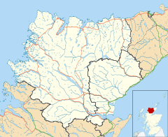 Balnakeil |
|
| OS grid reference | NC394678 |
|---|---|
| Council area | Highland |
| Country | Scotland |
| Sovereign state | United Kingdom |
| Post town | Durness |
| Postcode district | IV27 4 |
| Police | Scottish |
| Fire | Scottish |
| Ambulance | Scottish |
| EU Parliament | Scotland |
Coordinates: 58°34′34″N 4°46′05″W / 58.576°N 4.768°W
Balnakeil is a hamlet in the parish of Durness, in the north of the county of Sutherland, Scottish Highlands, and is in the Scottish council area of Highland. It is located on the north coast of Scotland around 0.75 miles (1.21 km) north-west of Durness. The ruins of Balnakeil Church are a scheduled monument.
The Kyle of Durness lies directly west of Balnakeil which gives its name to the 2-mile-wide (3.2 km) Balnakeil Bay which the Kyle opens into.[1] The peninsula of Faraid Head is directly to the north of Balnakeil. This was the site of a 1950s radar station and remains the range control for Ministry of Defence bombing operations in the Cape Wrath Training Area located to the west.[2]
Three small lochs lie directly south of Balnakeil, Loch Croispol, Loch Borralie and Loch Caladail. The area to the south-west is the site of Durness Golf Course.[3]
See also
References
- ↑ Groome.F.H (1885) 'Parish of Durness', Ordnance Gazetteer of Scotland: A Survey of Scottish Topography, Statistical, Biographical and Historical, (available online). Retrieved 2013-02-20.
- ↑ RAF Faraid Head ('RAI') CEW R10 ROTOR Radar station, Subterranea Britannica, 2004-06-15. Retrieved 2013-02-20.
- ↑ Loch Borralie, Kyle of Durness, Historic Scotland, 2003. Retrieved 2013-02-20.
| Wikimedia Commons has media related to Balnakeil. |