Aunrihar
| Aunrihar | |
|---|---|
| Town | |
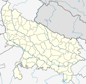 Aunrihar Location of Aunrihar in Uttar Pradesh | |
| Coordinates: 25°19′N 83°07′E / 25.32°N 83.11°ECoordinates: 25°19′N 83°07′E / 25.32°N 83.11°E | |
| Country |
|
| State | Uttar Pradesh |
| District | Ghazipur |
| Elevation | 73 m (240 ft) |
| Languages | |
| • Official | Hindi |
| Time zone | IST (UTC+5:30) |
| PIN | 233321 |
| Vehicle registration | UP-61 |
| Sex ratio | male female ♂/♀ |
| Website | Bhimapar Ghazipur |
| Holy City Of Ghazipur | |
Aunrihar is a place in Ghazipur district of Varanasi division of Uttar Pradesh. Aunrihar is situated in lat. 25° 32' N and long. 83° 11' E on the main road leading from Varanasi to Kushinagar on NH 29, about 42 Km. west from Ghazipur city and about 3.2 km. from Saidpur. This place is archaeologically interesting . One of the oldest and most important sites in the district is the belt having collection of mounds stretching from Saidpur to Aunrihar. The whole surface of the ground of Aunrihar is strewn with fragments , large carved stones & fine pieces of sculpture which are being utilised as common building stone. Every few yards traces of masonry wall appears.
Transport
Aunrihar Junction (under Varanasi division of the North Eastern Railway Zone of Indian Railways) is a railway station on Allahabad-Mau-Gorakhpur Main Line and Aunrihar–Jaunpur line, linking Aunrihar with other major cities. Departures from ARJ/Aunrihar Junction
Aunrihar Station connects Mau Junction, Bhatni Junction and Gorakhpur Junction on north east direction, Ghazipur City, Phephna Junction, Ballia of east direction, Sarnath and Varanasi Junction on south-west direction and Jaunpur junction on north-west direction.[1]