Anantnag railway station
Anantnag | |
|---|---|
| Indian Railway Station | |
 | |
| Location | Anantnag, Jammu and Kashmir |
| Coordinates | 33°44′19″N 75°06′27″E / 33.7386°N 75.1074°ECoordinates: 33°44′19″N 75°06′27″E / 33.7386°N 75.1074°E |
| Elevation | 1599.89 m |
| Owned by | Ministry of Railways, Indian Railways |
| Line(s) | Northern railway |
| Platforms | 2 |
| Tracks | 2 |
| Construction | |
| Structure type | Standard on-ground station |
| Parking | Yes |
| Other information | |
| Station code | ANT |
| Fare zone | Northern railway |
| History | |
| Opened | 2008 |
| Electrified | Not yet |
Kashmir Railway route map | ||||||||||||||||||||||||||||||||||||||||||||||||||||||||||||||||||||||||||||||||||||||||||||||||||||||||||||||||||||||||||||||||||||||||||||||||||||||||||||||||||||||||||||||||||||||||||||||||||||||||||||||||||||||||||||||||||||||||||||||||||||||||||||||||||||||||
|---|---|---|---|---|---|---|---|---|---|---|---|---|---|---|---|---|---|---|---|---|---|---|---|---|---|---|---|---|---|---|---|---|---|---|---|---|---|---|---|---|---|---|---|---|---|---|---|---|---|---|---|---|---|---|---|---|---|---|---|---|---|---|---|---|---|---|---|---|---|---|---|---|---|---|---|---|---|---|---|---|---|---|---|---|---|---|---|---|---|---|---|---|---|---|---|---|---|---|---|---|---|---|---|---|---|---|---|---|---|---|---|---|---|---|---|---|---|---|---|---|---|---|---|---|---|---|---|---|---|---|---|---|---|---|---|---|---|---|---|---|---|---|---|---|---|---|---|---|---|---|---|---|---|---|---|---|---|---|---|---|---|---|---|---|---|---|---|---|---|---|---|---|---|---|---|---|---|---|---|---|---|---|---|---|---|---|---|---|---|---|---|---|---|---|---|---|---|---|---|---|---|---|---|---|---|---|---|---|---|---|---|---|---|---|---|---|---|---|---|---|---|---|---|---|---|---|---|---|---|---|---|---|---|---|---|---|---|---|---|---|---|---|---|---|---|---|---|---|---|---|---|---|---|---|---|---|---|---|---|---|---|---|---|---|
Legend
| ||||||||||||||||||||||||||||||||||||||||||||||||||||||||||||||||||||||||||||||||||||||||||||||||||||||||||||||||||||||||||||||||||||||||||||||||||||||||||||||||||||||||||||||||||||||||||||||||||||||||||||||||||||||||||||||||||||||||||||||||||||||||||||||||||||||||
Anantnag railway station is a railway station on the Northern railway network. It is the headquarters of Anantnag division of Northern Railway zone .
History
Main article: Kashmir Railway
The station has been built as part of the Kashmir Railway megaproject, intending to link the Kashmir Valley with Jammu Tawi and the rest of the Indian rail network.
The station is basically located in rice fields which are between . wanpoh and harnag. It is approximately 4.5km far from Anantnag town.
Design
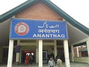
The station features Kashmiri wood architecture, with an intended ambience of a royal court which is designed to complement the local surroundings to the station. Station signage is predominantly in Urdu, English and Hindi.
See also
- Srinagar railway station
- Bijbehara railway station
- Kashmir railway
- Srinagar-Kargil-Leh railway
- Srinagar Airport
References
This article is issued from Wikipedia - version of the 9/29/2016. The text is available under the Creative Commons Attribution/Share Alike but additional terms may apply for the media files.