Airla
| Airla एरला | |
|---|---|
| Village | |
 Airla 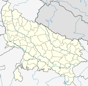 Airla  Airla Village location on Varanasi district map | |
| Coordinates: 25°26′01″N 83°01′17″E / 25.433563°N 83.021367°ECoordinates: 25°26′01″N 83°01′17″E / 25.433563°N 83.021367°E | |
| Country |
|
| State | Uttar Pradesh |
| Elevation | 85 m (279 ft) |
| Population (2011) | |
| • Total | 1,693 |
| Languages | |
| • Official | Hindi |
| Time zone | IST (UTC+5:30) |
| PIN | 221104 |
| STD | 0542 |
| Vehicle registration | UP65 XXXX |
| Village code | 209594 |
| Website |
up |
Airla (Hindi: एरला) is a village in Varanasi district in the Indian state of Uttar Pradesh. It is about 316 kilometers from the state capital Lucknow and 812 kilometers from the national capital Delhi.[1][2][3]
Demography
Airla has a total population of 1,693 people amongst 285 families. Sex ratio of Akhari is 950 and child sex ratio is 827. Uttar Pradesh state average for both ratios is 912 and 902 respectively.[2]
| Details | Male | Female | Total | Comments |
|---|---|---|---|---|
| Number of houses | - | - | 285 | (census 2011) [2] |
| Adult | 729 | 710 | 1,439 | |
| Children (0–6 years) | 139 | 115 | 254 | |
| Total population | 868 | 825 | 1,693 | |
| Literacy | 87.65% | 61.13% | 74.57% | |
Transportation
Airla can be accessed by road and by Indian railways. Closest railway station to this place is Sarnath (9 km). Nearest operational airports are Varanasi airport (23 kilometers) and Allahabad Airports (149 kilometers).[4]
See also
References
- ↑ "Village coordinates". latlong.net. Retrieved Feb 2015. Check date values in:
|access-date=(help) - 1 2 3 "Population & General info". 2011 census. Retrieved Feb 2015. Check date values in:
|access-date=(help) - ↑ "Village code:2011". Village info. Retrieved Feb 2015. Check date values in:
|access-date=(help) - ↑ "Rail information". indiarailinfo.com. Retrieved Feb 2015. Check date values in:
|access-date=(help)
Villages in Varanasi district | ||
|---|---|---|
| Pindra Tehsil |
| |
| Varanasi Tehsil | ||
India : Uttar Pradesh : Varanasi | ||
 |
Jaunpur | Roochandpur | Saidpur | |
| Babatpur | |
Madhopur | ||
| ||||
| | ||||
| Newadhiya | Sarnath | Chandauli |
This article is issued from Wikipedia - version of the 10/2/2016. The text is available under the Creative Commons Attribution/Share Alike but additional terms may apply for the media files.