Achakanani
| Achakanani | |
|---|---|
 Achakanani Location within Bolivia | |
| Highest point | |
| Elevation | 3,980 m (13,060 ft) [1] |
| Coordinates | 19°27′13″S 65°43′05″W / 19.45361°S 65.71806°WCoordinates: 19°27′13″S 65°43′05″W / 19.45361°S 65.71806°W |
| Geography | |
| Location |
Bolivia, Potosí Department |
| Parent range | Andes |
Achakanani (Aymara achakana pearl-fruit,[2] -ni a suffix, "the one with the pearl-fruit", also spelled Achacanani) is a mountain in the Bolivian Andes which reaches a height of approximately 3,980 m (13,060 ft). It is located in the Potosí Department, Tomás Frías Province, Potosí Municipality. It lies near the village of Q'illu Mayu, northeast of Lik'ichiri. The Q'illu Mayu ("yellow river") flows along its eastern slopes.[1][3]
References
Capital: Potosí | ||
| Provinces | 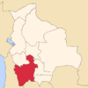 | |
| Municipalities (and seats) |
| |
This article is issued from Wikipedia - version of the 5/6/2016. The text is available under the Creative Commons Attribution/Share Alike but additional terms may apply for the media files.